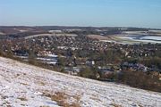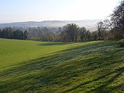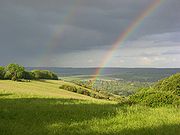
Lardon Chase, the Holies and Lough Down
Encyclopedia


National Trust for Places of Historic Interest or Natural Beauty
The National Trust for Places of Historic Interest or Natural Beauty, usually known as the National Trust, is a conservation organisation in England, Wales and Northern Ireland...
countryside properties in the English
England
England is a country that is part of the United Kingdom. It shares land borders with Scotland to the north and Wales to the west; the Irish Sea is to the north west, the Celtic Sea to the south west, with the North Sea to the east and the English Channel to the south separating it from continental...
county of Berkshire
Berkshire
Berkshire is a historic county in the South of England. It is also often referred to as the Royal County of Berkshire because of the presence of the royal residence of Windsor Castle in the county; this usage, which dates to the 19th century at least, was recognised by the Queen in 1957, and...
. They are situated on the edge of the Berkshire Downs
Berkshire Downs
The Berkshire Downs are a range of chalk downland hills in southern England, part of the North Wessex Downs Area of Outstanding Natural Beauty...
above the village of Streatley
Streatley, Berkshire
Streatley is a village and civil parish on the River Thames in Berkshire, England.-Location:Streatley is about from Reading and from Oxford. It is in the Goring Gap on the River Thames and is directly across the river from the Oxfordshire village of Goring-on-Thames...
and overlooking the Goring Gap
Goring Gap
The Goring Gap is a British geological feature located on the River Thames approximately 8 miles upstream from Reading.Half a million years ago the River Thames flowed on its existing course through Oxfordshire, but then turned northeast to flow through Hertfordshire before eventually reaching the...
. Together they comprise an outstanding area of 27 hectare
Hectare
The hectare is a metric unit of area defined as 10,000 square metres , and primarily used in the measurement of land. In 1795, when the metric system was introduced, the are was defined as being 100 square metres and the hectare was thus 100 ares or 1/100 km2...
s (67 acre
Acre
The acre is a unit of area in a number of different systems, including the imperial and U.S. customary systems. The most commonly used acres today are the international acre and, in the United States, the survey acre. The most common use of the acre is to measure tracts of land.The acre is related...
s) of downland
Downland
A downland is an area of open chalk hills. This term is especially used to describe the chalk countryside in southern England. Areas of downland are often referred to as Downs....
and woodland
Woodland
Ecologically, a woodland is a low-density forest forming open habitats with plenty of sunlight and limited shade. Woodlands may support an understory of shrubs and herbaceous plants including grasses. Woodland may form a transition to shrubland under drier conditions or during early stages of...
with many attractive walks and views.
Lardon Chase, and a part of the Holies known as Holies Down, are also designated as Sites of Special Scientific Interest. The properties lie within the North Wessex Downs Area of Outstanding Natural Beauty
North Wessex Downs AONB
The North Wessex Downs Area of Outstanding Natural Beauty is located in the English counties of Berkshire, Hampshire, Oxfordshire and Wiltshire...
.
Lardon Chase and Lough Down comprise a spur of downland which lies to the west of Goring and Streatley. The slopes form one of the largest remaining areas of chalk grassland
Calcareous grassland
Calcareous grassland is an ecosystem associated with thin basic soil, such as that on chalk and limestone downland. Plants on calcareous grassland are typically short and hardy, and include grasses and herbs such as clover...
in the county and support a wide range of flowers and butterflies. The area has a long history of ancient settlements and there are several Neolithic
Neolithic
The Neolithic Age, Era, or Period, or New Stone Age, was a period in the development of human technology, beginning about 9500 BC in some parts of the Middle East, and later in other parts of the world. It is traditionally considered as the last part of the Stone Age...
and Iron Age
Iron Age
The Iron Age is the archaeological period generally occurring after the Bronze Age, marked by the prevalent use of iron. The early period of the age is characterized by the widespread use of iron or steel. The adoption of such material coincided with other changes in society, including differing...
forts. It is crossed by The Ridgeway
The Ridgeway
thumb|right|thumb|The ancient tree-lined path winds over the downs countrysideThe Ridgeway is a ridgeway or ancient trackway described as Britain's oldest road...
and other ancient routes used by the Romans
Ancient Rome
Ancient Rome was a thriving civilization that grew on the Italian Peninsula as early as the 8th century BC. Located along the Mediterranean Sea and centered on the city of Rome, it expanded to one of the largest empires in the ancient world....
.
The Holies is a grassy coombe
Coombe
-Places in England:* Coombe, Buckinghamshire* Coombe, Bude, Cornwall* Coombe, Camborne, Cornwall* Coombe, Liskeard, Cornwall* Coombe, Redruth, Cornwall* Coombe, St...
which is separated from Lardon Chase and Lough Down by the B4009
B roads in Zone 4 of the Great Britain numbering scheme
B roads are numbered routes in Great Britain of lesser importance than A roads. See the article Great Britain road numbering scheme for the rationale behind the numbers allocated.-3 digits:-4 digits :-4 digits :-4 digits :...
road from Streatley to Newbury
Newbury, Berkshire
Newbury is a civil parish and the principal town in the west of the county of Berkshire in England. It is situated on the River Kennet and the Kennet and Avon Canal, and has a town centre containing many 17th century buildings. Newbury is best known for its racecourse and the adjoining former USAF...
. Before acquisition by the National Trust, the Holies was used for motorbike scrambling
Motocross
Motocross is a form of motorcycle sport or all-terrain vehicle racing held on enclosed off road circuits. It evolved from trials, and was called scrambles, and later motocross, combining the French moto with cross-country...
and turf
Grass
Grasses, or more technically graminoids, are monocotyledonous, usually herbaceous plants with narrow leaves growing from the base. They include the "true grasses", of the Poaceae family, as well as the sedges and the rushes . The true grasses include cereals, bamboo and the grasses of lawns ...
stripping, resulting in considerable damage to the ground. Now the natural recolonisation of the bare land by chalk-loving plant species is being carefully nurtured and monitored.
All three properties are accessible from a car park located on the B4009, or by steeply climbing footpaths from Streatley village. Access is free, and available at all times.

