Surya taal
Encyclopedia
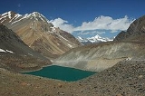
Suraj Tal or Suraj Tal Lake also called Surya taal, is a sacred body of water, literally means the Lake of the Sun God, and lies just below the Bara-lacha-la
pass (4,890m) (8 km (5 mi) in length) in the Lahaul and Spiti valley of Himachal Pradesh
State in India and is the third highest lake in India, and the 21st-highest in the world. Suraj Tal Lake is the source of Bhaga River which joins the Chandra
River downstream at Tandi
to form the Chandrabhaga
River in Himachal Pradesh territory, and as it enters Jammu and Kashmir
it is renamed as the Chenab River. The Bhaga River (a tributary of the Chandrabhaga
or Chenab) originates from Surya taal. The other major tributary of the Chandrabhaga, the Chandra
originates from the glacier close to the Chandra Taal
lake in the Spiti
district.
, the district headquarters of the Lahaul Spiti district, a frontier district of India which is approachable by road by the National Highway NH 21, also known as the Leh-Manali Highway
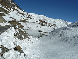
. The NH 21 is the vital road link for the people living in the Lahaul Spiti district. The road skirts the Suraj Tal and is just 3 km (1.9 mi) short of the Bara-lacha-la pass. It is sometimes falsely claimed to be the highest mountain road in the world (probably the true highest road is the Semo La
in Tibet) but it remains inaccessible from Rohtang Pass
to Leh during winter months of November to April since the pass becomes totally snowbound during this period.
 The lake is fed from the glaciers and torrential nullahs (streams) originating from the Bara-lacha-la pass, which is 8 km (5 mi) long and is also called the "Pass with crossroads on summit" since roads from Zanskar
, Ladakh
, Spiti and Lahaul meet at this pass. In addition to the Suraj Tal and the Bhaga River that originates from it, Bara-lacha-la Pass is also the source of the Chandra and Yunan Rivers in the northwest and north, respectively.
The lake is situated in the Upper Himalayan Zone or High Latitudinal Zone part of the Himalayas
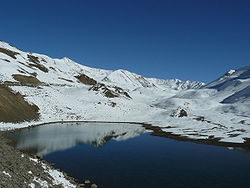
which has very sparse population with climatic conditions akin to polar conditions. Snowfall in this zone, though scanty, is reported to be spread all round the year. Rainfall precipitation is rare in the region. Snow
precipitation
from snow storms is reported to be less than 20 cm (7.9 in) of snow in nearly 50 % of the storms, even though one observatory in the region has reported 80 cm (31.5 in) of snow fall. The precipitation starts melting from May. Snow on slopes is generally slackly bonded, with wind
redistributing it. The average total snowfall recorded in a year is reported to be 12 m (39.4 ft) –15 m (49.2 ft) with temperatures of Highest Max. 13 °C (55.4 °F), Mean Max.0.5 °C (32.9 °F),Mean Minimum minus 11.7 °C (53.1 °F) and Lowest Minimum of minus 27 °C (80.6 °F). The ground in the zone is covered with scree and boulders.
is represented by the Bara-lacha-la Pass, which is reported to be an early rifting event on the northern Indian passive margin and that the Basalt
s which are emplaced along the trans–tensional faults indicate that.
 The Bhaga Valley (Tod or Stod Valley) formed from Suraj Tal up to Tandi
, the confluence point with Chandra River, is 64 km (39.8 mi) long. The valley, which is a narrow gorge, is devoid of any vegetation up to Darcha and thereafter it widens up to its confluence with Chandra River at Tandi with terraces between Darcha and Tandi which are under cultivation in the lower slopes, with the middle slopes having grasslands. Plantation of trees and shrubs to meet fuel wood and fodder requirements have been done on the hill slopes.
 Lahaul Spiti valley is common a destination for Indian and foreign tourists for road trips, trekking and motorcycling which cover the Lake and the Bara-lacha-la pass, en-route from Manali to Leh.
–Suraj Tal–Bara-lacha-la, which involves trek along the Bhaga River for 3 km (1.9 mi), cross a bridge to the North bank, then a further climb of 2.5 km (1.6 mi) from the bridge followed by a steep foot trail up to Suraj Tal.
Bara-lacha-la
Bara-lacha la also known as Bara-lacha Pass, or Bārā Lācha La, is a high mountain pass in Zanskar range, connecting Lahaul district in Himachal Pradesh to Ladakh in Jammu and Kashmir, situated along the Leh-Manali highway....
pass (4,890m) (8 km (5 mi) in length) in the Lahaul and Spiti valley of Himachal Pradesh
Himachal Pradesh
Himachal Pradesh is a state in Northern India. It is spread over , and is bordered by the Indian states of Jammu and Kashmir on the north, Punjab on the west and south-west, Haryana and Uttar Pradesh on the south, Uttarakhand on the south-east and by the Tibet Autonomous Region on the east...
State in India and is the third highest lake in India, and the 21st-highest in the world. Suraj Tal Lake is the source of Bhaga River which joins the Chandra
Chandra
In Hinduism, Chandra is a lunar deity and a Graha. Chandra is also identified with the Vedic Lunar deity Soma . The Soma name refers particularly to the juice of sap in the plants and thus makes the Moon the lord of plants and vegetation. He is described as young, beautiful, fair; two-armed and...
River downstream at Tandi
Tandi
Tandi is a city in the Ratnanagar Municipality of the Chitwan District in Nepal. It lies on the eastern side of Chitwan district.-Background:...
to form the Chandrabhaga
Chandrabhaga
Chandrabhaga may refer to:* Chenab River in Punjab* Bhima River near Pandharpur, Maharashtra...
River in Himachal Pradesh territory, and as it enters Jammu and Kashmir
Jammu and Kashmir
Jammu and Kashmir is the northernmost state of India. It is situated mostly in the Himalayan mountains. Jammu and Kashmir shares a border with the states of Himachal Pradesh and Punjab to the south and internationally with the People's Republic of China to the north and east and the...
it is renamed as the Chenab River. The Bhaga River (a tributary of the Chandrabhaga
Chandrabhaga
Chandrabhaga may refer to:* Chenab River in Punjab* Bhima River near Pandharpur, Maharashtra...
or Chenab) originates from Surya taal. The other major tributary of the Chandrabhaga, the Chandra
Chandra
In Hinduism, Chandra is a lunar deity and a Graha. Chandra is also identified with the Vedic Lunar deity Soma . The Soma name refers particularly to the juice of sap in the plants and thus makes the Moon the lord of plants and vegetation. He is described as young, beautiful, fair; two-armed and...
originates from the glacier close to the Chandra Taal
Chandra Taal
Chandra Taal , or Chandra Tal, is situated at an altitude of about in the Himalayas. Mountains of scree overlook the lake on one side, and a magnificent cirque presents a view on the other. The name of the lake originates from its crescent shape...
lake in the Spiti
Spiti
-Geographical locations:*Lahaul and Spiti, a district in the state of Himachal Pradesh in India.*Spiti Valley, former heartland of the former Spiti district now combined.*Spiti River, in the Spiti Valley, Himachal Pradesh.*Spitia River-Language:...
district.
Access
Suraj Tal is 65 km (40.4 mi) from KeylongKeylong
Keylong is the administrative centre of the Lahaul and Spiti district in the Indian state of Himachal Pradesh, some 120 kilometres from the Indo-Tibetan border....
, the district headquarters of the Lahaul Spiti district, a frontier district of India which is approachable by road by the National Highway NH 21, also known as the Leh-Manali Highway
Leh-Manali Highway
The Leh-Manali Highway is a highway in India connecting Leh and Manali. It is open only between June and mid-September when snow is cleared from the road by the Border Roads Organisation. It connects the Manali valley to Kullu valley, Lahaul and Spiti and Ladakh...
. The NH 21 is the vital road link for the people living in the Lahaul Spiti district. The road skirts the Suraj Tal and is just 3 km (1.9 mi) short of the Bara-lacha-la pass. It is sometimes falsely claimed to be the highest mountain road in the world (probably the true highest road is the Semo La
Semo La
Semo La is a mountain pass situated in the central part of Tibet and gives access to the Chang Tang region. It is found on the so-called Northern Route, north of Raka and south of Coqen in Central Tibet...
in Tibet) but it remains inaccessible from Rohtang Pass
Rohtang Pass
Rohtang Pass , is a high mountain pass on the eastern Pir Panjal Range of the Himalayas some from Manali...
to Leh during winter months of November to April since the pass becomes totally snowbound during this period.
Terrain

Zanskar
Zanskar is a subdistrict or tehsil of the Kargil district, which lies in the eastern half of the Indian state of Jammu and Kashmir. The administrative centre is Padum...
, Ladakh
Ladakh
Ladakh is a region of Jammu and Kashmir, the northernmost state of the Republic of India. It lies between the Kunlun mountain range in the north and the main Great Himalayas to the south, inhabited by people of Indo-Aryan and Tibetan descent...
, Spiti and Lahaul meet at this pass. In addition to the Suraj Tal and the Bhaga River that originates from it, Bara-lacha-la Pass is also the source of the Chandra and Yunan Rivers in the northwest and north, respectively.
The lake is situated in the Upper Himalayan Zone or High Latitudinal Zone part of the Himalayas
Himalayas
The Himalaya Range or Himalaya Mountains Sanskrit: Devanagari: हिमालय, literally "abode of snow"), usually called the Himalayas or Himalaya for short, is a mountain range in Asia, separating the Indian subcontinent from the Tibetan Plateau...
which has very sparse population with climatic conditions akin to polar conditions. Snowfall in this zone, though scanty, is reported to be spread all round the year. Rainfall precipitation is rare in the region. Snow
Snow
Snow is a form of precipitation within the Earth's atmosphere in the form of crystalline water ice, consisting of a multitude of snowflakes that fall from clouds. Since snow is composed of small ice particles, it is a granular material. It has an open and therefore soft structure, unless packed by...
precipitation
Precipitation (meteorology)
In meteorology, precipitation In meteorology, precipitation In meteorology, precipitation (also known as one of the classes of hydrometeors, which are atmospheric water phenomena is any product of the condensation of atmospheric water vapor that falls under gravity. The main forms of precipitation...
from snow storms is reported to be less than 20 cm (7.9 in) of snow in nearly 50 % of the storms, even though one observatory in the region has reported 80 cm (31.5 in) of snow fall. The precipitation starts melting from May. Snow on slopes is generally slackly bonded, with wind
Wind
Wind is the flow of gases on a large scale. On Earth, wind consists of the bulk movement of air. In outer space, solar wind is the movement of gases or charged particles from the sun through space, while planetary wind is the outgassing of light chemical elements from a planet's atmosphere into space...
redistributing it. The average total snowfall recorded in a year is reported to be 12 m (39.4 ft) –15 m (49.2 ft) with temperatures of Highest Max. 13 °C (55.4 °F), Mean Max.0.5 °C (32.9 °F),Mean Minimum minus 11.7 °C (53.1 °F) and Lowest Minimum of minus 27 °C (80.6 °F). The ground in the zone is covered with scree and boulders.
Geology
The Lake's geologyGeology
Geology is the science comprising the study of solid Earth, the rocks of which it is composed, and the processes by which it evolves. Geology gives insight into the history of the Earth, as it provides the primary evidence for plate tectonics, the evolutionary history of life, and past climates...
is represented by the Bara-lacha-la Pass, which is reported to be an early rifting event on the northern Indian passive margin and that the Basalt
Basalt
Basalt is a common extrusive volcanic rock. It is usually grey to black and fine-grained due to rapid cooling of lava at the surface of a planet. It may be porphyritic containing larger crystals in a fine matrix, or vesicular, or frothy scoria. Unweathered basalt is black or grey...
s which are emplaced along the trans–tensional faults indicate that.
Bhaga Valley

Tandi
Tandi is a city in the Ratnanagar Municipality of the Chitwan District in Nepal. It lies on the eastern side of Chitwan district.-Background:...
, the confluence point with Chandra River, is 64 km (39.8 mi) long. The valley, which is a narrow gorge, is devoid of any vegetation up to Darcha and thereafter it widens up to its confluence with Chandra River at Tandi with terraces between Darcha and Tandi which are under cultivation in the lower slopes, with the middle slopes having grasslands. Plantation of trees and shrubs to meet fuel wood and fodder requirements have been done on the hill slopes.
Tourism

Trekking
Trekking tours are a common feature. One such trek route is the ZingzingbarZingzingbar
Zingzingbar is a road building camp and tea house situated 18 km from Bara-lacha-la on the Manali to Leh road in the Lahaul and Spiti district of Himachal Pradesh. It lies at an altitude of around 4,270 m....
–Suraj Tal–Bara-lacha-la, which involves trek along the Bhaga River for 3 km (1.9 mi), cross a bridge to the North bank, then a further climb of 2.5 km (1.6 mi) from the bridge followed by a steep foot trail up to Suraj Tal.

