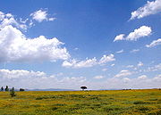
Bajío
Encyclopedia

Mexico
The United Mexican States , commonly known as Mexico , is a federal constitutional republic in North America. It is bordered on the north by the United States; on the south and west by the Pacific Ocean; on the southeast by Guatemala, Belize, and the Caribbean Sea; and on the east by the Gulf of...
that includes the plains south of the Sierra de Guanajuato, in the state of Guanajuato
Guanajuato
Guanajuato officially Estado Libre y Soberano de Guanajuato is one of the 31 states which, with the Federal District, comprise the 32 Federal Entities of Mexico. It is divided in 46 municipalities and its capital city is Guanajuato....
, as well as parts of the states of Querétaro
Querétaro
Querétaro officially Estado Libre y Soberano de Querétaro de Arteaga is one of the 31 states which, with the Federal District, comprise the 32 Federal Entities of Mexico. It is divided into 18 municipalities and its capital city is Santiago de Querétaro....
(the Valley of Querétaro
Santiago de Querétaro
Santiago de Querétaro is the capital and largest city of the state of Querétaro, located in central Mexico. It is located 213 km northwest of Mexico City, 96 km southeast of San Miguel de Allende and 200 km south of San Luis Potosí...
) and Michoacán
Michoacán
Michoacán officially Estado Libre y Soberano de Michoacán de Ocampo is one of the 31 states which, with the Federal District, comprise the 32 Federal Entities of Mexico. It is divided in 113 municipalities and its capital city is Morelia...
(particularly the area around Zamora
Zamora, Michoacán
Zamora de Hidalgo, is a city in the Mexican state of Michoacán. The 2010 census population was 141,627. making it the third largest city in the state. The city is the municipal seat of Zamora Municipality, which has an area of 330.97 km² and includes many other smaller communities, the largest of...
).
In general parlance, it is usually associated with the States of Guanajuato and Querétaro, although it only forms a part of them. It is characterized by its highly mechanized agriculture, with mean precipitation in the order of 700 millimetres (27.6 in) per annum (one of the highest in the country). During the Viceroyalty of New Spain
New Spain
New Spain, formally called the Viceroyalty of New Spain , was a viceroyalty of the Spanish colonial empire, comprising primarily territories in what was known then as 'América Septentrional' or North America. Its capital was Mexico City, formerly Tenochtitlan, capital of the Aztec Empire...
, the area was known as the breadbasket of the territory.
The Bajío is known for being one of the most conservative bastions of Mexican Catholicism.
The Bajío is where in April 1915, during the Mexican Revolution
Mexican Revolution
The Mexican Revolution was a major armed struggle that started in 1910, with an uprising led by Francisco I. Madero against longtime autocrat Porfirio Díaz. The Revolution was characterized by several socialist, liberal, anarchist, populist, and agrarianist movements. Over time the Revolution...
, General Álvaro Obregón
Álvaro Obregón
General Álvaro Obregón Salido was the President of Mexico from 1920 to 1924. He was assassinated in 1928, shortly after winning election to another presidential term....
provoked decisive battles against Pancho Villa
Pancho Villa
José Doroteo Arango Arámbula – better known by his pseudonym Francisco Villa or its hypocorism Pancho Villa – was one of the most prominent Mexican Revolutionary generals....
. Villa's troops lost in June outside Celaya
Celaya
Celaya is a city and its surrounding municipality in the state of Guanajuato, Mexico, located in the southeast quadrant of the state. It is the third most populous city in the state, with a 2005 census population of 310,413. The municipality for which the city serves as municipal seat, had a...
.
Pre-historic Bajío culture
Recent archaeological studies of the Bajío have discovered an extensive, pre-historic cultural tradition unique to the region, particularly along the flood plains of the LermaLerma River
The Lerma Santiago River is Mexico's second longest river. It is a river in west-central Mexico that begins in Mexican Plateau at an altitude over above sea level, and ends where it empties into Lake Chapala, Mexico's largest lake, near Guadalajara, Jalisco...
and Laja
Laja River (Mexico)
Laja River is a river in Guanajuato in central Mexico. It is 137 km long. The river rises in the Sierra Madre Occidental, and flows east and then south to join the Apaseo near Celaya.-References:*...
rivers. The Bajío Culture flourished from 300 to 650CE, with cultural centers ranging from El Cóporo
El Cóporo
El Cóporo is a prehispanic archaeological site at the northern frontiers of the Mesoamerican cultural area, located at an elevation of 150 meters on the western slopes of the Santa Bárbara range , near the San José del Torreón community, and lies some due south of its municipal seat and largest...
in the far north of Guanajuato to Plazuelas
Plazuelas
Plazuelas is a prehispanic archaeological site located just north of San Juan el Alto, some 2.7 kilometers north of federal highway 90 , and about 11 kilometers west of the city of Penjamo in the state of Guanajuato, Mexico...
in the far south west. More than 1,400 sites have been discovered throughout the state of Guanajuato, with only the sites of Cañada de la Virgen
Cañada de la Virgen
Cañada de la Virgen is a pre-Columbian archaeological site in the Mexican state of Guanajuato. The site lies about 16 km west-southwest of the city of San Miguel de Allende within a private property, already registered by INAH in 1985....
, El Cóporo, Peralta
Peralta (Mesoamerican site)
Peralta is a prehispanic mesoamerican archaeological site located in the municipality of Abasolo, Guanajuato, just outside the village of San Jose de Peralta in the Mexican state of Guanajuato. The site is reached via Mexico highway 90 of from Irapuato. Approximately 15.5 km south of the...
, and Plazuelas having received extensive study.

