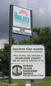
Baker's Haulover Inlet
Encyclopedia


Miami-Dade County, Florida
Miami-Dade County is a county located in the southeastern part of the state of Florida. As of 2010 U.S. Census, the county had a population of 2,496,435, making it the most populous county in Florida and the eighth-most populous county in the United States...
connecting the northern end of Biscayne Bay
Biscayne Bay
Biscayne Bay is a lagoon that is approximately 35 miles long and up to 8 miles wide located on the Atlantic coast of South Florida, United States. It is usually divided for purposes of discussion and analysis into three parts: North Bay, Central Bay, and South Bay. Its area is...
with the Atlantic Ocean
Atlantic Ocean
The Atlantic Ocean is the second-largest of the world's oceanic divisions. With a total area of about , it covers approximately 20% of the Earth's surface and about 26% of its water surface area...
, at coordinates 25°53′59"N 80°07′26"W. The inlet was cut in 1925 through a narrow point in the peninsula that extends to a point east of the mouth of the Miami River
Miami River (Florida)
The Miami River is a river in the United States state of Florida that drains out of the Everglades and runs through the Downtown and the city of Miami. The long river flows from the terminus of the Miami Canal at Miami International Airport to Biscayne Bay...
, and which now is occupied by the cities of Bal Harbour
Bal Harbour, Florida
Bal Harbour is a village in Miami-Dade County, Florida, United States. The population was 3,305 at the 2000 census.-Geography:Bal Harbour is located at .According to the United States Census Bureau, the village has a total area of...
, Surfside
Surfside, Florida
Surfside is a town in Miami-Dade County, Florida, United States. The population was 4,909 at the 2000 census. As of 2005, the population recorded by the U.S. Census Bureau is 4,710.-Geography:...
and Miami Beach
Miami Beach, Florida
Miami Beach is a coastal resort city in Miami-Dade County, Florida, United States, incorporated on March 26, 1915. The municipality is located on a barrier island between the Atlantic Ocean and Biscayne Bay, the latter which separates the Beach from Miami city proper...
. The cut is bordered to the south by Bal Harbour, and to the north by Miami-Dade County Haulover Park
Haulover Park
Haulover Park is a urban park in metropolitan Miami, just north of Bal Harbour, Florida. The park is located on a shoal between the Atlantic Ocean and Biscayne Bay, just north of the Broad Causeway and Collins Avenue.-History:...
. A fixed bridge carries SR A1A
State Road A1A (Florida)
State Road A1A is a Florida State Road that runs mostly along the Atlantic Ocean, with sections from Key West at the southern tip of Florida, to Callahan, just south of Georgia. It is the main road through most oceanfront towns. SR A1A is designated the A1A Scenic and Historic Coastal Highway, a...
across the inlet.
The name is reported to have appeared on maps as early as 1823.
There is a State of Florida Historical Landmark Marker (over 50 years old) at the original Lighthouse Dock site dedicated on February 21, 2004, to the first charter-boat captains at the 1926-1951 dock. It is the only marker in the State of Florida for a fishing dock.

