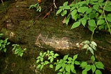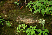
Ellicott's Rock
Encyclopedia
In 1811, Andrew Ellicott
made a survey for the State of Georgia
to resolve the boundary dispute between Georgia and North Carolina
. He marked a large rock in the Chattooga River
with "NC-GA", standing for North Carolina - Georgia.
 Two years later commissioners representing South Carolina
and North Carolina
marked a large rock along the Chattooga River bank with the inscription "Lat 35 AD 1813 NC + S.C." as the juncture where the South Carolina and North Carolina state lines joined. The rock marked by the S.C. and N.C. commissioners in 1813, rather than the rock marked by Ellicott in 1811, is usually called Ellicott's Rock. It is also known as Ellicott Rock. This is commonly accepted as the point where the boundary lines of South Carolina, North Carolina, and Georgia join.
There are two versions in print on the distance between the two rocks. One is that Ellicott's original rock was 500 ft upstream. In the other story, the rocks are much closer. De Hart's South Carolina Trails guide said that they are a "few feet apart." In the North Carolina trail guide, he said Commissioner Rock is "ten feet downstream".
This rock was listed in the National Register of Historic Places in 1973 and is located in Ellicott Rock Wilderness
. The South Carolina Department of Archives and History has additional information, and copies of the nomination forms.
Andrew Ellicott
Andrew Ellicott was a U.S. surveyor who helped map many of the territories west of the Appalachians, surveyed the boundaries of the District of Columbia, continued and completed Pierre Charles L'Enfant's work on the plan for Washington, D.C., and served as a teacher in survey methods for...
made a survey for the State of Georgia
Georgia (U.S. state)
Georgia is a state located in the southeastern United States. It was established in 1732, the last of the original Thirteen Colonies. The state is named after King George II of Great Britain. Georgia was the fourth state to ratify the United States Constitution, on January 2, 1788...
to resolve the boundary dispute between Georgia and North Carolina
North Carolina
North Carolina is a state located in the southeastern United States. The state borders South Carolina and Georgia to the south, Tennessee to the west and Virginia to the north. North Carolina contains 100 counties. Its capital is Raleigh, and its largest city is Charlotte...
. He marked a large rock in the Chattooga River
Chattooga River
The Chattooga River is the main tributary of the Tugaloo River. Its headwaters are located southwest of Cashiers, North Carolina, and it stretches to where it has its confluence with the Tallulah River within Lake Tugalo, held back by the Tugalo Dam...
with "NC-GA", standing for North Carolina - Georgia.

South Carolina
South Carolina is a state in the Deep South of the United States that borders Georgia to the south, North Carolina to the north, and the Atlantic Ocean to the east. Originally part of the Province of Carolina, the Province of South Carolina was one of the 13 colonies that declared independence...
and North Carolina
North Carolina
North Carolina is a state located in the southeastern United States. The state borders South Carolina and Georgia to the south, Tennessee to the west and Virginia to the north. North Carolina contains 100 counties. Its capital is Raleigh, and its largest city is Charlotte...
marked a large rock along the Chattooga River bank with the inscription "Lat 35 AD 1813 NC + S.C." as the juncture where the South Carolina and North Carolina state lines joined. The rock marked by the S.C. and N.C. commissioners in 1813, rather than the rock marked by Ellicott in 1811, is usually called Ellicott's Rock. It is also known as Ellicott Rock. This is commonly accepted as the point where the boundary lines of South Carolina, North Carolina, and Georgia join.
There are two versions in print on the distance between the two rocks. One is that Ellicott's original rock was 500 ft upstream. In the other story, the rocks are much closer. De Hart's South Carolina Trails guide said that they are a "few feet apart." In the North Carolina trail guide, he said Commissioner Rock is "ten feet downstream".
This rock was listed in the National Register of Historic Places in 1973 and is located in Ellicott Rock Wilderness
Ellicott Rock Wilderness
The Ellicott Rock Wilderness was designated in 1975 and currently consists of surrounding the point at which Georgia, North Carolina, and South Carolina come together. It is the only wilderness that straddles three states...
. The South Carolina Department of Archives and History has additional information, and copies of the nomination forms.

