King's Sedgemoor
Encyclopedia
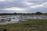
King's Sedgemoor is a piece of rich animal habit and farming land, that forms part of the Somerset Levels
in South West England
.
The area of King's Sedgemoor fell within the Whitley
Hundred,
It is a Site of Special Scientific Interest
, at the centre of the larger Altcar series peat basin of King’s Sedgemoor; lying between the River Sowy to the west, Cradle Bridge to the east and extending to the south over Beer Wall into part of Aller Moor. It is adjacent to the Greylake
SSSI.
King's Sedgemoor Drain
, originally constructed in 1797-8, proved inadequate for draining the village of Chedzoy
's moors, so in 1861 the Chedzoy Internal Drainage District built a small pumping station on the River Parrett
, in Westonzoyland
parish, to drain the Chedzoy moors southwards.
Somerset Levels
The Somerset Levels, or the Somerset Levels and Moors as they are less commonly but more correctly known, is a sparsely populated coastal plain and wetland area of central Somerset, South West England, between the Quantock and Mendip Hills...
in South West England
South West England
South West England is one of the regions of England defined by the Government of the United Kingdom for statistical and other purposes. It is the largest such region in area, covering and comprising Bristol, Gloucestershire, Somerset, Dorset, Wiltshire, Devon, Cornwall and the Isles of Scilly. ...
.
The area of King's Sedgemoor fell within the Whitley
Whitley (hundred)
The Hundred of Whitley is one of the 40 historical Hundreds in the ceremonial county of Somerset, England, dating from before the Norman conquest during the Anglo-Saxon era although exact dates are unknown. Each hundred had a 'fyrd', which acted as the local defence force and a court which was...
Hundred,
It is a Site of Special Scientific Interest
Site of Special Scientific Interest
A Site of Special Scientific Interest is a conservation designation denoting a protected area in the United Kingdom. SSSIs are the basic building block of site-based nature conservation legislation and most other legal nature/geological conservation designations in Great Britain are based upon...
, at the centre of the larger Altcar series peat basin of King’s Sedgemoor; lying between the River Sowy to the west, Cradle Bridge to the east and extending to the south over Beer Wall into part of Aller Moor. It is adjacent to the Greylake
Greylake
Greylake is a 9.3 hectare geological Site of Special Scientific Interest near Middlezoy in Somerset, notified in 1987.This site, on the Somerset Levels, consists of 20 low-lying fields in the north west corner of King's Sedgemoor, and includes the Royal Society for the Protection of Birds Greylake...
SSSI.
King's Sedgemoor Drain
King's Sedgemoor Drain
King's Sedgemoor Drain is an artificial drainage channel which diverts the River Cary in Somerset, England along the southern flank of the Polden Hills, to discharge into the River Parrett at Dunball near Bridgwater. As the name suggests, the channel is used to help drain the peat moors of King's...
, originally constructed in 1797-8, proved inadequate for draining the village of Chedzoy
Chedzoy
Chedzoy is a civil parish village east of Bridgwater in the Sedgemoor district of Somerset, England.-History:The village is at the western end of King's Sedgemoor and lies on an 'island' of Burtle marine sands, close to King's Sedgemoor Drain. The area was settled possibly in the Mesolithic...
's moors, so in 1861 the Chedzoy Internal Drainage District built a small pumping station on the River Parrett
River Parrett
The River Parrett flows through the counties of Dorset and Somerset in South West England, from its source in the Thorney Mills springs in the hills around Chedington in Dorset...
, in Westonzoyland
Westonzoyland
Westonzoyland is a village and civil parish in Somerset, England. It is situated on the Somerset Levels, south east of Bridgwater.-History:The name of the parish derives from its location on the "island" of Sowy, an area of slightly higher ground on the Somerset Levels between the River Cary and...
parish, to drain the Chedzoy moors southwards.

