Lady's Well
Encyclopedia
The Lady's Well is beside the Tour rivulet in Kilmaurs
, East Ayrshire. (NS 4144 4063), Scotland.
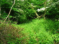
is a patch of woodland which was once an orchard. The Tour Rivulet joins the Carmel Water
nearby and before the confluence can be found an old well, covered over, known as the Lady's well, with never-failing, excellent and refeshingly cool water. A small wooden bridge used to run across to it from the church glebe side.
The hamlet of Pathfoot existed nearby, however no remains are visible today apart from irregularities in the surface of the ground. The orchard is no longer present, however some Crab apples are present that may have reverted back from the old orchard trees. The occupants of old Pathfoot no doubt used the well water as a purer source of water than the Tour Rivulet. The remains of a group of the pre-reformation ecclesiatical collegiate church buildings lie close by, including a doocot. The 'Tower' or 'Tour' was taken down some years ago and only the foundations now exist.
Today (2007) the well is sadly neglected although it is substantially intact.

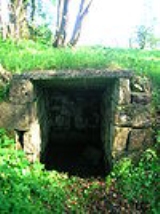
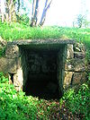
 The "Lady's Well" is a rectangular compartment of ashlar masonry, 2.5m in length, 1.1m wide at the opening, and 1.4m high. It is built into the bank, a short distance above the stream, and has been partly restored some years past with a partly (a repair) concrete roof which slopes gradually downwards from the entrance to the rear. The well is filled with water, however it does not flow as it must have done in the past, probably due to nearby field drainage works. The overflow channel is still extant and a nearby field drain carries a significant volume of water, which may once have flowed from the well, into the Tour Rivulet. The masonry of the well is comparable with that of the nearby doocot (dovecot) (NS44SW 5), indicating either a possible 17th-century date of construction or the re-use of stones from the site of the old tower.
Ashlar walls make up the well sides and a possible niche exists at the back. Low stone walling runs off to the right hand side as seen when facing the well, and steps may have existed, now buried under soil. The stones framing the entrance have the remains of the leaded holes that have held a gate at one time and one side is recessed for a 'door'. One of the stones on the left shows clear signs of having been re-used from another structure.
Various stones lie fallen or thrown inside the well, one possibly being the remains of the broken sandstone covering slab which the concrete slab replaced.
 In 1879 David Landsborough describes the local wells and springs, including the Monk's Well, but makes no reference to a Lady's Well.
John Smith in the 1890s refers to the Monk's well rather than Lady's Well. In 1912, Duncan McNaught the local schoolmaster stated that the "Lady's Well" is an old well, arched over, which provided the water supply for the buildings associated with the collegiate church. Robert Beattie in 1993 saw the well as being associated with the old collegiate church.
A 1982 a description states that the drystone construction of the well-head could be of relatively late date, built with debris from the nearby ruinous tower. Another suggestion was that the well dates from the 17th-century.
The 1856 25 inch to the mile map shows and names the Lady's Well and marks the path that led from the building in the Tour Garden to the well, across the Tour Burn.
The church Minister (2007), the Rev. John Urquhart, has been informed by locals that the well is named after the wife of an owner of Tour House
who daily came to collect the cool water. Certainly Mr.Findlay of Tour is recorded by McNaught as having enjoy the never failing water, of excellent quality, and refreshingly coll on the hottest day of summer. This information may be partly correct in that an opening in the wall opposite the entrance to Tour House has clearly been made to allow access to the woods in which the well is situated. The repairs using a concrete slab as part of the roof and the ashlar walling may have been carried out within the last hundred years or so.
Kilmaurs
Kilmaurs is a village in East Ayrshire, Scotland. It lies on the Carmel, 21.1 miles south by west of Glasgow. Population recorded in 2001 Census, 2601- History :...
, East Ayrshire. (NS 4144 4063), Scotland.
Introduction
Next to the Saint Maurs-Glencairn church in KilmaursKilmaurs
Kilmaurs is a village in East Ayrshire, Scotland. It lies on the Carmel, 21.1 miles south by west of Glasgow. Population recorded in 2001 Census, 2601- History :...
is a patch of woodland which was once an orchard. The Tour Rivulet joins the Carmel Water
River Irvine
The River Irvine is a river flowing through southwest Scotland, with its watershed on the Lanarkshire border of Ayrshire at an altitude of above sea-level, near Drumclog, and SW by W of Strathaven...
nearby and before the confluence can be found an old well, covered over, known as the Lady's well, with never-failing, excellent and refeshingly cool water. A small wooden bridge used to run across to it from the church glebe side.
The hamlet of Pathfoot existed nearby, however no remains are visible today apart from irregularities in the surface of the ground. The orchard is no longer present, however some Crab apples are present that may have reverted back from the old orchard trees. The occupants of old Pathfoot no doubt used the well water as a purer source of water than the Tour Rivulet. The remains of a group of the pre-reformation ecclesiatical collegiate church buildings lie close by, including a doocot. The 'Tower' or 'Tour' was taken down some years ago and only the foundations now exist.
Today (2007) the well is sadly neglected although it is substantially intact.
Description


Ashlar walls make up the well sides and a possible niche exists at the back. Low stone walling runs off to the right hand side as seen when facing the well, and steps may have existed, now buried under soil. The stones framing the entrance have the remains of the leaded holes that have held a gate at one time and one side is recessed for a 'door'. One of the stones on the left shows clear signs of having been re-used from another structure.
Various stones lie fallen or thrown inside the well, one possibly being the remains of the broken sandstone covering slab which the concrete slab replaced.
History

John Smith in the 1890s refers to the Monk's well rather than Lady's Well. In 1912, Duncan McNaught the local schoolmaster stated that the "Lady's Well" is an old well, arched over, which provided the water supply for the buildings associated with the collegiate church. Robert Beattie in 1993 saw the well as being associated with the old collegiate church.
A 1982 a description states that the drystone construction of the well-head could be of relatively late date, built with debris from the nearby ruinous tower. Another suggestion was that the well dates from the 17th-century.
The 1856 25 inch to the mile map shows and names the Lady's Well and marks the path that led from the building in the Tour Garden to the well, across the Tour Burn.
The church Minister (2007), the Rev. John Urquhart, has been informed by locals that the well is named after the wife of an owner of Tour House
Lambroughton
Lambroughton is a village in the old Barony of Kilmaurs, North Ayrshire, Scotland. This is a rural area famous for its milk and cheese production and the Ayrshire or Dunlop breed of cattle.-Origins of the name:...
who daily came to collect the cool water. Certainly Mr.Findlay of Tour is recorded by McNaught as having enjoy the never failing water, of excellent quality, and refreshingly coll on the hottest day of summer. This information may be partly correct in that an opening in the wall opposite the entrance to Tour House has clearly been made to allow access to the woods in which the well is situated. The repairs using a concrete slab as part of the roof and the ashlar walling may have been carried out within the last hundred years or so.

