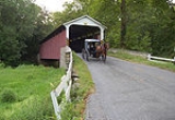
Mercer's Mill Covered Bridge
Encyclopedia
Mercer's Mill Covered Bridge or Mercer's Ford Covered Bridge is a covered bridge
that spans the East branch of the Octoraro Creek on the border between Lancaster County
and Chester County
in Pennsylvania
, United States
. A Lancaster County-owned and maintained bridge, its official designation is the East Octoraro #2 Bridge.
The bridge has a single span, wooden, double Burr arch trusses design with the addition of steel hanger rods. The deck is made from oak planks. It is painted red, the traditional color of Lancaster County covered bridges, on both the inside and outside. Both approaches to the bridge are painted in the traditional white color. The bridge has a single window on only one side of the bridge.
The bridge's WGCB
Numbers are 38-15-19/38-36-38. Added in 1980, it is listed on the National Register of Historic Places
as structure number 80003509. It is located at 39°55′53.4"N 75°58′53.4"W (39.93150, -75.98150). The bridge is located in Sadsbury Township
, 0.5 miles (0.8 km) south of Christiana
on Bailey Crossroads Road off Creek Road, to the south of Pennsylvania Route 372.
(built in 1884), it was one of a number of covered bridges built along the border between Lancaster and Chester counties.
Covered bridge
A covered bridge is a bridge with enclosed sides and a roof, often accommodating only a single lane of traffic. Most covered bridges are wooden; some newer ones are concrete or metal with glass sides...
that spans the East branch of the Octoraro Creek on the border between Lancaster County
Lancaster County, Pennsylvania
Lancaster County, known as the Garden Spot of America or Pennsylvania Dutch Country, is a county located in the southeastern part of the Commonwealth of Pennsylvania, in the United States. As of 2010 the population was 519,445. Lancaster County forms the Lancaster Metropolitan Statistical Area, the...
and Chester County
Chester County, Pennsylvania
-State parks:*French Creek State Park*Marsh Creek State Park*White Clay Creek Preserve-Demographics:As of the 2010 census, the county was 85.5% White, 6.1% Black or African American, 0.2% Native American or Alaskan Native, 3.9% Asian, 0.0% Native Hawaiian, 1.8% were two or more races, and 2.4% were...
in Pennsylvania
Pennsylvania
The Commonwealth of Pennsylvania is a U.S. state that is located in the Northeastern and Mid-Atlantic regions of the United States. The state borders Delaware and Maryland to the south, West Virginia to the southwest, Ohio to the west, New York and Ontario, Canada, to the north, and New Jersey to...
, United States
United States
The United States of America is a federal constitutional republic comprising fifty states and a federal district...
. A Lancaster County-owned and maintained bridge, its official designation is the East Octoraro #2 Bridge.
The bridge has a single span, wooden, double Burr arch trusses design with the addition of steel hanger rods. The deck is made from oak planks. It is painted red, the traditional color of Lancaster County covered bridges, on both the inside and outside. Both approaches to the bridge are painted in the traditional white color. The bridge has a single window on only one side of the bridge.
The bridge's WGCB
World Guide to Covered Bridges
The World Guide to Covered Bridges is a covered bridge numbering system. The system was invented by John Diehl, the chairman of the Ohio Covered Bridge Committee. The committee first used the numbering system in 1953 to publish a list of covered bridges in Ohio....
Numbers are 38-15-19/38-36-38. Added in 1980, it is listed on the National Register of Historic Places
National Register of Historic Places
The National Register of Historic Places is the United States government's official list of districts, sites, buildings, structures, and objects deemed worthy of preservation...
as structure number 80003509. It is located at 39°55′53.4"N 75°58′53.4"W (39.93150, -75.98150). The bridge is located in Sadsbury Township
Sadsbury Township, Lancaster County, Pennsylvania
Sadsbury Township is a township in east central Lancaster County, Pennsylvania, United States. The population was 3,025 at the 2000 census.-History:...
, 0.5 miles (0.8 km) south of Christiana
Christiana, Pennsylvania
Christiana is a borough in Lancaster County, Pennsylvania, United States. The population was 1,124 at the 2000 census. In 1851 it was the site of the Battle of Christiana .-Geography:...
on Bailey Crossroads Road off Creek Road, to the south of Pennsylvania Route 372.
History
The bridge was built in 1880 by B. J. Carter. Along with the Pine Grove Covered BridgePine Grove Covered Bridge
Pine Grove Covered Bridge is a covered bridge that spans the East branch of the Octoraro Creek on the border between Lancaster County and Chester County in Pennsylvania, United States. It is the longest covered bridge in Lancaster County....
(built in 1884), it was one of a number of covered bridges built along the border between Lancaster and Chester counties.
Dimensions
- Length: 87 feetFtFt or ft. may mean:* Foot , a unit of distance or length* Hungarian forint, the currency of Hungary* Fair Trade, the principle to give a fair price when trading* Fort, a fortified place, especially in place names...
(26.5 m) spanSpan (architecture)Span is the distance between two intermediate supports for a structure, e.g. a beam or a bridge.A span can be closed by a solid beam or of a rope...
Note: - Width: 15 feet 4 inches (4.7 m) Note:
- Overhead clearance: 11 feet 6 inches (3.5 m)
- Underclearance: 13 feet 6 inches (4.1 m)

