
Pedro Muñoz
Encyclopedia
Pedro Muñoz is a municipality
in the autonomous community named Castile-La Mancha
, Spain. It lies in the province of Ciudad Real
, in the extreme northeast of the province on right basin of the Záncara
river. It is in the La Mancha region, in the "Mancha Alta" sub-region. It is a small municipality due to its abandonment as a municipality in 1410, but Pedro Muñoz has 45,27 enterprises for each 1000 inhabitants.
, on the west by Campo de Criptana
, on the east by Mota del Cuervo and on the south by Socuéllamos and Tomelloso. It has a population of 7905 inhabitants. (INE 2006) or 9300 inhabitants, according to the municipal roll of June 2007. It has an area of 101.3 km ² and is located 113 km from the provincial capital. Its population density is 78.04 inhabitants / km ². Although it is at a comparatively high altitude, the region is itself flat. It is a typical village in La Mancha concentrated population and low housing typical of the region.
It is located in the southern part of the submeseta south of the Iberian peninsula, in the Guadiana river basin and the Záncara river, and has a nature reserve surrounding a lake complex.
This lake complex has seven lakes. La Vega or Laguna del pueblo lagoon is considered "green", Alcahozo, Manjavacas and Monte Chico are salt lakes and Retamar and Navalafuente are "endorreic" lakes (sealed off from sources of water such as streams or rivers).
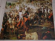 In pre-Roman times, the area had a native population of about 100 people, which have been found several samples of his sculpture in the Cerro de La Nieve. Later this area was occupied by the Romans, in the fourth century by the Visigoths, in the eighth century by Muslims, and finally the new settlers arrivals of Castile
. It was the Archdeacon of Alcaraz, named Pero Muñoz and belonging to the Order of Santiago, the one who longed to find in the vast plain Mancha an elevated and defensible from any razzia of often carried out by Muslim troops and causing major havoc among Christians. The village was founded in the year 1284, the year of the death of King Alfonso X the Wise of Castile, will happen on the throne his son Sancho IV
. The Archbishop of Toledo had asked permission to found churches throughout this region, expropriating the land on which they stood. Realizing that the site was inhabited, the villagers tried to leave the village to take it. The Archdeacon of Alcaraz petitioned the Archbishop of Toledo for permission to annex the land, although it was already populated. Arcediano was famous for the complicated that forced the Archbishop of Toledo to concede the town to Alcaraz, and relinquish his own rights to it. For this reason, the villagers wanted to honor him by putting his name to this. In 1410 the villagers were driven out when pests rendered their part of Castile barren, in particular wreaking havoc in areas with wetlands (one lake was divided into three parts) and the villages which surrounded this lake.
The town began to be repopulated in the sixteenth century when Spain already positioned as one of the major European powers and Emperor Charles V was occupying the throne. When it became necessary for him to leave Spain to resolving issues in Spain's territories throughout Europe, Charles granted the village of Pedro Muñoz to his wife, Dona Isobel, on August 10, 1531. Six years earlier, in 1525, he had begun to settle the land for a family Cuenca, surnamed Mayordomo. The father, Juan Mayordomo, was encouraged to go to the abandoned village by what he had heard about the fertility of the lands. Later, the town came back to life as people came to repopulate the area. Juan Mayordomo would become the first mayor of the municipality for his leadership skills. Farmers in neighboring villages, Socuéllamos, El Toboso, Campo de Criptana and Mota del Cuervo, came with farming implements to destroy the houses where the new residents had settled, as they were afraid they'd lose the limes, forests and rangelands that had been abandoned when the people fled in 1410.
Between that point and the seventeenth century, a number of large mansions, such as "Paca's House-Palace" were built, and in 1700 the construction of the Church of St. Peter the Apostle began, which epitomized all that was beautiful in the Renaissance and Baroque and reflected the splendor of the villa which were proclaimed as such.
Pedro Muñoz still had far to go to match the glory it achieved in the beginning of the twentieth century, with the beginnings of the vinyards and winemaking industry. It gained the momentum for greater democracy and freedom for its enterprising citizens who created companies to meet market needs of the people and to provide jobs to its neighbors and those in the region who, in turn, help to maintain and grow this great municipality that is located in the heart of La Mancha and while it is expecting a fairly promising future.
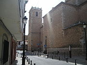
It is certainly the most representative architectural Pedro Muñoz. It is a graceful style that mixes with the Renaissance Baroque. The church has a Latin cross with low body townhouses in three of the corners of the tower and cruise square floor plan. Coinciding with the celebration of the third centenary of the start of work was to the rehabilitation and placement of the bell tower, which has contributed to enhancing its beauty.
In 1769 work began on the new chapel, but it did not resume until 1771 and ended eight years later. He had extensive arcades and seating throughout. The building was largely destroyed in the Civil War and was not rebuilt until the war ended.
"Siendo entre tus hechos, aqueste señero a tus castillos Heredia Granero añade el león feroz que mataste que nan tu rey también amparaste".
"Being among your facts, this Sir to your castles Heredia Granero added that ferocious lion that you killed for your king also save him".
It takes cimera, but if a warrior armed with a sword and the cross of Saint James in the chest, bordura baroque and a border with eight bundles of arrows, the symbol of the Catholic Monarchs.
(Cuenca) and Campo de Criptana
(Ciudad Real).
In successive interventions made at the site have found numerous archaeological remains, including small-scale metal through a possible workshop copper smelter; Ceramics hand tradition Field Ballot boxes; bronze fibules and Greek pottery and numerous burials Iberians, a Roman and many medieval burials.
Municipality
A municipality is essentially an urban administrative division having corporate status and usually powers of self-government. It can also be used to mean the governing body of a municipality. A municipality is a general-purpose administrative subdivision, as opposed to a special-purpose district...
in the autonomous community named Castile-La Mancha
Castile-La Mancha
Castile-La Mancha is an autonomous community of Spain. Castile-La Mancha is bordered by Castile and León, Madrid, Aragon, Valencia, Murcia, Andalusia, and Extremadura. It is one of the most sparsely populated of Spain's autonomous communities...
, Spain. It lies in the province of Ciudad Real
Ciudad Real (province)
The province of Ciudad Real is a province of South-central Spain, in the southwestern part of the autonomous community of Castile-La Mancha. It is bordered by the provinces of Cuenca, Albacete, Jaén, Córdoba, Badajoz, and Toledo. Its extent is effectively that of the old province of La Mancha...
, in the extreme northeast of the province on right basin of the Záncara
Záncara
The Záncara is a 168 km long river in Castile-La Mancha, Spain. It is a tributary to the Cigüela, a tributary of the Guadiana. Its source is near the village Abia de la Obispalía, west of Cuenca, in the Iberian System. The Záncara flows southwest, along the town of Socuéllamos...
river. It is in the La Mancha region, in the "Mancha Alta" sub-region. It is a small municipality due to its abandonment as a municipality in 1410, but Pedro Muñoz has 45,27 enterprises for each 1000 inhabitants.
Geography
The municipality is bounded on the north by El TobosoEl Toboso
El Toboso is a town and municipality located in the province of Toledo, central Spain. According to the 2009 data, El Toboso has a total population of 2,219 inhabitants...
, on the west by Campo de Criptana
Campo de Criptana
Campo de Criptana is a municipality and town in the province of Ciudad Real in the autonomous community of Castilla-La Mancha . It is found in the region known as La Mancha.-Historical development:...
, on the east by Mota del Cuervo and on the south by Socuéllamos and Tomelloso. It has a population of 7905 inhabitants. (INE 2006) or 9300 inhabitants, according to the municipal roll of June 2007. It has an area of 101.3 km ² and is located 113 km from the provincial capital. Its population density is 78.04 inhabitants / km ². Although it is at a comparatively high altitude, the region is itself flat. It is a typical village in La Mancha concentrated population and low housing typical of the region.
It is located in the southern part of the submeseta south of the Iberian peninsula, in the Guadiana river basin and the Záncara river, and has a nature reserve surrounding a lake complex.
This lake complex has seven lakes. La Vega or Laguna del pueblo lagoon is considered "green", Alcahozo, Manjavacas and Monte Chico are salt lakes and Retamar and Navalafuente are "endorreic" lakes (sealed off from sources of water such as streams or rivers).
History

Castile (historical region)
A former kingdom, Castile gradually merged with its neighbours to become the Crown of Castile and later the Kingdom of Spain when united with the Crown of Aragon and the Kingdom of Navarre...
. It was the Archdeacon of Alcaraz, named Pero Muñoz and belonging to the Order of Santiago, the one who longed to find in the vast plain Mancha an elevated and defensible from any razzia of often carried out by Muslim troops and causing major havoc among Christians. The village was founded in the year 1284, the year of the death of King Alfonso X the Wise of Castile, will happen on the throne his son Sancho IV
Sancho IV of Castile
Sancho IV the Brave was the King of Castile, León and Galicia from 1284 to his death. He was the second son of Alfonso X and Yolanda, daughter of James I of Aragon.-Biography:...
. The Archbishop of Toledo had asked permission to found churches throughout this region, expropriating the land on which they stood. Realizing that the site was inhabited, the villagers tried to leave the village to take it. The Archdeacon of Alcaraz petitioned the Archbishop of Toledo for permission to annex the land, although it was already populated. Arcediano was famous for the complicated that forced the Archbishop of Toledo to concede the town to Alcaraz, and relinquish his own rights to it. For this reason, the villagers wanted to honor him by putting his name to this. In 1410 the villagers were driven out when pests rendered their part of Castile barren, in particular wreaking havoc in areas with wetlands (one lake was divided into three parts) and the villages which surrounded this lake.
The town began to be repopulated in the sixteenth century when Spain already positioned as one of the major European powers and Emperor Charles V was occupying the throne. When it became necessary for him to leave Spain to resolving issues in Spain's territories throughout Europe, Charles granted the village of Pedro Muñoz to his wife, Dona Isobel, on August 10, 1531. Six years earlier, in 1525, he had begun to settle the land for a family Cuenca, surnamed Mayordomo. The father, Juan Mayordomo, was encouraged to go to the abandoned village by what he had heard about the fertility of the lands. Later, the town came back to life as people came to repopulate the area. Juan Mayordomo would become the first mayor of the municipality for his leadership skills. Farmers in neighboring villages, Socuéllamos, El Toboso, Campo de Criptana and Mota del Cuervo, came with farming implements to destroy the houses where the new residents had settled, as they were afraid they'd lose the limes, forests and rangelands that had been abandoned when the people fled in 1410.
Between that point and the seventeenth century, a number of large mansions, such as "Paca's House-Palace" were built, and in 1700 the construction of the Church of St. Peter the Apostle began, which epitomized all that was beautiful in the Renaissance and Baroque and reflected the splendor of the villa which were proclaimed as such.
Pedro Muñoz still had far to go to match the glory it achieved in the beginning of the twentieth century, with the beginnings of the vinyards and winemaking industry. It gained the momentum for greater democracy and freedom for its enterprising citizens who created companies to meet market needs of the people and to provide jobs to its neighbors and those in the region who, in turn, help to maintain and grow this great municipality that is located in the heart of La Mancha and while it is expecting a fairly promising future.
Major events in Pedro Muñoz
- In 1284 was named Pedro Muñoz; this is the recorded year of inception, but the town was not settled until 40 years later.
- In 1324 Alfonso XI granted the town Privilege Villa, in the General Chapter held in MéridaMérida, SpainMérida is the capital of the autonomous community of Extremadura, western central Spain. It has a population of 57,127 . The Archaeological Ensemble of Mérida is a UNESCO World Heritage site since 1993.- Climate :...
. - In 1410 was abandoned by the municipality when a drought dried up the water sources.
- In 1525 John Majordomo consolidated the town after 115 years of neglect.
- In 1531 Doña Isobel (wife of Charles I of Spain) returns to grant Privilege Villa Pedro Muñoz.
- During the Carlist wars there was an agreement signed in this village between the conflicting parties. In fact, one of its streets refers to the same (street Agreement), and is an event related in some academic books on the topic. For this reason, one quarter of the town's shield contains, under a crossed sword and baton, two clasped right hands. This is depicted on the glass shield Genuine at the head of the stairs of City Hall.
- On August 12, 1994, about 4 pm a storm of mud and hail caused chaos in the town. It was of such magnitude that several hundred year old cypress trees in the local cemetery were uprooted and fell on surrounding tombstones. The swimming pool was crowded with people (minutes before the thermometer marked more than 40 °C) and there was mass panic. Fortunately, nobody was injured as there was enough shelter in the locker room of same.
- Coincidentally, another August 12, but in 2007 an earthquake (magnitude 5.1 on the Richter scale) with its epicenter in the municipality of Pedro Muñoz shook most of the Iberian peninsula. It could be felt in more than a dozen different communities, though without causing noticeable damage; only a portion of the Municipal Theater Almagro, over ninety miles away, sank. The epicenter was six miles underground.
Monuments and sites of interest


City Hall
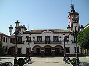
City Hall is located in the Plaza de España (Spain square), in the center of town. It has been remodeled several times to reach its current state, with a renewed appearance. It emphasizes the twentieth century tower historicist style, which retains the sole remaining original Old Town Hall, built in the early twentieth century in the neomudéjar style (a sixteenth century Spanish architectural style), being the actual building of 1946. The design stresses its slenderness, and it is capped with a cover dome its forms and curves contain eastern aspects and elements and it is ornamented with dovecotes and an upper turret.Church of St. Peter the Apostle
As they fled the inhabitants of the gaps looking drier lands and healthy, were the need to abandon the old Church of San Antonio. The pedroteños then decided that it was necessary to build a new, and the day on September 8, 1700, it became the foundation stone of the present church finishing works in 1722.It is certainly the most representative architectural Pedro Muñoz. It is a graceful style that mixes with the Renaissance Baroque. The church has a Latin cross with low body townhouses in three of the corners of the tower and cruise square floor plan. Coinciding with the celebration of the third centenary of the start of work was to the rehabilitation and placement of the bell tower, which has contributed to enhancing its beauty.
Chapel of the Madonna of Los Angeles
Mrs. De los Angeles wished to perpetuate the name of the only daughter of our founder John Majordomo, who was born shortly after arriving in the town and died a few years after birth while still a child. When it started to build new houses in the second restocking, was present at the Cuesta de la Tahona and on the streets of the Campo. That was when the works started in the chapel of Santa Ana and of Ntra. Mrs. De los Angeles, the latter apparently took on a construición that were there before. It is a rustic chapel on the basis of little rock and a lot of land.In 1769 work began on the new chapel, but it did not resume until 1771 and ended eight years later. He had extensive arcades and seating throughout. The building was largely destroyed in the Civil War and was not rebuilt until the war ended.
Paca's House
Among the manor houses out of the Paca House, the manor house was built in 1760 (eighteenth century). It has a baroque facade blasonada, vain symmetrical grids forge typical inner courtyard and Spanish. It is designated as casa-palacio. The facade excels main front, built in red sandstone contrasts with the white walls. Inside is accessed through a hall door and security. The central courtyard manages the distribution of the rooms.House of Granero
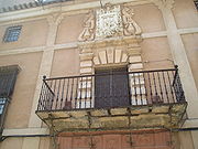
The House-Palace of the family Granero Heredia, known since its founding "The house of Graneros" built in postrimetrías of s. XVIII by D. Juan Jose Granero Heredia and Quiros Garces of Marcilla. Above the central balcony of artistic forging, is the shield of the family, which has a single field gules, five silver castles and a lion rampant in the center of gold, with the following motto or legend:"Siendo entre tus hechos, aqueste señero a tus castillos Heredia Granero añade el león feroz que mataste que nan tu rey también amparaste".
"Being among your facts, this Sir to your castles Heredia Granero added that ferocious lion that you killed for your king also save him".
It takes cimera, but if a warrior armed with a sword and the cross of Saint James in the chest, bordura baroque and a border with eight bundles of arrows, the symbol of the Catholic Monarchs.
Fernandez Cuellar's House
It is a manor house of s. XVIII, with facade with coat of amrs, whose founder not have a history, it is believed that once belonged to Fernandez Cuellar, surname that existed in the town and later disappeared. He holds the arms of one field with a pine and a wolf lifted on their feet. Typically your typical Spanish courtyard, with main gate of rustic wood and artistic forge.Roman bridge
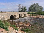
The Roman bridge is a bridge formed for three eyes located on the river Záncara linking other way also built by them. The bridge still linger in time but the road has been progressively destroyed by the work on crops nearby.Bridge of San Miguel
Also on the river Záncara, this bridge beside the hermitage of San Miguel. Recently there have carried out major tasks of recovery and beautification of this environment with two "greenways" to both banks of the river.The Vega Lake
It has an area of 34 hectares. Its wildlife is abundant, highlights ducks and limícolas, but there are more than 23 different species of waterfowl.Archaeological discoveries
Archaeological excavations carried out at Cerro de La Nieve, between 1984 and 1990, threw light on the first inhabitants of Pedro Muñoz. Faced with the Vega or Laguna del Pueblo, and on a wide elevation amesetada of marl clay accumulated remnants of successive reconstructions of the Iberian of adobe buildings, creating a promontory tell which type of power archaeological varies among more than three meters in the top, and one meter in the area flatter. The settlement probably was part of a system of towns Iberian contemporaries at the time, being the closest in Las MesasLas Mesas
Las Mesas is a municipality in Cuenca, Castile-La Mancha, Spain. It has a population of 2,420....
(Cuenca) and Campo de Criptana
Campo de Criptana
Campo de Criptana is a municipality and town in the province of Ciudad Real in the autonomous community of Castilla-La Mancha . It is found in the region known as La Mancha.-Historical development:...
(Ciudad Real).
In successive interventions made at the site have found numerous archaeological remains, including small-scale metal through a possible workshop copper smelter; Ceramics hand tradition Field Ballot boxes; bronze fibules and Greek pottery and numerous burials Iberians, a Roman and many medieval burials.

