Pirtó
Encyclopedia

Village
A village is a clustered human settlement or community, larger than a hamlet with the population ranging from a few hundred to a few thousand , Though often located in rural areas, the term urban village is also applied to certain urban neighbourhoods, such as the West Village in Manhattan, New...
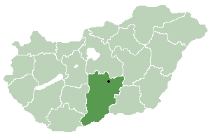
in Bács-Kiskun
Bács-Kiskun
Bács-Kiskun is a county located in southern Hungary. It was created as a result of World War II, merging the pre war Bács-Bodrog and the southern parts of Pest-Pilis-Solt-Kiskun counties. With an area of 8,445 km2, Bács-Kiskun is the largest county in the country. The terrain is mostly flat...
county, in the Southern Great Plain
Southern Great Plain
Southern Great Plain is a statistical region of Hungary. It is part of Great Plain and North region. Southern Great Plain includes the 3 counties:* Bács-Kiskun* Békés* Csongrád...
region
Region
Region is most commonly found as a term used in terrestrial and astrophysics sciences also an area, notably among the different sub-disciplines of geography, studied by regional geographers. Regions consist of subregions that contain clusters of like areas that are distinctive by their uniformity...
of southern Hungary
Hungary
Hungary , officially the Republic of Hungary , is a landlocked country in Central Europe. It is situated in the Carpathian Basin and is bordered by Slovakia to the north, Ukraine and Romania to the east, Serbia and Croatia to the south, Slovenia to the southwest and Austria to the west. The...
.
Croats in Hungary call this village Pirtov .
History
According to archeological finds, the area was already inhabited in the Migration PeriodMigration Period
The Migration Period, also called the Barbarian Invasions , was a period of intensified human migration in Europe that occurred from c. 400 to 800 CE. This period marked the transition from Late Antiquity to the Early Middle Ages...
. Under the reign of the Árpád dynasty
Árpád dynasty
The Árpáds or Arpads was the ruling dynasty of the federation of the Hungarian tribes and of the Kingdom of Hungary . The dynasty was named after Grand Prince Árpád who was the head of the tribal federation when the Magyars occupied the Carpathian Basin, circa 895...
Cumans
Cumans
The Cumans were Turkic nomadic people comprising the western branch of the Cuman-Kipchak confederation. After Mongol invasion , they decided to seek asylum in Hungary, and subsequently to Bulgaria...
settled here. In the 16th century the region fell under Ottoman
Ottoman Empire
The Ottoman EmpireIt was usually referred to as the "Ottoman Empire", the "Turkish Empire", the "Ottoman Caliphate" or more commonly "Turkey" by its contemporaries...
control and since then shared the fate of Kiskunhalas
Kiskunhalas
- Railroad :The city is an important railway junction. It crosses the Budapest-Subotica-Belgrade railway line. The Kiskunfélegyháza railway ends in Kiskunhalas.- Name :...
town. After the expulsion of Turks Pirtó became a pasture field shared by Kiskunhalas and the Counts Cseszneky de Milvány
House of Cseszneky
The House of Cseszneky was one of the most prominent noble families in the Kingdom of Hungary. The Counts Cseszneky de Milvány et Csesznek have produced many individuals notable in Hungarian and general European history and culture.-Name and origin:...
. By the 19th century and extended network of isolated farms characterized the Pirtó area which was still administered by the council of Kiskunhalas. Pirtó as an independent village was founded only in 1947.
Geography
It covers an areaArea
Area is a quantity that expresses the extent of a two-dimensional surface or shape in the plane. Area can be understood as the amount of material with a given thickness that would be necessary to fashion a model of the shape, or the amount of paint necessary to cover the surface with a single coat...
of 34.49 km² (13 sq mi) and has a population
Population
A population is all the organisms that both belong to the same group or species and live in the same geographical area. The area that is used to define a sexual population is such that inter-breeding is possible between any pair within the area and more probable than cross-breeding with individuals...
of 992 people (2002).

