Sgurr a' Bhealaich Dheirg
Encyclopedia

Scotland
Scotland is a country that is part of the United Kingdom. Occupying the northern third of the island of Great Britain, it shares a border with England to the south and is bounded by the North Sea to the east, the Atlantic Ocean to the north and west, and the North Channel and Irish Sea to the...
mountain situated in Kintail
Kintail
Kintail is an area of mountains in the Northwest Highlands of Scotland. It consists of the mountains to the north of Glen Shiel and the A87 road between the heads of Loch Duich and Loch Cluanie; its boundaries, other than Glen Shiel, are generally taken to be the valleys of Strath Croe and Gleann...
on the northern side of Glen Shiel
Glen Shiel
Glen Shiel is a glen in the Northwest Highlands of Scotland.The glen runs approximately 9 miles from north-west to south-east, from sea level at the village of Shiel Bridge and Loch Duich to the Cluanie Inn at the western end of Loch Cluanie and the start of Glenmoriston.W. H...
, 30 kilometres south east of Kyle of Lochalsh
Kyle of Lochalsh
Kyle of Lochalsh is a village on the northwest coast of Scotland, 63 miles west of Inverness. It is located at the entrance to Loch Alsh, opposite the village of Kyleakin on the Isle of Skye...
.
Overview
It is part of a group of three MunroMunro
A Munro is a mountain in Scotland with a height over . They are named after Sir Hugh Munro, 4th Baronet , who produced the first list of such hills, known as Munros Tables, in 1891. A Munro top is a summit over 3,000 ft which is not regarded as a separate mountain...
s (the other two being Aonach Meadhoin
Aonach Meadhoin
Aonach Meadhoin is a Munro mountain situated in the Kintail region of Scotland. It stands on the northern side of Glen Shiel some 31 kilometres south east of Kyle of Lochalsh.- Overview :...
and Sàileag
Sàileag
Sàileag is Scottish mountain located on the northern side of Glen Shiel, 27 kilometres south east of Kyle of Lochalsh.-Overview:It lies just to the east of the famous Five Sisters of Kintail group of hills to which it is connected by the Bealach an Lapain...
) known as the North Glen Shiel Ridge; they are also known as the “Brothers of Kintail” in contrast to the Five Sisters of Kintail
Sgurr Fhuaran
Sgùrr Fhuaran is a Scottish mountain that is situated on the northern side of Glen Shiel, east south east of Kyle of Lochalsh.- Overview :...
which lie just to the west. Sgurr a' Bhealaich Dheirg is the highest of the three Brothers with a height of 1036 metres (3399 feet). The mountain's name translates from Gaelic
Scottish Gaelic language
Scottish Gaelic is a Celtic language native to Scotland. A member of the Goidelic branch of the Celtic languages, Scottish Gaelic, like Modern Irish and Manx, developed out of Middle Irish, and thus descends ultimately from Primitive Irish....
as “Peak of the Red Pass” but the Red Pass (Bhealaich Dheirg) is not marked on Ordnance Survey maps so its exact location is uncertain.
Topography
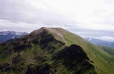
Sgurr a' Bhealaich Dheirg is similar to the other Munros on the northern side of Glen Shiel in that it has extremely steep grassy slopes which descend into Glen Shiel, while to the north there are craggy coires and ridges. The southern flank of the mountain descends 850 metres in two kilometres to the valley floor: this steepness deters direct ascents of the mountain from the A87 roadA87 road
The A87 is a major road in the Highland region of Scotland.It runs west from its junction with the A82 road at Invergarry , along the north shores of Loch Garry and Loch Cluanie, then down through Glen Shiel and along Loch Duich to Kyle of Lochalsh before crossing the Skye Bridge to Kyleakin,...
in the glen. There are also steepy grassy slopes to the east which descend to Coire nan Eun. The mountain is made up of four ridges. The main east - west ridge links with the adjoining Munros of Sàileag (west) and Aonach Meadhoin (east). There are two ridges which go northerly (north and north east) from the summit plateau and descend into the isolated country of the Kintail Forest.
Sgurr a' Bhealaich Dheirg stands on the main east-west watershed
Water divide
A drainage divide, water divide, divide or watershed is the line separating neighbouring drainage basins...
of Scotland with drainage going to both coasts of the country. It has the distinction of having two sizable rivers rising from its northern corries. The River Croe which emerges from a small lochan called Loch a Glas Choire within the Glas Choire flows north west for 12 kilometres to join the sea at Loch Duich
Loch Duich
Loch Duich is a sea loch situated on the western coast of Scotland, in the Highlands.-History:In 1719, British forces burned many homesteads along the loch’s shores in the month preceding the Battle of Glen Shiel....
on the west coast. The River Affric rises in Coire nan Eun on the eastern flank of the mountain and flows some 80 kilometres to reach the east coast at the Beauly Firth
Beauly Firth
The Beauly Firth is a firth in northern Scotland. It is effectively a continuation of the Moray Firth westward, and is bounded at one end by Beauly and at the other by Inverness . The Kessock Ferry has crossed at the eastern end since the 15th Century...
. The steep southern slopes of the mountain are clothed in the trees of the Glenshiel Forest below the 450 metre contour.
Ascents and summit
As mentioned, the steepness of the southern slopes deter direct ascents of the mountain. It is possible to tackle the mountain from a starting point two kilometres west of the Cluanie Inn, going through the forest and ascending by a subsidiary ridge called Meall a’ Charra which joins the eastern ridge at the colMountain pass
A mountain pass is a route through a mountain range or over a ridge. If following the lowest possible route, a pass is locally the highest point on that route...
with Aonach Meadhoin. The majority of visitors to the summit arrive along either the east or west ridges from the adjoining “Brothers” Munros. This traverse of all three mountains starts either at the Cluanie Inn to the east of the group, or from a parking place in Glen Shiel at grid reference to the west. The starting and finishing point of this walk is several kilometres apart.
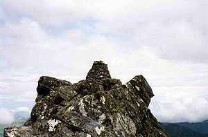
The Summit of Sgurr a' Bhealaich Dheirg can come as a surprise to the walker with the highest point situated off the main summit plateau, 80 metres along the narrow north east ridge with a strange dry stone wall leading to it. It is an easy scramble to reach the well built summit cairn
Cairn
Cairn is a term used mainly in the English-speaking world for a man-made pile of stones. It comes from the or . Cairns are found all over the world in uplands, on moorland, on mountaintops, near waterways and on sea cliffs, and also in barren desert and tundra areas...
which commands good views of the mountainous country to the north.

