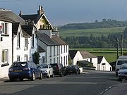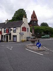
St. John's Town of Dalry
Encyclopedia


Dumfries and Galloway
Dumfries and Galloway is one of 32 unitary council areas of Scotland. It was one of the nine administrative 'regions' of mainland Scotland created in 1975 by the Local Government etc. Act 1973...
, formerly in Kirkcudbrightshire
Kirkcudbrightshire
The Stewartry of Kirkcudbright or Kirkcudbrightshire was a county of south-western Scotland. It was also known as East Galloway, forming the larger Galloway region with Wigtownshire....
. It is located sixteen miles (26 km) from Castle Douglas
Castle Douglas
Castle Douglas , a town in the south of Scotland in Dumfries and Galloway, lies in the eastern part of Galloway known as the Stewartry, between the towns of Dalbeattie and Gatehouse of Fleet.-History:...
along the A713 road, and is at the southern terminus of the A702 road
A702 road
The A702 is a major road in Scotland, that runs from Edinburgh to St. John's Town of Dalry in Dumfries and Galloway. It is the last section of a sometimes recommended route between London and Edinburgh, the English and Scottish capitals, which now follows the M1, M6, A74 and A702 roads, rather than...
(to Edinburgh
Edinburgh
Edinburgh is the capital city of Scotland, the second largest city in Scotland, and the eighth most populous in the United Kingdom. The City of Edinburgh Council governs one of Scotland's 32 local government council areas. The council area includes urban Edinburgh and a rural area...
). It is located on an old pilgramage route to Whithorn
Whithorn
Whithorn is a former royal burgh in Dumfries and Galloway, Scotland, about ten miles south of Wigtown. The town was the location of the first recorded Christian church in Scotland, Candida Casa : the 'White [or 'Shining'] House', built by Saint Ninian about 397.-Eighth and twelfth centuries:A...
and St Ninian's Cave and named after the Knights of St John. The town was the centre of the 1666 Pentland rising The village is about three miles (5 km) from the northern edge of Loch Ken
Loch Ken
Loch Ken is 9-mile long freshwater loch in Dumfries and Galloway, Scotland. It lies in the Glenkens, where it is fed from the north by the Water of Ken and from the west by the Dee. It continues as the Dee south from Glenlochar, where the water is held back by the Glenlochar Barrage...
.
St. Johns Town makes a good base for exploring the surrounding region, including the Southern Upland Way
Southern Upland Way
Opened in 1984, the Southern Upland Way is a coast to coast walk in Scotland between Portpatrick in the west and Cockburnspath in the east....
and the nearby Galloway Hills
Galloway Hills
The Galloway hills are part of the Southern Uplands of Scotland, and form the northern boundary of western Galloway. They lie within the bounds of Galloway Forest Park, an area of some of largely uninhabited wild land, managed by the Forestry Commission...
, including the peaks of Corserine
Corserine
Corserine is the highest point of the Rhinns of Kells range in the Southern Uplands of southern Scotland. The usual route of ascent is from the car park at Forest Lodge to the east of the hill via Loch Harrow and North Gairy Top. Forest Lodge is a short drive from the village of St. John's Town of...
and Cairnsmore of Carsphairn
Cairnsmore of Carsphairn
Cairnsmore of Carsphairn is a 797m high hill in the Southern Uplands of southern Scotland. An alternative name, rarely used nowadays, is Cairnsmore of Deugh...
.
Notable people from Dalry
- John Johnston, a farmer born in nearby Knocknalling, is credited with introducing agricultural drainageDrainageDrainage is the natural or artificial removal of surface and sub-surface water from an area. Many agricultural soils need drainage to improve production or to manage water supplies.-Early history:...
to the United StatesUnited StatesThe United States of America is a federal constitutional republic comprising fifty states and a federal district...
. - Cathy CassidyCathy CassidyCathy Cassidy is a British author of young adult fiction, mainly focusing on domestic fiction. She was born in Coventry, but now lives in Galloway, Scotland. She has written 14 books...
, children's author - Cowan DobsonCowan DobsonDavid Cowan Dobson , referred to as 'Cowan' Dobson ARBA , RBA , was a leading Scottish portrait artist who mainly worked in London...
, the artist and portrait painter.
Climate
As with the rest of the country, Dalry displays a climate classified as OceanicOceanic climate
An oceanic climate, also called marine west coast climate, maritime climate, Cascadian climate and British climate for Köppen climate classification Cfb and subtropical highland for Köppen Cfb or Cwb, is a type of climate typically found along the west coasts at the middle latitudes of some of the...
(Köppen
Köppen climate classification
The Köppen climate classification is one of the most widely used climate classification systems. It was first published by Crimea German climatologist Wladimir Köppen in 1884, with several later modifications by Köppen himself, notably in 1918 and 1936...
Cfb), encompassing cool summers and usually mild winters with year round rainfall. Temperature extremes at Glenlee, under 1 mile to the South West, have ranged from 31 °C (87.8 °F) during July 2005 to -18.3 C in both January 1940 and December 1995.

