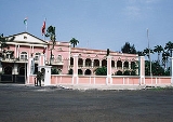
São Tomé
Encyclopedia
Transport
São Tomé is served by São Tomé International AirportSão Tomé International Airport
São Tomé International Airport is an airport located on São Tomé Island, from the city of São Tomé. It is the main airport serving São Tomé and Príncipe.-Facilities:...
with regular flights to Europe and other African Countries.
Climate
São Tomé features a tropical wet and dry climate with a relatively lengthy wet seasonWet season
The the wet season, or rainy season, is the time of year, covering one or more months, when most of the average annual rainfall in a region occurs. The term green season is also sometimes used as a euphemism by tourist authorities. Areas with wet seasons are dispersed across portions of the...
and a short dry season
Dry season
The dry season is a term commonly used when describing the weather in the tropics. The weather in the tropics is dominated by the tropical rain belt, which oscillates from the northern to the southern tropics over the course of the year...
. The wet season runs from October through May while the dry season covers the remaining four months. São Tomé sees on average just under 1000 mm of precipitation per year. Temperatures in the city are relatively constant, with average high temperatures usually around 30°C and average low temperatures around 22°C.
External links
- Map and aerial photos:
- Street map: Street map from Mapquest, MapPoint or Google or Yahoo! Maps
- Satellite images: Google or Microsoft Virtual Earth - image not yet available
- www.saotome.st - Facts about the country, how to get there, where to stay, what do to, images etc.
- Local travel agency Navetur-Equatour - information&pictures http://www.navetur-equatour.st/
- Coordinates: 0°20′10"N 6°40′53"E

