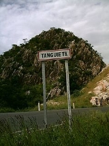
Tanguiéta
Encyclopedia
Tanguiéta is a town, arrondissement
and commune
located in the Atakora Department
of Benin
.The commune covers an area of 5465 square kilometres and as of 2002 had a population of 54,719 people. As of 2007 the town had an estimated population of 21,290.
It lies on the RNIE 3
highway which connects it to Natitingou
.
Tanguiéta was the departmental seat of government during French colonial rule
. The headquarters of the Pendjari National Park
are based in the town, and the Hôpital Saint Jean de Dieu de Tanguiéta is a regionally recognized hospital. The town has internet access available.
The main languages spoken in the town include French
, Dendi, Waama, Nateni, and Biali.
Arrondissements of Benin
The Arrondissements of Benin refer to the third-level administrative units of Benin, after Departments and communes. In turn they contain villages and may often have several quartiers or city districts/urban neighborhoods:...
and commune
Communes of Benin
The departments of Benin are subdivided into 77 communes, which in turn are divided into arrondissements and finally into villages or city districts. Prior to 1999 provinces were broken down into 84 districts, titled either urban or rural...
located in the Atakora Department
Atakora Department
Atakora is the northwestern department of Benin, bordering Togo to the west and Burkina Faso to the north. Also, it borders the departments of Alibori, Borgou, and Donga. It is the most mountainous region of Benin, and the birth place of the president, Mathieu Kérékou...
of Benin
Benin
Benin , officially the Republic of Benin, is a country in West Africa. It borders Togo to the west, Nigeria to the east and Burkina Faso and Niger to the north. Its small southern coastline on the Bight of Benin is where a majority of the population is located...
.The commune covers an area of 5465 square kilometres and as of 2002 had a population of 54,719 people. As of 2007 the town had an estimated population of 21,290.
It lies on the RNIE 3
RNIE 3
RNIE 3 is a national highway of Benin. It passes from north to south in the west of the country running near the border with Togo.-External links:*...
highway which connects it to Natitingou
Natitingou
Natitingou is a city and commune in north western Benin. It is about 50 km from Benin's Pendjari National Park, where tourists can see West African wildlife during the months of December through June...
.
Tanguiéta was the departmental seat of government during French colonial rule
French colonial empires
The French colonial empire was the set of territories outside Europe that were under French rule primarily from the 17th century to the late 1960s. In the 19th and 20th centuries, the colonial empire of France was the second-largest in the world behind the British Empire. The French colonial empire...
. The headquarters of the Pendjari National Park
Pendjari National Park
The Pendjari National Park lies in north western Benin, adjoining the Arli National Park in Burkina Faso. Named for the Pendjari River, the national park is known for its wildlife and his home to some of the last populations of big game like elephants, West African lions, hippopotamuses, buffalo...
are based in the town, and the Hôpital Saint Jean de Dieu de Tanguiéta is a regionally recognized hospital. The town has internet access available.
The main languages spoken in the town include French
French language
French is a Romance language spoken as a first language in France, the Romandy region in Switzerland, Wallonia and Brussels in Belgium, Monaco, the regions of Quebec and Acadia in Canada, and by various communities elsewhere. Second-language speakers of French are distributed throughout many parts...
, Dendi, Waama, Nateni, and Biali.

