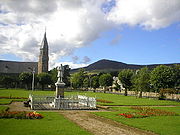
Tap o' Noth
Encyclopedia

Hill fort
A hill fort is a type of earthworks used as a fortified refuge or defended settlement, located to exploit a rise in elevation for defensive advantage. They are typically European and of the Bronze and Iron Ages. Some were used in the post-Roman period...
on top of the Hill of Noth, 20 miles west of Inverurie
Inverurie
Inverurie is a Royal Burgh and town in Aberdeenshire, Scotland, approximately north west of Aberdeen on the A96 road and is served by Inverurie railway station on the Aberdeen to Inverness Line...
in Aberdeenshire
Aberdeenshire
Aberdeenshire is one of the 32 unitary council areas in Scotland and a lieutenancy area.The present day Aberdeenshire council area does not include the City of Aberdeen, now a separate council area, from which its name derives. Together, the modern council area and the city formed historic...
, Scotland
Scotland
Scotland is a country that is part of the United Kingdom. Occupying the northern third of the island of Great Britain, it shares a border with England to the south and is bounded by the North Sea to the east, the Atlantic Ocean to the north and west, and the North Channel and Irish Sea to the...
at grid reference NJ485293. It is the second highest fort in Scotland and its main feature is its well-preserved vitrified wall
Vitrified fort
Vitrified fort is the name given to certain crude stone enclosures whose walls have been subjected in a greater or lesser degree to the action of fire. They are generally situated on hills offering strong defensive positions. Their form seems to have been determined by the contour of the flat...
which encloses an area of approximately 100 m by 30 m. Archaeological finds from the site include a stone axe head dated to between c2000BC–c800BC, and a decorated bronze rein-ring dated to the 1st–3rd century AD.

