Werra-Meißner-Kreis
Encyclopedia
Werra-Meißner is a Kreis (district
) in the north of Hesse
, Germany
. Neighboring districts are Göttingen
, Eichsfeld
, Unstrut-Hainich
, Wartburgkreis
, district-free Eisenach
, Hersfeld-Rotenburg
, Schwalm-Eder, Kassel
.
. The Hohe Meißner at 754 m is the highest elevation of the Meißner mountains, a big basalt
massif, the other geographical feature which gave the district its name.
The Hohe Meißner was also home to US military forces up to the fall of the Berlin Wall. Soldiers of the Special Forces guarded the eavsdropping post on the hilltop.
See also: Wanfried agreement
.
District
Districts are a type of administrative division, in some countries managed by a local government. They vary greatly in size, spanning entire regions or counties, several municipalities, or subdivisions of municipalities.-Austria:...
) in the north of Hesse
Hesse
Hesse or Hessia is both a cultural region of Germany and the name of an individual German state.* The cultural region of Hesse includes both the State of Hesse and the area known as Rhenish Hesse in the neighbouring Rhineland-Palatinate state...
, Germany
Germany
Germany , officially the Federal Republic of Germany , is a federal parliamentary republic in Europe. The country consists of 16 states while the capital and largest city is Berlin. Germany covers an area of 357,021 km2 and has a largely temperate seasonal climate...
. Neighboring districts are Göttingen
Göttingen (district)
Göttingen is a district in Lower Saxony, Germany. It is bounded by the districts of Northeim and Osterode, and by the states of Thuringia and Hesse .-History:...
, Eichsfeld
Eichsfeld (district)
Eichsfeld is a district in Thuringia, Germany, and part of the historical region of Eichsfeld. It is bounded by the districts of Nordhausen, Kyffhäuserkreis and Unstrut-Hainich, and by the states of Hesse and Lower Saxony .-History:In medieval times the Eichsfeld, which is larger than the...
, Unstrut-Hainich
Unstrut-Hainich
Unstrut-Hainich is a Kreis in the north of Thuringia, Germany. Neighboring districts are the districts Eichsfeld, Kyffhäuserkreis, Sömmerda, Gotha, Wartburgkreis and the district Werra-Meißner in Hesse.-History:...
, Wartburgkreis
Wartburgkreis
Wartburgkreis is a Kreis in the west of Thuringia, Germany. Neighboring districts are the districts Unstrut-Hainich, Gotha, Schmalkalden-Meiningen, and the districts Fulda, Hersfeld-Rotenburg and Werra-Meißner in Hesse...
, district-free Eisenach
Eisenach
Eisenach is a city in Thuringia, Germany. It is situated between the northern foothills of the Thuringian Forest and the Hainich National Park. Its population in 2006 was 43,626.-History:...
, Hersfeld-Rotenburg
Hersfeld-Rotenburg
Hersfeld-Rotenburg is a Kreis in the east of Hesse, Germany. Neighboring districts are Werra-Meißner, Wartburgkreis, Fulda, Vogelsbergkreis, Schwalm-Eder.-History:...
, Schwalm-Eder, Kassel
Kassel (district)
Kassel is a Kreis in the north of Hesse, Germany. Neighboring districts are Northeim, Göttingen, Werra-Meißner, Schwalm-Eder, Waldeck-Frankenberg, Höxter...
.
History
The district was created in 1974 by merging the two districts of Eschwege and Witzenhausen, which had both existed with only slight modifications since 1821.Geography
The main river in the district is the WerraWerra
The Werra is a river in central Germany, the right-source river of the Weser. The Werra has its source near Eisfeld in southern Thuringia. After 293 km the Werra joins the river Fulda in the town of Hann. Münden, forming the Weser....
. The Hohe Meißner at 754 m is the highest elevation of the Meißner mountains, a big basalt
Basalt
Basalt is a common extrusive volcanic rock. It is usually grey to black and fine-grained due to rapid cooling of lava at the surface of a planet. It may be porphyritic containing larger crystals in a fine matrix, or vesicular, or frothy scoria. Unweathered basalt is black or grey...
massif, the other geographical feature which gave the district its name.
The Hohe Meißner was also home to US military forces up to the fall of the Berlin Wall. Soldiers of the Special Forces guarded the eavsdropping post on the hilltop.
See also: Wanfried agreement
Wanfried agreement
The Wanfried Agreement concerned a transfer of territory between the U.S. and Soviet occupation zones after World War II in Hesse, Germany, which took place after the determination of the main inner German border at the end of July 1945.In the U.S...
.
Coat of arms
 |
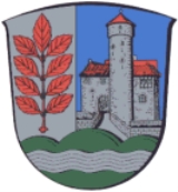
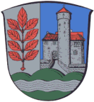
The coat of arms show a branch of an aspen Aspen Populus section Populus, of the Populus genus, includes the aspen trees and the white poplar Populus alba. The five typical aspens are all native to cold regions with cool summers, in the north of the Northern Hemisphere, extending south at high altitudes in the mountains. The White Poplar, by... tree in the left half, as sign for the former Eschwege district as well as the Eschwege Eschwege Eschwege , the district seat of the Werra-Meißner-Kreis, is a town in northeastern Hesse, Germany.- Location :The town lies on a broad plain tract of the river Werra at the foot of the Leuchtberg northwest of the Schlierbachswald and east of the Hoher Meißner... city - the German word for aspen is Esche. The castle in the right half is the castle Ludwigstein Burg Ludwigstein Burg Ludwigstein is a 15th-century castle overlooking the river Werra and surrounded by beautiful woodland. It stands southwest of the town of Witzenhausen in North Hesse and can easily be reached by car or train and bus... , taken from the coat of arms of the Witzenhausen district. The hills below symbolize the landscape, the Meißner, and the wavy line the Werra Werra The Werra is a river in central Germany, the right-source river of the Weser. The Werra has its source near Eisfeld in southern Thuringia. After 293 km the Werra joins the river Fulda in the town of Hann. Münden, forming the Weser.... river. |
Towns and municipalities
| Towns | Municipalities |
|---|---|
|
Berkatal -Location:Berkatal lies in the Meißner-Kaufunger Wald Nature Park at the foot of the Hoher Meißner massif. The river Berka rises within community limits.-Neighbouring communities:... Herleshausen -Location:Herleshausen lies north of a section of the boundary with Thuringia in the thickly wooded area between the Ringgau and the Thuringian Forest with the Thuringian Forest Nature Park in the southeast... Meinhard Meinhard is a community in the Werra-Meißner-Kreis in Hesse, Germany.-Location:The community lies in the North Hesse Low Mountain Range landscape on the edge of the Werra valley, 3 km from the district seat of Eschwege.... Meißner, Hesse Meißner is a community in the Werra-Meißner-Kreis in Hesse, Germany.-Location:Meißner lies at the Krösselberg between the Hoher Meißner and the Werra valley in the Meißner-Kaufunger Wald Nature Park, some 40 km southeast of Kassel and 10 km west of Eschwege.-Neighbouring... Neu-Eichenberg -Location:Neu-Eichenberg lies near the three-state common point shared by Hesse, Thuringia and Lower Saxony between Kassel and Göttingen .-Neighbouring communities:... Ringgau - Location :The community of Ringgau lies in the like-named low mountain range some 11 km south of Eschwege between the Hoher Meißner and the Thuringian Forest.- Neighbouring communities :... Wehretal Wehretal is a community in the Werra-Meißner-Kreis in northeastern Hesse, Germany.-Location:Wehretal lies roughly 50 km southeast of the North Hesse city of Kassel... Weißenborn, Hesse Weißenborn is a community in the Werra-Meißner-Kreis in Hesse, Germany.-Location:Weißenborn lies in the North Hesse Uplands some 8 km southeast of Eschwege and abuts a section of the boundary with Thuringia. It is found in the Schlierbachswald, onto which borders the Ringgau not far south... |

