Östermalm
Encyclopedia

Stockholm
Stockholm is the capital and the largest city of Sweden and constitutes the most populated urban area in Scandinavia. Stockholm is the most populous city in Sweden, with a population of 851,155 in the municipality , 1.37 million in the urban area , and around 2.1 million in the metropolitan area...
, Sweden
Sweden
Sweden , officially the Kingdom of Sweden , is a Nordic country on the Scandinavian Peninsula in Northern Europe. Sweden borders with Norway and Finland and is connected to Denmark by a bridge-tunnel across the Öresund....
. With 36,636 inhabitants it is one of the most populous districts in Stockholm. It is a wealthy area, having the highest housing prices in Sweden.
History
During the reign of the all-Scandinavian king Eric of PomeraniaEric of Pomerania
Eric of Pomerania KG was King Eric III of Norway Norwegian Eirik, King Eric VII of Denmark , and as Eric King of Sweden...
in the early 15th century, a royal cow-house was erected on the domains of the village Vädla. In the 17th century, the inhabitants of Stockholm were allowed to keep their cattle there. Since the town of Stockholm had grown and bordered on the area there were lots of complaints about animals causing damage in the town. In 1639, parts of the cow-house land were allowed to be developed, and in 1672 the eastern part became a military exercise field. During the following 200 years, some higher officers lived here but most of the inhabitants were poor.
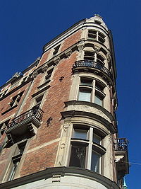
A new town plan about 1880 implied a grid of streets and avenues that became lined with elegant houses in 4-6 floors. This put an end to the rustic appearance of the district, and the older official name Ladugårdslandet with the actual meaning cow-house land was replaced with the modern Östermalm. Since the Crown has been the owner of parts of the district for centuries a number of official buildings, museums and higher public educational institutions are located in Östermalm. In the 20th century, a large number of embassies, including those of USA, Britain,France,Germany,Poland,Thailand, Norway and Malaysia were located there.
ParishParishA parish is a territorial unit historically under the pastoral care and clerical jurisdiction of one parish priest, who might be assisted in his pastoral duties by a curate or curates - also priests but not the parish priest - from a more or less central parish church with its associated organization...
es
- Engelbrekt
- Hedvig Eleonora
- Oscar
Neighbourhoods
Neighbourhoods in Östermalm include:- DiplomatstadenDiplomatstadenDiplomatstaden is a neighbourhood in the Östermalm district in central Stockholm, Sweden.Diplomatstaden encompasses the area facing the Djurgårdsbrunnsviken bay which is located south of the eastern-most part of Strandvägen...
- Eriksberg
- LappkärrsbergetLappkärrsbergetLappkärrsberget is a residential area in Norra Djurgården in central-eastern Stockholm, Sweden. Located just north of the Stockholm University, it is known for the approximately 2,000 student flats located there. It is known amongst students as Lappis ....
- LärkstadenLärkstadenLärkstaden is an urban area within the city district of Östermalm in central Stockholm, Sweden.The name originates from the large block "Lärkan" which used to dominated the area before the present buildings were built in 1907...
- Nedre Östermalm
- Villastaden
- Övre Östermalm
Railway stations
- KarlaplanKarlaplanKarlaplan is an open park-plaza area in Östermalm in Stockholm. The architect Lindhagen was created the characteristic form of the plaza, during the 1890's. It was created in the image of Place de l'Étoile in Paris. The plaza is named in honour of all the Swedish kings called Karl, like Karl X...
: metroStockholm MetroThe Stockholm Metro is a metro system in Stockholm, Sweden. The first line opened in 1950, and today the system has 100 stations in use, of which 47 are underground and 53 above ground. There are seven lines numbered from 10 to 19, in three groups identified by a color: the Green, Red and Blue lines...
13 - StadionStockholms OlympiastadionStockholms Olympiastadion, most often called Stockholms Stadion or just Stadion, is a stadium in Stockholm, Sweden. Designed by architect Torben Grut, it was opened in 1912, its original use was as a venue for the 1912 Olympic Games...
: metro 14 - Stockholm Östra/Tekniska HögskolanRoyal Institute of TechnologyThe Royal Institute of Technology is a university in Stockholm, Sweden. KTH was founded in 1827 as Sweden's first polytechnic and is one of Scandinavia's largest institutions of higher education in technology. KTH accounts for one-third of Sweden’s technical research and engineering education...
: suburban railway 27, 28, 29 (RoslagsbananRoslagsbanan-SL southern network:*Stockholms östra–Djursholms Ösby–Roslags Näsby–Vallentuna–Lindholmen–Kårsta *Stockholms östra–Djursholms Ösby–Roslags Näsby–Åkersberga–Österskär...
) and metro 14 - ÖstermalmstorgÖstermalmstorgÖstermalmstorg is a square in the district of Östermalm, Stockholm. It is known for its food market hall, Östermalmshallen, opened in 1889. Östermalmstorg was also the location of the first Åhléns City department store, opened in 1932....
: metro 13, 14
See also
- Geography of StockholmGeography of StockholmThe City of Stockholm is situated on fourteen islands and on the banks to the archipelago where Lake Mälaren meets the Baltic Sea. The city centre is virtually situated on the water.- Islands and islets :- Lakes and watercourses :...

