
A299 road
Encyclopedia
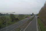
The A299, better known as the Thanet Way, is a major road in the county of Kent
, England, and runs from Brenley Corner near Faversham
(where it merges into the M2) to Ramsgate
via Whitstable
and Herne Bay
. It is predominantly used for freight traffic to Ramsgate Harbour and local traffic to Thanet
.
Most of the A299 was constructed in the 1930s as an unemployment relief project. Prior to this, all traffic from the west to the Isle of Thanet had to go via Canterbury
.
The A299 was upgraded in the 1990s to dual carriageway for almost its entire length. Whitstable and Herne Bay were bypassed, with the old road becoming the A2990, and the A299 to the west of Whitstable and east of Herne Bay received an online upgrade.
The A299 used to end near Monkton
, where the A253 once continued to Ramsgate. This section of road has become the A299 direct to Ramsgate Harbour, passing Kent International Airport
on the way. The section from Minster roundabout to the Lord of the Manor roundabout remains a single-carriageway, but is planned to be diverted on to a new dual carriageway current being constructed as part of East Kent access phase 2.
Kent
Kent is a county in southeast England, and is one of the home counties. It borders East Sussex, Surrey and Greater London and has a defined boundary with Essex in the middle of the Thames Estuary. The ceremonial county boundaries of Kent include the shire county of Kent and the unitary borough of...
, England, and runs from Brenley Corner near Faversham
Faversham
Faversham is a market town and civil parish in the Swale borough of Kent, England. The parish of Faversham grew up around an ancient sea port on Faversham Creek and was the birthplace of the explosives industry in England.-History:...
(where it merges into the M2) to Ramsgate
Ramsgate
Ramsgate is a seaside town in the district of Thanet in east Kent, England. It was one of the great English seaside towns of the 19th century and is a member of the ancient confederation of Cinque Ports. It has a population of around 40,000. Ramsgate's main attraction is its coastline and its main...
via Whitstable
Whitstable
Whitstable is a seaside town in Northeast Kent, Southeast England. It is approximately north of the city of Canterbury and approximately west of the seaside town of Herne Bay. It is part of the City of Canterbury district and has a population of about 30,000.Whitstable is famous for its oysters,...
and Herne Bay
Herne Bay, Kent
Herne Bay is a seaside town in Kent, South East England, with a population of 35,188. On the south coast of the Thames Estuary, it is north of Canterbury and east of Whitstable. It neighbours the ancient villages of Herne and Reculver and is part of the City of Canterbury local government district...
. It is predominantly used for freight traffic to Ramsgate Harbour and local traffic to Thanet
Isle of Thanet
The Isle of Thanet lies at the most easterly point of Kent, England. While in the past it was separated from the mainland by the nearly -wide River Wantsum, it is no longer an island ....
.
Most of the A299 was constructed in the 1930s as an unemployment relief project. Prior to this, all traffic from the west to the Isle of Thanet had to go via Canterbury
Canterbury
Canterbury is a historic English cathedral city, which lies at the heart of the City of Canterbury, a district of Kent in South East England. It lies on the River Stour....
.
The A299 was upgraded in the 1990s to dual carriageway for almost its entire length. Whitstable and Herne Bay were bypassed, with the old road becoming the A2990, and the A299 to the west of Whitstable and east of Herne Bay received an online upgrade.
The A299 used to end near Monkton
Monkton, Kent
Monkton is a village and civil parish in the Thanet District of Kent, England. The village is located at the south-western edge of the Isle of Thanet and is situated mainly along the B2047 road, leading off the A263 road between Canterbury and Ramsgate. The civil parish stretches south to the...
, where the A253 once continued to Ramsgate. This section of road has become the A299 direct to Ramsgate Harbour, passing Kent International Airport
Kent International Airport
Manston - Kent's International Airport is an airport located at Manston in the District of Thanet within Kent, England, northeast of Canterbury. It was formerly called RAF Manston , and was also known as London Manston Airport...
on the way. The section from Minster roundabout to the Lord of the Manor roundabout remains a single-carriageway, but is planned to be diverted on to a new dual carriageway current being constructed as part of East Kent access phase 2.
Junctions
| A299 Road | ||
| Eastbound exits | Junction | Westbound exits |
| End of Road | Port of Ramsgate | Start of Road |
| Pegwell Tunnel | ||
| Ramsgate Ramsgate Ramsgate is a seaside town in the district of Thanet in east Kent, England. It was one of the great English seaside towns of the 19th century and is a member of the ancient confederation of Cinque Ports. It has a population of around 40,000. Ramsgate's main attraction is its coastline and its main... A255 St. Lawrence |
Ramsgate Ramsgate Ramsgate is a seaside town in the district of Thanet in east Kent, England. It was one of the great English seaside towns of the 19th century and is a member of the ancient confederation of Cinque Ports. It has a population of around 40,000. Ramsgate's main attraction is its coastline and its main... A255 St. Lawrence |
|
| Manston, Margate Margate -Demography:As of the 2001 UK census, Margate had a population of 40,386.The ethnicity of the town was 97.1% white, 1.0% mixed race, 0.5% black, 0.8% Asian, 0.6% Chinese or other ethnicity.... , Broadstairs Broadstairs Broadstairs is a coastal town on the Isle of Thanet in the Thanet district of east Kent, England, about south-east of London. It is part of the civil parish of Broadstairs and St Peter's, which includes St. Peter's and had a population in 2001 of about 24,000. Situated between Margate and... , Westwood Cross, A256 A256 road The A256 is a key road running north-south through East Kent which connects the Thanet towns to Dover.- Thanet :The road begins in the outskirts of the Thanet town of Broadstairs, at a roundabout with the A255 where it heads westwards through the Westwood Retail Parks via "Westwood Road".The A256... Sandwich Sandwich, Kent Sandwich is a historic town and civil parish on the River Stour in the Non-metropolitan district of Dover, within the ceremonial county of Kent, south-east England. It has a population of 6,800.... A256 A256 road The A256 is a key road running north-south through East Kent which connects the Thanet towns to Dover.- Thanet :The road begins in the outskirts of the Thanet town of Broadstairs, at a roundabout with the A255 where it heads westwards through the Westwood Retail Parks via "Westwood Road".The A256... |
Lord of the Manor | Manston, Margate Margate -Demography:As of the 2001 UK census, Margate had a population of 40,386.The ethnicity of the town was 97.1% white, 1.0% mixed race, 0.5% black, 0.8% Asian, 0.6% Chinese or other ethnicity.... , Broadstairs Broadstairs Broadstairs is a coastal town on the Isle of Thanet in the Thanet district of east Kent, England, about south-east of London. It is part of the civil parish of Broadstairs and St Peter's, which includes St. Peter's and had a population in 2001 of about 24,000. Situated between Margate and... , Westwood Cross, A256 A256 road The A256 is a key road running north-south through East Kent which connects the Thanet towns to Dover.- Thanet :The road begins in the outskirts of the Thanet town of Broadstairs, at a roundabout with the A255 where it heads westwards through the Westwood Retail Parks via "Westwood Road".The A256... Sandwich Sandwich, Kent Sandwich is a historic town and civil parish on the River Stour in the Non-metropolitan district of Dover, within the ceremonial county of Kent, south-east England. It has a population of 6,800.... A256 A256 road The A256 is a key road running north-south through East Kent which connects the Thanet towns to Dover.- Thanet :The road begins in the outskirts of the Thanet town of Broadstairs, at a roundabout with the A255 where it heads westwards through the Westwood Retail Parks via "Westwood Road".The A256... |
| No exit | Cliffsend | |
| London Manston Airport B2190 Minster Minster-in-Thanet Minster-in-Thanet, also known as Minster, is a village and civil parish in the Thanet District of Kent, England. The village is situated to the west of Ramsgate and to the north east of Canterbury; it lies just south west of Kent International Airport and just north of the River Stour... End of dual carriageway |
Minster Roundabout | London Manston Airport B2190 Minster Start of dual carriageway |
| Sarre Sarre, Kent Sarre is a village and civil parish in Thanet District in Kent, England. The village is a part of St. Nicholas-at-Wade ecclesiastical parish, after having lost the local church of St. Giles in Elizabethan times; the ecclesiastical parishes were subsequently combined. In its own right Sarre is an... A253 A253 road The A253 is a short primary route running west-east through East Kent within the Isle of Thanet.- Current route :The road begins at the junction with the A28 in the centre of Sarre, close to the Sarre Windmill, at a mini-roundabout. It then travels eastwards through an area of flat and low lying... Monkton Monkton, Kent Monkton is a village and civil parish in the Thanet District of Kent, England. The village is located at the south-western edge of the Isle of Thanet and is situated mainly along the B2047 road, leading off the A263 road between Canterbury and Ramsgate. The civil parish stretches south to the... Acol |
Monkton Roundabout | Sarre A253 Monkton Acol |
| St. Nicholas-at-Wade St Nicholas at Wade St Nicholas-at-Wade is a both a village and a civil parish in the Thanet District of Kent, England. The parish had a recorded population of 782 at the 2001 Census... , Sarre Sarre, Kent Sarre is a village and civil parish in Thanet District in Kent, England. The village is a part of St. Nicholas-at-Wade ecclesiastical parish, after having lost the local church of St. Giles in Elizabethan times; the ecclesiastical parishes were subsequently combined. In its own right Sarre is an... , Sturry Sturry Sturry is a village on the Great Stour river three miles north-east of Canterbury in Kent. The large parish of Sturry Church incorporates the former mining village of Hersden and several hamlets.-Geography:... , Canterbury Canterbury Canterbury is a historic English cathedral city, which lies at the heart of the City of Canterbury, a district of Kent in South East England. It lies on the River Stour.... A28 Margate A28 Potten Street |
St Nicholas-at-Wade Roundabout | St. Nicholas-at-Wade St Nicholas at Wade St Nicholas-at-Wade is a both a village and a civil parish in the Thanet District of Kent, England. The parish had a recorded population of 782 at the 2001 Census... , Sarre Sarre, Kent Sarre is a village and civil parish in Thanet District in Kent, England. The village is a part of St. Nicholas-at-Wade ecclesiastical parish, after having lost the local church of St. Giles in Elizabethan times; the ecclesiastical parishes were subsequently combined. In its own right Sarre is an... , Sturry Sturry Sturry is a village on the Great Stour river three miles north-east of Canterbury in Kent. The large parish of Sturry Church incorporates the former mining village of Hersden and several hamlets.-Geography:... , Canterbury Canterbury Canterbury is a historic English cathedral city, which lies at the heart of the City of Canterbury, a district of Kent in South East England. It lies on the River Stour.... A28 Margate A28 Potten Street |
| St. Nicholas-at-Wade St Nicholas at Wade St Nicholas-at-Wade is a both a village and a civil parish in the Thanet District of Kent, England. The parish had a recorded population of 782 at the 2001 Census... |
St. Nicholas-at-Wade St Nicholas at Wade St Nicholas-at-Wade is a both a village and a civil parish in the Thanet District of Kent, England. The parish had a recorded population of 782 at the 2001 Census... |
|
| No exit | Marshside | |
| Hillborough Hillborough Hillborough is an area of eastern Herne Bay in Kent, England.... , Reculver Reculver Reculver is a hamlet and coastal resort situated about east of Herne Bay in southeast England. It is a ward of the City of Canterbury district in the county of Kent. Reculver once occupied a strategic location at the western end of the Wantsum Channel, between the Isle of Thanet and the Kent... |
Hillborough Hillborough Hillborough is an area of eastern Herne Bay in Kent, England.... , Reculver Reculver Reculver is a hamlet and coastal resort situated about east of Herne Bay in southeast England. It is a ward of the City of Canterbury district in the county of Kent. Reculver once occupied a strategic location at the western end of the Wantsum Channel, between the Isle of Thanet and the Kent... |
|
| Broomfield Broomfield, Kent Broomfield is a village in the Maidstone District of Kent, England, and forms part of the civil parish of Broomfield and Kingswood. It lies to the east of Maidstone... , Beltinge Beltinge Beltinge is a suburb of Herne Bay in Kent, England. It is at the eastern part of the town, just west of the ancient village of Reculver.In Beltinge, you can find:*ABC Pre-Schools*Londis Beltinge is a suburb of Herne Bay in Kent, England. It is at the eastern part of the town, just west of the... |
Broomfield, Beltinge | |
| Eddington Eddington, Kent Eddington, Kent, was a village in South East England to the south-east of Herne Bay, Kent, to the east of Beltinge and to the north of Herne. It is now a suburb of Herne Bay, in Greenhill and Eddington Ward, one of the five wards of Herne Bay... , Greenhill Greenhill, Kent Greenhill is an outlying suburb of the coastal town of Herne Bay, in Kent in southeast England. The erstwhile Thanet Way, now renumbered as the A2990 road, separates Greenhill from Herne Bay.... A2990 Herne Herne, Kent Herne is a village in South East England, divided by the Thanet Way from the seaside resort of Herne Bay. Administratively it is in the civil parish of Herne and Broomfield in Kent. Between Herne and Broomfield is the former hamlet of Hunters Forstal; Herne Common lies to the south.The hamlet of... , Sturry A291 Herne Bay Herne Bay, Kent Herne Bay is a seaside town in Kent, South East England, with a population of 35,188. On the south coast of the Thames Estuary, it is north of Canterbury and east of Whitstable. It neighbours the ancient villages of Herne and Reculver and is part of the City of Canterbury local government district... B2205 |
Eddington, Greenhill A2990 Herne, Sturry A291 Herne Bay B2205 |
|
| Tunnel | ||
| No exit | Canterbury Canterbury Canterbury is a historic English cathedral city, which lies at the heart of the City of Canterbury, a district of Kent in South East England. It lies on the River Stour.... , Clapham Hill, Blean Blean Blean is located in the Canterbury district of Kent, England. It is the name of the civil parish as well as the village within it: the latter is scattered along the road between Canterbury and Whitstable, in the middle of what was once the extensive Forest of Blean.The village name of Blean is... A290 Whitstable Whitstable Whitstable is a seaside town in Northeast Kent, Southeast England. It is approximately north of the city of Canterbury and approximately west of the seaside town of Herne Bay. It is part of the City of Canterbury district and has a population of about 30,000.Whitstable is famous for its oysters,... A2990 |
|
| Canterbury, Clapham Hill, Blean A290 Whitstable A2990 |
No exit | |
| No exit | Yorkletts Yorkletts Yorkletts is a village near Whitstable in Kent, England. Housing is predominantly private. It has a garage at one end. The garages are the only facility in the village, with most inhabitants having to travel to Whitstable or Canterbury for forms of entertainment and nightlife... |
|
| Services | Services | |
| Waterham Waterham Waterham is a hamlet in the borough of Swale in Kent, England.... , Highstreet, Yorkletts |
Waterham, Highstreet | |
| No exit | Dargate Dargate Dargate is a hamlet near Faversham in Kent, England.... , Hernhill Hernhill Hernhill is a village and civil parish between Faversham and Canterbury in southeast England. The parish includes the hamlets of Crockham, Dargate, The Fostall, Lamberhurst, Oakwell, Staple Street, Thread, Waterham and Wey Street.-Churches:... |
|
| Dargate, Hernhill | No exit | |
| Goodnestone Goodnestone, Swale Goodnestone is a village and civil parish east of Faversham in southeast England.-History:The village was referred to in 1242 as "Godwineston", meaning "the farm or settlement of Godwin". St Bartholomew's Church is an unspoilt Norman church, built about 1100. The church has not been used for... |
Goodnestone | |
| Start of Road | M2 J7 Brenley Corner |
Canterbury, Dover, Channel Tunnel A2 Non motorway traffic |
| Canterbury, Channel Tunnel, Dover, Faversham A2 |
Road continues as M2 to London | |