Abington, Cambridgeshire
Encyclopedia
The Abingtons are a community in South Cambridgeshire consisting of two villages: Little Abington and Great Abington, 7 miles (11.3 km) south east of Cambridge
.
 Though often listed as a single entity, Great and Little Abington have since early medieval times been two parishes divided by the River Granta and remain so. The southernmost of the two, Great Abington, covers 1588 acres (6.4 km²) and is bounded to the south by the county border with Essex
, to the west by a branch of the Icknield Way
(now the A11
), and to the east by the parish of Hildersham
. Little Abington covers 1309 acres (5.3 km²), again bordered by the Icknield Way and Hildersham to the west and east, and by the ancient thoroughfare of Wool Street to the north.
The village history dates back to the Bronze Age
, some 4000 years ago. The Saxons
gave the village its name, originally called "Abba's Farm," and the village was listed as Abintone in the Domesday Book
. The Great and Little came later, long after the two manors on either side of the river were allotted to different people at the Norman Conquest.
In the decades before the Second World War the Land Settlement Association
created a site to the south of Great Abington consisting of over sixty houses and plots of land for unemployed miners mainly from the coalfields of Yorkshire
and Durham
.
The Cambridge to Haverhill
railway line that opened in 1865 crossed Great Abington just south of the village, but closed in 1967. The medieval Cambridge
to Colchester
road that was the main route through the village was by-passed in the 1960s.
Little Abington's parish church is also dedicated to St Mary, and has been since at least the 16th century. The present building consists of a chancel, nave with north chapel and south porch, and west tower. The nave is believed to date from around 1100, and the chancel was rebuilt in the 13th century. The three-storey tower is probably 14th century.
A Protestant chapel was built in Little Abington towards the end of the 19th century. It remains open as a United Reform Church.
including The Welding Institute
which started in Abington Hall in 1946. In 2009 Abington cricket club played a friendly against Babraham cricket club to commemorate 150 years of the cricket team.
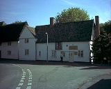
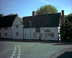
The remaining public house, The Three Tuns in Great Abington, is a 17th-century building that was possibly open in 1687 and certainly by 1756. Former pubs in Little Abington include The Crown which closed in the late 20th century, and The Bricklayers' Arms, which opened in the mid-19th century and was sold in 1912. The Princess (later Prince) of Wales in Great Abington opened at the end of the 19th century and closed in about 1963. The King's Arms opened on the Stump Cross to Newmarket road (now the A11) just north of Bourn Bridge in the late 17th century, closing in 1850 with the advent of the railway. The antiquary William Cole
was born there while his father was publican. The White Hart opened on the same road just south of the bridge in around 1750, but closed by the end of the century.
Cambridge
The city of Cambridge is a university town and the administrative centre of the county of Cambridgeshire, England. It lies in East Anglia about north of London. Cambridge is at the heart of the high-technology centre known as Silicon Fen – a play on Silicon Valley and the fens surrounding the...
.
History

Essex
Essex is a ceremonial and non-metropolitan county in the East region of England, and one of the home counties. It is located to the northeast of Greater London. It borders with Cambridgeshire and Suffolk to the north, Hertfordshire to the west, Kent to the South and London to the south west...
, to the west by a branch of the Icknield Way
Icknield Way
The Icknield Way is an ancient trackway in southern England. It follows the chalk escarpment that includes the Berkshire Downs and Chiltern Hills.-Background:...
(now the A11
A11 road
The A11 is a major road in England. It runs roughly north east from London to Norwich, Norfolk, although after the M11 opened in the 1970s and then the A12 extension in 1999, a lengthy section has been downgraded between the suburbs of east London and the north-west corner of the county of Essex...
), and to the east by the parish of Hildersham
Hildersham
Hildersham is a small village 8 miles to the south-east of Cambridge, England. It is situated just off the A1307 between Linton and Great Abington on a tributary of the River Cam known locally as the River Granta...
. Little Abington covers 1309 acres (5.3 km²), again bordered by the Icknield Way and Hildersham to the west and east, and by the ancient thoroughfare of Wool Street to the north.
The village history dates back to the Bronze Age
Bronze Age
The Bronze Age is a period characterized by the use of copper and its alloy bronze as the chief hard materials in the manufacture of some implements and weapons. Chronologically, it stands between the Stone Age and Iron Age...
, some 4000 years ago. The Saxons
Saxons
The Saxons were a confederation of Germanic tribes originating on the North German plain. The Saxons earliest known area of settlement is Northern Albingia, an area approximately that of modern Holstein...
gave the village its name, originally called "Abba's Farm," and the village was listed as Abintone in the Domesday Book
Domesday Book
Domesday Book , now held at The National Archives, Kew, Richmond upon Thames in South West London, is the record of the great survey of much of England and parts of Wales completed in 1086...
. The Great and Little came later, long after the two manors on either side of the river were allotted to different people at the Norman Conquest.
In the decades before the Second World War the Land Settlement Association
Land Settlement Association
The Land Settlement Association was a UK Government scheme set up in 1934, with help from the charities Plunkett Foundation and Carnegie Trust, to re-settle unemployed workers from depressed industrial areas of Britain, particularly from North-East England and Wales...
created a site to the south of Great Abington consisting of over sixty houses and plots of land for unemployed miners mainly from the coalfields of Yorkshire
Yorkshire
Yorkshire is a historic county of northern England and the largest in the United Kingdom. Because of its great size in comparison to other English counties, functions have been increasingly undertaken over time by its subdivisions, which have also been subject to periodic reform...
and Durham
Durham
Durham is a city in north east England. It is within the County Durham local government district, and is the county town of the larger ceremonial county...
.
The Cambridge to Haverhill
Haverhill
Haverhill is the name of a number of different places in the world:*Haverhill, Suffolk, England*Haverhill, Florida, USA*Haverhill, Iowa, USA*Haverhill, Massachusetts, USA**Haverhill , also serving the MBTA***Haverhill Line of the MBTA...
railway line that opened in 1865 crossed Great Abington just south of the village, but closed in 1967. The medieval Cambridge
Cambridge
The city of Cambridge is a university town and the administrative centre of the county of Cambridgeshire, England. It lies in East Anglia about north of London. Cambridge is at the heart of the high-technology centre known as Silicon Fen – a play on Silicon Valley and the fens surrounding the...
to Colchester
Colchester
Colchester is an historic town and the largest settlement within the borough of Colchester in Essex, England.At the time of the census in 2001, it had a population of 104,390. However, the population is rapidly increasing, and has been named as one of Britain's fastest growing towns. As the...
road that was the main route through the village was by-passed in the 1960s.
Churches
Great Abington's parish church has been dedicated to St Mary since at least the 16th century and comprises a chancel, nave with south aisle and porch, and west tower. The majority of the present building dates from the 13th century, possibly earlier, including the two-storey tower with short leaded spire.Little Abington's parish church is also dedicated to St Mary, and has been since at least the 16th century. The present building consists of a chancel, nave with north chapel and south porch, and west tower. The nave is believed to date from around 1100, and the chancel was rebuilt in the 13th century. The three-storey tower is probably 14th century.
A Protestant chapel was built in Little Abington towards the end of the 19th century. It remains open as a United Reform Church.
Village life
The village has a vibrant community with a primary school, village shop, pub, football and cricket team and a large number of local businesses, most of them at Granta ParkGranta Park
Granta Park is a science, technology and biopharmaceutical park based on the bank of the River Granta in Great Abington near Cambridge, England....
including The Welding Institute
The Welding Institute
The Welding Institute or TWI is a research and technology organisation with a specialty in welding. The Welding Institute is based in Cambridgeshire, England, since 1946, and has several offices around the world....
which started in Abington Hall in 1946. In 2009 Abington cricket club played a friendly against Babraham cricket club to commemorate 150 years of the cricket team.
The remaining public house, The Three Tuns in Great Abington, is a 17th-century building that was possibly open in 1687 and certainly by 1756. Former pubs in Little Abington include The Crown which closed in the late 20th century, and The Bricklayers' Arms, which opened in the mid-19th century and was sold in 1912. The Princess (later Prince) of Wales in Great Abington opened at the end of the 19th century and closed in about 1963. The King's Arms opened on the Stump Cross to Newmarket road (now the A11) just north of Bourn Bridge in the late 17th century, closing in 1850 with the advent of the railway. The antiquary William Cole
William Cole (antiquary)
William Cole , was a Cambridgeshire clergyman and antiquary.Cole was born in Little Abington, Cambridgeshire, the son of a well-to-do farmer...
was born there while his father was publican. The White Hart opened on the same road just south of the bridge in around 1750, but closed by the end of the century.

