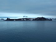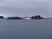
Aitcho Islands (South Shetland Islands)
Encyclopedia


English Strait
English Strait is the 17 km long and 2 km wide strait lying between Greenwich Island and Robert Island in the South Shetland Islands, Antarctica. Trending southeast-northwest, and entered between Santa Cruz Point and Edwards Point in the south, and Fort William Point and Okol Rocks,...
separating Greenwich Island and Robert Island in the South Shetland Islands
South Shetland Islands
The South Shetland Islands are a group of Antarctic islands, lying about north of the Antarctic Peninsula, with a total area of . By the Antarctic Treaty of 1959, the Islands' sovereignty is neither recognized nor disputed by the signatories and they are free for use by any signatory for...
, Antarctica, which are situated between Dee Island
Dee Island
Dee Island is the ice-free island lying between Greenwich Island and Aitcho Islands in the South Shetland Islands, Antarctica and is separated from Greenwich Island to the south by the wide Orión Passage and from Aitcho Islands to the northeast by the wide Villalón Passage. Extending , with the...
to the south and Table Island
Table Island (South Shetland Islands)
Table Island is a conspicuous flat-topped, rocky island lying north of Greenwich Island and north-northwest of the Aitcho group on the west side of English Strait in the South Shetland Islands, Antarctica. The island is rising to over and extending , with a surface area of . Turmoil Rock is...
to the north. The group is separated from Dee Island and Sierra Island
Sierra Island
Sierra Island is a narrow island which is marked by a series of small elevations throughout its length, lying northwest of Dee Island and north of Greenwich Island in the South Shetland Islands, Antarctica. Surface area ....
to the southwest by Villalón Passage (62°24′48.3"S 59°46′12.3"W). The area was visited by early 19th century sealers
Seal hunting
Seal hunting, or sealing, is the personal or commercial hunting of seals. The hunt is currently practiced in five countries: Canada, where most of the world's seal hunting takes place, Namibia, the Danish region of Greenland, Norway and Russia...
operating from nearby Clothier Harbour
Clothier Harbour
Clothier Harbour is the 1.5 km wide bay indenting for 1 km the north coast of Robert Island in the South Shetland Islands, Antarctica between Hammer Point on the northeast and Onogur Islands on the southwest...
. During the austral summer the islands are often visited by Antarctic cruise ships with tourists who land to watch wildlife.
The islands were mapped in 1935 during the oceanographic
Oceanography
Oceanography , also called oceanology or marine science, is the branch of Earth science that studies the ocean...
investigations carried out by the Discovery Committee
Discovery Committee
The Discovery Committee was a popular name for the Interdepartmental Committee for the Dependencies of the Falkland Islands established by the British Government to carry out scientific investigations and to propose nature resource conservation and economic development policies for the Falkland...
, and named after the Hydrographic Office
United Kingdom Hydrographic Office
The United Kingdom Hydrographic Office is an organisation within the UK government responsible for providing navigational and other hydrographic information for national, civil and defence requirements...
of the UK Admiralty
Admiralty
The Admiralty was formerly the authority in the Kingdom of England, and later in the United Kingdom, responsible for the command of the Royal Navy...
. Some of the island names were given by Chile
Chile
Chile ,officially the Republic of Chile , is a country in South America occupying a long, narrow coastal strip between the Andes mountains to the east and the Pacific Ocean to the west. It borders Peru to the north, Bolivia to the northeast, Argentina to the east, and the Drake Passage in the far...
an Antarctic expeditions between 1949 and 1951.
Islands
The islands and some notable rocks of the Aitcho group are:- Barrientos IslandBarrientos IslandBarrientos Island is an ice-free island in the Aitcho group on the west side of English Strait in the South Shetland Islands, Antarctica. Extending , surface area . The area was visited by early 19th century sealers...
- Bilyana IslandBilyana IslandBilyana Island is an ice-free island in the Aitcho group on the west side of English Strait in the South Shetland Islands, Antarctica. Extending , surface area...
- Cecilia IslandCecilia IslandCecilia Island is the ice-free southernmost island of the Aitcho group on the west side of English Strait in the South Shetland Islands, Antarctica. Extending , surface area...
, named Isla Torre by ChileChileChile ,officially the Republic of Chile , is a country in South America occupying a long, narrow coastal strip between the Andes mountains to the east and the Pacific Ocean to the west. It borders Peru to the north, Bolivia to the northeast, Argentina to the east, and the Drake Passage in the far... - Chaos ReefChaos ReefChaos Reef is the confused area of breakers and shoal water in the north extremity of Aitcho Islands group on the west side of English Strait in the South Shetland Islands, Antarctica...
- Cheshire Rock
- Emeline IslandEmeline IslandEmeline Island is a conspicuous rocky island rising to over in the Aitcho group on the west side of English Strait in the South Shetland Islands, Antarctica. Extending , surface area...
- Jorge IslandJorge IslandJorge Island is an ice-free island in the Aitcho group on the west side of English Strait in the South Shetland Islands, Antarctica. Extending , surface area...
- Kilifarevo IslandKilifarevo IslandKilifarevo Island is an ice-free island in the Aitcho group on the west side of English Strait in the South Shetland Islands, Antarctica. The island is situated northwest of Jorge Island, north of Riksa Islands and southeast of Morris Rock. Extending , surface area...
- Morris RockMorris RockMorris Rock is rising to in the northwest extremity of Aitcho group, English Strait in the South Shetland Islands, Antarctica. The area was visited by early 19th century sealers....
- Okol RocksOkol RocksOkol Rocks is a group of rocks in the north of Aitcho Islands group on the west side of English Strait in the South Shetland Islands, Antarctica...
- Pasarel IslandPasarel IslandPasarel Island is an ice-free island in the Aitcho group on the west side of English Strait in the South Shetland Islands, Antarctica. The island is situated northwest of Barrientos Island, northeast of Sierra Island and southeast of Emeline Island. Extending...
- Passage Rock
- Riksa IslandsRiksa IslandsRiksa Islands are three adjacent ice-free islands in the Aitcho group on the west side of English Strait in the South Shetland Islands, Antarctica. The islands are situated west of Bilyana Island, northeast of Emeline Island and east of Holmes Rock...
Flora and fauna
Among the bird species found on the islands are chinstrap and gentoo penguins, southern giant petrelsSouthern Giant Petrel
The Southern Giant Petrel , also known as the Antarctic Giant Petrel, Giant Fulmar, Stinker, and Stinkpot, is a large seabird of the southern oceans. Its distribution overlaps broadly with the similar Northern Giant Petrel, though it overall is centered slightly further south...
, and skuas. Southern elephant seals are among the larger life forms. There are also a wide variety of lichens and mosses reported.
See also
- Composite Antarctic Gazetteer
- Greenwich Island
- List of Antarctic islands south of 60° S
- Robert Island
- SCARScientific Committee on Antarctic ResearchThe Scientific Committee on Antarctic Research is an interdisciplinary body of the International Council for Science . It was established in February 1958 to continue the international coordination of Antarctic scientific activities that had begun during the International Geophysical Year of 1957-58...
- South Shetland IslandsSouth Shetland IslandsThe South Shetland Islands are a group of Antarctic islands, lying about north of the Antarctic Peninsula, with a total area of . By the Antarctic Treaty of 1959, the Islands' sovereignty is neither recognized nor disputed by the signatories and they are free for use by any signatory for...
- Territorial claims in Antarctica
Maps
- L.L. Ivanov et al., Antarctica: Livingston Island and Greenwich Island, South Shetland Islands (from English Strait to Morton Strait, with illustrations and ice-cover distribution), 1:100000 scale topographic map, Antarctic Place-names Commission of Bulgaria, Sofia, 2005
- L.L. Ivanov. Antarctica: Livingston Island and Greenwich, Robert, Snow and Smith Islands. Scale 1:120000 topographic map. Troyan: Manfred Wörner Foundation, 2009. ISBN 978-954-92032-6-4

