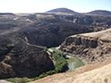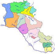
Akhurian River
Encyclopedia

South Caucasus
The South Caucasus is a geopolitical region located on the border of Eastern Europe and Southwest Asia also referred to as Transcaucasia, or The Trans-Caucasus...
. It originates in Armenia
Armenia
Armenia , officially the Republic of Armenia , is a landlocked mountainous country in the Caucasus region of Eurasia...
and flows from Lake Tseli south, along the border with Turkey
Turkey
Turkey , known officially as the Republic of Turkey , is a Eurasian country located in Western Asia and in East Thrace in Southeastern Europe...
, forming part of the geographic border between the two states, until it flows into the Aras River as a left tributary near Bagaran
Bagaran
Bagaran is a town and former fortress in the Armavir Province of Armenia, located 5 kilometers west of the right bank of the Akhurian River, and formerly a capital of Armenia....
. The Akhurian drains an area of about 9,500 km² (3,700 mi²); and has total length of 186 km (116 mi).
Gyumri
Gyumri
Gyumri is the capital and largest city of the Shirak Province in northwest Armenia. It is located about 120 km from the capital Yerevan, and, with a population of 168,918 , is the second-largest city in Armenia.The name of the city has been changed many times in history...
, the second largest city of Armenia, is located on the east bank of the river, which also flows past four of the twelve historical capitals of Armenia: Ani
Ani
Ani is a ruined and uninhabited medieval Armenian city-site situated in the Turkish province of Kars, near the border with Armenia. It was once the capital of a medieval Armenian kingdom that covered much of present day Armenia and eastern Turkey...
, Bagaran
Bagaran
Bagaran is a town and former fortress in the Armavir Province of Armenia, located 5 kilometers west of the right bank of the Akhurian River, and formerly a capital of Armenia....
, Yervandashat
Yervandashat
Yervandashat is a village in the Armavir Province of Armenia. The village has a ruined basilica dated to the 4th or 5th century and the Saint Shushanik church of the 10th to 17th century...
and Yerazgavors
Shirakavan
Shirakavan also known by the name Yerazgavors was a medieval Armenian town that, during the 9th century AD, served as the capital for the Bagratid Kingdom of Armenia...
.
History
When the ByzantineByzantine Empire
The Byzantine Empire was the Eastern Roman Empire during the periods of Late Antiquity and the Middle Ages, centred on the capital of Constantinople. Known simply as the Roman Empire or Romania to its inhabitants and neighbours, the Empire was the direct continuation of the Ancient Roman State...
army arrived in the province of Shirak in 1041, local Armenian
Armenians
Armenian people or Armenians are a nation and ethnic group native to the Armenian Highland.The largest concentration is in Armenia having a nearly-homogeneous population with 97.9% or 3,145,354 being ethnic Armenian....
nobles (nakharar
Nakharar
Nakharar was a hereditary title of the highest order given to houses of the ancient and medieval Armenian nobility.-Nakharar system:Medieval Armenia was divided into large estates, which were the property of an enlarged noble family and were ruled by a member of it, to whom the title of Nahapet...
s) assembled together against them under the command of the Pahlavuni
Pahlavuni
Pahlavuni was an Armenian noble family that rose to prominence in the late 10th century during the last years of the Bagratuni monarchy.-Origins:...
general Vahram Pahlavouni
Vahram Pahlavouni
Vahram Pahlavouni was an Armenian army commander and Prince of Bjni and Nik in Bagratuni Armenia. He was the head of the noble family of Pahlavouni, who held the hereditary title of sparapet in the Bagratuni kingdom of Ani....
. Vahram then selected a body of 30,000 infantry and 20,000 cavalry, forming three divisions, which fought against the Byzantines. A battle ensued in which the invaders were routed with great slaughter. The fight was so ferocious that the effusion of blood flowing into the Akhurian River is said to have coloured its waters completely red.
The Byzantines left 20,000 dead behind. This victory allowed Vahram Pahlavuni along with Catholicos
Catholicos
Catholicos, plural Catholicoi, is a title used for the head of certain churches in some Eastern Christian traditions. The title implies autocephaly and in some cases is borne by the designated head of an autonomous church, in which case the holder might have other titles such as Patriarch...
Petros Guedadarts to crown Gagik II
Gagik II
Gagik II of Ani was the last Bagratuni King of Ani from 1042 to 1045.-Historical background:During the reign of John Smbat III, a feudal lord, David, who owned Taik during his battles against the Muslims, gained a large area which stretched all the way to Manzikert...
king of Armenia and subsequently take the fortress of Ani, which had been in the hands of Vest Sarkis.
Bridges over the Akhurian River
Several medieval bridges once existed over the Akhurian River. The bridge at AniAni
Ani is a ruined and uninhabited medieval Armenian city-site situated in the Turkish province of Kars, near the border with Armenia. It was once the capital of a medieval Armenian kingdom that covered much of present day Armenia and eastern Turkey...
may date back to the Bagratuni Dynasty
Bagratuni Dynasty
The Bagratuni, Bagratid or alternatively Pakradouni royal dynasty of Armenia was a royal family whose branches formerly ruled many regional polities, including the Armenian lands of Sper|presently Ispir in Tayk Province of the Armenian Kingdom, Bagrevand in Ayrarat Province of the Armenian...
. More likely it dates to the thirteenth century. An inscription found nearby said that building work was done on the approach to the bridge in the early fourteenth century.
The bridge's single arch has fallen, leaving only tall abutments that were perhaps part of a fortified gate. Nineteenth century travelers reported a guardhouse next to the bridge, but this has since disappeared.
See also
- Geography of ArmeniaGeography of ArmeniaArmenia is a landlocked country in the South Caucasus region, between the Black and Caspian Seas, bordered on the north and east by Georgia and Azerbaijan and on the south and west by Iran and Turkey....
- Geography of TurkeyGeography of TurkeyTurkey is situated in Anatolia and the Balkans, bordering the Black Sea, between Bulgaria and Georgia, and bordering the Aegean Sea and the Mediterranean Sea, between Greece and Syria. The geographic coordinates of the country lie at:...
- Rivers and lakes in ArmeniaRivers and lakes in ArmeniaThe Rivers and lakes in Armenia are mainly powered by fresh water. Throughout history Armenia has been called Nairi by the Assyrians meaning the "Land of the lakes and rivers". The Armenia is home to many rivers and lakes....

