Aldrington
Encyclopedia
Aldrington is the name of an area of the city
of Brighton and Hove, previously part of the old borough of Hove
. For centuries it was meadow land along the English Channel
stretching west from the old village of Hove to the old mouth of the River Adur
, and it is now a prosperous residential area integrated within Hove.
as Eldretune. During the High Middle Ages the fortunes of the village waned as the mouth of the River Adur moved west to Portslade
, and as acres of land were lost to the sea. By the end of the sixteenth century its church dedicated to St Leonard
was a ruin, and though the population rallied for a time in the seventeenth century by the 1831 census the area recorded a population of just two.
in 1895. Parallel with it to the south is Kingsway (previously called Shoreham Road) which runs along the edge of the sea. Parallel to the north is Portland Road.
 The identity of Aldrington is as a residential area of Hove
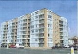
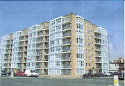
. It is characterised by late nineteenth and early twentieth century villa style houses on tree-lined roads. In places, particularly along the sea-front, are more recent apartment blocks. Channings (pictured) is typical of 20th century development; the colour scheme reflects the ubiquitous Brighton and Hove blue-green.
(formerly known at various times as Aldrington Halt, and as Dyke Junction) is located on the West Coastway Line
west of Hove
and east of Portslade
.
City
A city is a relatively large and permanent settlement. Although there is no agreement on how a city is distinguished from a town within general English language meanings, many cities have a particular administrative, legal, or historical status based on local law.For example, in the U.S...
of Brighton and Hove, previously part of the old borough of Hove
Hove
Hove is a town on the south coast of England, immediately to the west of its larger neighbour Brighton, with which it forms the unitary authority Brighton and Hove. It forms a single conurbation together with Brighton and some smaller towns and villages running along the coast...
. For centuries it was meadow land along the English Channel
English Channel
The English Channel , often referred to simply as the Channel, is an arm of the Atlantic Ocean that separates southern England from northern France, and joins the North Sea to the Atlantic. It is about long and varies in width from at its widest to in the Strait of Dover...
stretching west from the old village of Hove to the old mouth of the River Adur
River Adur
The Adur is a river in Sussex, England; it gives its name to the Adur district of West Sussex. The river was formerly navigable for large vessels up as far as Steyning, where there was a large port, but over time the river valley became silted up and the port moved down to the deeper waters nearer...
, and it is now a prosperous residential area integrated within Hove.
History
There was Roman activity and settlement in the area. The Anglo-Saxons gave it the name Ealdhere's Tun — Ealdhere's farm — and the name appears in the Domesday BookDomesday Book
Domesday Book , now held at The National Archives, Kew, Richmond upon Thames in South West London, is the record of the great survey of much of England and parts of Wales completed in 1086...
as Eldretune. During the High Middle Ages the fortunes of the village waned as the mouth of the River Adur moved west to Portslade
Portslade
Portslade is the name of an area of the city of Brighton and Hove, England. Portslade Village, the original settlement a mile inland to the north, was built up in the 16th century...
, and as acres of land were lost to the sea. By the end of the sixteenth century its church dedicated to St Leonard
St Leonard's Church, Aldrington
St Leonard's Church is an Anglican church in Hove, in the English city of Brighton and Hove. It is on New Church Road in the Aldrington area of Hove, which was previously a separate village, and it serves as Aldrington's parish church...
was a ruin, and though the population rallied for a time in the seventeenth century by the 1831 census the area recorded a population of just two.
Nineteenth century
The area of Aldrington began to be developed from the late nineteenth century as a westward extension of Hove. The church of St Leonard was restored in 1878, and incorporates parts of the medieval structure. Aldrington was amalgamated with Hove in 1894. The ground plan of Aldrington was set out on a grid-iron system, most unusual within England. The main artery running east-west is New Church Road, a broad and straight residential road. Originally called simply Church Road. it was renamed New Church Road to reflect the opening of St Philip's ChurchSt Philip's Church, Hove
St Philip's Church is an Anglican church in Hove, in the English city of Brighton and Hove. Opened in 1895 and consecrated in 1898 on New Church Road, on a site close to Aldrington's parish church of St Leonard's, it has come under threat of closure but is still active as of 2009...
in 1895. Parallel with it to the south is Kingsway (previously called Shoreham Road) which runs along the edge of the sea. Parallel to the north is Portland Road.
Aldrington today

Hove
Hove is a town on the south coast of England, immediately to the west of its larger neighbour Brighton, with which it forms the unitary authority Brighton and Hove. It forms a single conurbation together with Brighton and some smaller towns and villages running along the coast...
. It is characterised by late nineteenth and early twentieth century villa style houses on tree-lined roads. In places, particularly along the sea-front, are more recent apartment blocks. Channings (pictured) is typical of 20th century development; the colour scheme reflects the ubiquitous Brighton and Hove blue-green.
Rail
Aldrington railway stationAldrington railway station
Aldrington railway station, sometimes known by its former names of Aldrington Halt and Dyke Junction, is a railway station in Hove, in East Sussex, England...
(formerly known at various times as Aldrington Halt, and as Dyke Junction) is located on the West Coastway Line
West Coastway Line
The West Coastway Line is a railway line in England, along the south coast of West Sussex and Hampshire, between Brighton and Southampton, plus the short branches to Littlehampton and Bognor Regis....
west of Hove
Hove railway station
Hove railway station is in Hove in the county of East Sussex, England. The station and the majority of trains serving it are operated by Southern. The only other operator is First Great Western, who provide a limited number of services each day to Wales and the West Country. However Gatwick Express...
and east of Portslade
Portslade railway station
Portslade railway station is a railway station serving the town of Portslade-by-Sea in East Sussex, but located on the western fringes of the village of Aldrington ....
.

