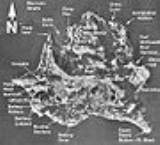
Angel Island, California
Overview
San Francisco Bay
San Francisco Bay is a shallow, productive estuary through which water draining from approximately forty percent of California, flowing in the Sacramento and San Joaquin rivers from the Sierra Nevada mountains, enters the Pacific Ocean...
that offers expansive views of the San Francisco
San Francisco, California
San Francisco , officially the City and County of San Francisco, is the financial, cultural, and transportation center of the San Francisco Bay Area, a region of 7.15 million people which includes San Jose and Oakland...
skyline, the Marin County
Marin County, California
Marin County is a county located in the North San Francisco Bay Area of the U.S. state of California, across the Golden Gate Bridge from San Francisco. As of 2010, the population was 252,409. The county seat is San Rafael and the largest employer is the county government. Marin County is well...
Headlands and Mount Tamalpais
Mount Tamalpais
Mount Tamalpais is a peak in Marin County, California, United States, often considered symbolic of Marin County. Much of Mount Tamalpais is protected within public lands such as Mount Tamalpais State Park and the Mount Tamalpais Watershed.-Geography:...
. The entire island is included within Angel Island State Park, and is administered by California State Parks. It has been used for a variety of purposes, including military forts and immigration centers. The Immigration Station
United States Immigration Station, Angel Island
Angel Island Immigration Station was an immigrant processing facility on Angel Island, in the San Francisco Bay. It opened in 1910 and is listed on the National Register of Historic Places. It is now the site of a museum. The museum and grounds were renovated and reopened to the public in February...
on the northeast corner of the island processed approximately one million immigrants and has been designated a National Historic Landmark
National Historic Landmark
A National Historic Landmark is a building, site, structure, object, or district, that is officially recognized by the United States government for its historical significance...
.
The highest point on the island, almost exactly at its center, is Mount Caroline Livermore at a height of 788 feet (240 m).
Unanswered Questions

