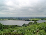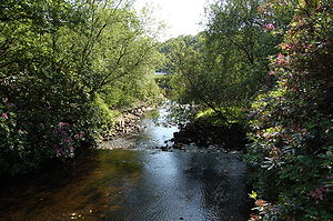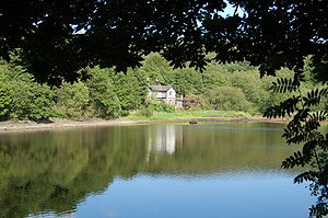
Anglezarke Reservoir
Encyclopedia

Reservoir
A reservoir , artificial lake or dam is used to store water.Reservoirs may be created in river valleys by the construction of a dam or may be built by excavation in the ground or by conventional construction techniques such as brickwork or cast concrete.The term reservoir may also be used to...
in the Rivington
Rivington
Rivington is a small village and civil parish of the Borough of Chorley, Lancashire, England, occupying . It is about southeast of Chorley and about northwest of Bolton. Rivington is situated on the fringe of the West Pennine Moors, at the foot of Rivington Pike...
chain to the west of Anglezarke
Anglezarke
Anglezarke is a sparsely populated civil parish in the Borough of Chorley in Lancashire, England. It is dominated by reservoirs that were built to supply water to Liverpool, and a large expanse of moorland with evidence of Bronze Age settlements...
in Lancashire
Lancashire
Lancashire is a non-metropolitan county of historic origin in the North West of England. It takes its name from the city of Lancaster, and is sometimes known as the County of Lancaster. Although Lancaster is still considered to be the county town, Lancashire County Council is based in Preston...
, England. Anglezarke Reservoir has three embankments, the longest, the Charnock Embankment is 777 metres long and 9.45 metres high, the Knowsley Embankment is 219.5 metres long and 14 metres high while the Heapey
Heapey
Heapey is a village and civil parish of the Borough of Chorley, in Lancashire, England. The village is two miles from Chorley and on the western fringe of the West Pennine Moors. In 2001 the population was 955.- History:...
Embankment is 85.3 metres long and 9.75 metres high. It is feed by the River Yarrow
River Yarrow (Lancashire)
The River Yarrow is in Lancashire, with its source at an area called Will Narr at Hordern Stoops, along Spitlers Edge - the Chorley/Blackburn boundary - on the West Pennine Moors. The river feeds the Yarrow Reservoir, which in turn feeds the Anglezarke and Upper and Lower Rivington Reservoirs...
, which has been diverted from its original course which is now covered by the Knowsley Embankment. It served the city of Liverpool
Liverpool
Liverpool is a city and metropolitan borough of Merseyside, England, along the eastern side of the Mersey Estuary. It was founded as a borough in 1207 and was granted city status in 1880...
before its current status as a supply mainly for Wigan
Wigan
Wigan is a town in Greater Manchester, England. It stands on the River Douglas, south-west of Bolton, north of Warrington and west-northwest of Manchester. Wigan is the largest settlement in the Metropolitan Borough of Wigan and is its administrative centre. The town of Wigan had a total...
. The original `Rivington Pike Scheme' was undertaken by Thomas Hawksley between 1850 and 1857. The scheme was to construct five reservoirs and a water treatment works at the south end of Lower Rivington with a 17-mile pipeline to storage reservoirs at Prescot
Prescot
Prescot is a town and civil parish, within the Metropolitan Borough of Knowsley in Merseyside, England. It is 8 miles to the east of Liverpool city centre and lies within the historic boundaries of Lancashire. At the 2001 Census, the population was 11,184 .Prescot marks the beginning of the...
. Water from two higher level reservoirs, Rake Brook
Rake Brook Reservoir
Rake Brook Reservoir is a reservoir fed by two streams, including the eponymous Rake Brook, a tributary of the River Roddlesworth in Lancashire.The reservoir is adjacent to the two Roddlesworth Reservoirs....
and Lower Roddlesworth
Lower Roddlesworth Reservoir
Lower Roddlesworth Reservoir is a reservoir on the River Roddlesworth close to Abbey Village in Lancashire.The reservoir is close to Upper Roddlesworth Reservoir and Rake Brook Reservoir, situated within thick forest....
, was carried south in `The Goit', a channel connecting them to the reservoirs.
In November 1997, the reservoir was refilled after a particularly dry summer. The water flow was so large that the reservoir required an emergency draw-down. With the water level at a temporary low, there was an opportunity to inspect the Heapey
Heapey
Heapey is a village and civil parish of the Borough of Chorley, in Lancashire, England. The village is two miles from Chorley and on the western fringe of the West Pennine Moors. In 2001 the population was 955.- History:...
embankment on Moor Road, which had been leaking since the 1960s. The condition of the embankment and surrounding strata
Stratum
In geology and related fields, a stratum is a layer of sedimentary rock or soil with internally consistent characteristics that distinguish it from other layers...
were such that a phased grout
Grout
Grout is a construction material used to embed rebars in masonry walls, connect sections of pre-cast concrete, fill voids, and seal joints . Grout is generally composed of a mixture of water, cement, sand, often color tint, and sometimes fine gravel...
ing operation was required to remedy the leakage. The reservoir was refilled, but was still leaking. After a second grouting and refill operation, the embankment was deemed leak-free.
It appears that the original cause of the leak was an 18" cast iron drawoff pipe which supplied White Brook to the north of the embankment. The trench for the pipe was cut much deeper than needed, through a glacial
Glacier
A glacier is a large persistent body of ice that forms where the accumulation of snow exceeds its ablation over many years, often centuries. At least 0.1 km² in area and 50 m thick, but often much larger, a glacier slowly deforms and flows due to stresses induced by its weight...
meltwater channel. However, shutting the pipe off in the 1970s failed to remedy the situation.

Tudorbethan architecture
The Tudor Revival architecture of the 20th century , first manifested itself in domestic architecture beginning in the United Kingdom in the mid to late 19th century based on a revival of aspects of Tudor style. It later became an influence in some other countries, especially the British colonies...
style structure also known as Heapey Cottage. It was occupied by Denis and Anne Oakden in the 1940s. Denis worked for the Water Authority and moved to the property after several years in Porch Cottages, White Coppice
White Coppice
White Coppice is a hamlet near Chorley, Lancashire, England. It was the most populated part of the township of Anglezarke in the 19th century. Close to the settlement in the early 19th century were quarries and small coal mines. The hamlet lies to the north of Anglezarke Reservoir in the Rivington...
.
To the east of the reservoir is the small High Bullough reservoir
High Bullough Reservoir
High Bullough reservoir is the oldest of all the reservoirs in the Rivington chain. Popular with walkers, it forms part of the Anglezarke trail, although it is also accessible from Manor House. Originally named as Chorley reservoir, it has since been disconnected from the rest of the system and...
and the Anglezarke Moors, Upper Rivington Reservoir
Upper Rivington Reservoir
Upper Rivington Reservoir is situated centrally in the Rivington chain of reservoirs, on the West Pennine Moors in Lancashire, England between Rivington and Anglezarke. The engineer for the Rivington reservoirs was Thomas Hawksley and construction took place between 1852 and 1857...
is to the south and Healey Nab
Healey Nab
Healey Nab or "The Nab" is an area of countryside owned by Lancashire County Council containing rolling hills, moorland, woodland, ponds and streams to the east of Chorley, Lancashire between the M61 and the West Pennine Moors. To the south east is Anglezarke Reservoir and to the north east White...
to the north west. The area is now a wildlife haven, with a Woodland Trail which links to High Bullough reservoir.

