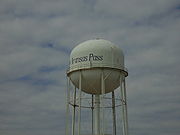
Aransas Pass, Texas
Encyclopedia

Aransas County, Texas
Aransas County is a county located in the U.S. state of Texas. It is part of the Corpus Christi Metropolitan Statistical Area. As of 2000, the population was 22,499. Its county seat is Rockport. Aransas County was formed in 1871 from Refugio County.-Geography:According to the U.S...
, Nueces, and San Patricio counties in the U.S. state
U.S. state
A U.S. state is any one of the 50 federated states of the United States of America that share sovereignty with the federal government. Because of this shared sovereignty, an American is a citizen both of the federal entity and of his or her state of domicile. Four states use the official title of...
of Texas
Texas
Texas is the second largest U.S. state by both area and population, and the largest state by area in the contiguous United States.The name, based on the Caddo word "Tejas" meaning "friends" or "allies", was applied by the Spanish to the Caddo themselves and to the region of their settlement in...
. The population was 8,138 at the 2000 census.
Geography
Aransas Pass is located at 27°54′7"N 97°8′22"W (27.901917, -97.139462).According to the United States Census Bureau
United States Census Bureau
The United States Census Bureau is the government agency that is responsible for the United States Census. It also gathers other national demographic and economic data...
, the city has a total area of 51.8 square miles (134.3 km²), of which, 10.7 square miles (27.8 km²) of it is land and 41.1 square miles (106.5 km²) of it (79.29%) is water.
The city is on the mainland of Texas and is connected to Mustang Island
Mustang Island
Mustang Island is a barrier island on the Gulf Coast of Texas in the United States. The island is 18 miles long, stretching from Corpus Christi to Port Aransas. The island is oriented generally northeast-southwest, with the Gulf of Mexico on the east and south, and Corpus Christi Bay on the north...
(which contains the city of Port Aransas
Port Aransas, Texas
Port Aransas is a city in Nueces County, Texas. The population was 3,370 at the 2000 census.-Early history:Karankawa Indians played a key role in the early development of the Texas Gulf Coast. The Karankawa Indians inhabited the Gulf Coast of Texas from Galveston Bay all the way to Corpus Christi Bay...
) via a 6 miles (9.7 km)-long causeway, and a free ferry
Ferry
A ferry is a form of transportation, usually a boat, but sometimes a ship, used to carry primarily passengers, and sometimes vehicles and cargo as well, across a body of water. Most ferries operate on regular, frequent, return services...
that carries vehicles to the island.
Demographics
As of the censusCensus
A census is the procedure of systematically acquiring and recording information about the members of a given population. It is a regularly occurring and official count of a particular population. The term is used mostly in connection with national population and housing censuses; other common...
of 2000, there were 8,138 people,US Census bureau 2007 estimate is 10,189 people, 2,961 households, and 2,140 families residing in the city. The population density
Population density
Population density is a measurement of population per unit area or unit volume. It is frequently applied to living organisms, and particularly to humans...
was 758.1 people per square mile (292.6/km²). There were 3,493 housing units at an average density of 325.4 per square mile (125.6/km²). The racial makeup of the city was 80.58% White, 3.44% African American, 0.76% Native American, 0.45% Asian, 0.01% Pacific Islander, 11.28% from other races
Race (United States Census)
Race and ethnicity in the United States Census, as defined by the Federal Office of Management and Budget and the United States Census Bureau, are self-identification data items in which residents choose the race or races with which they most closely identify, and indicate whether or not they are...
, and 3.47% from two or more races. Hispanic or Latino of any race were 37.70% of the population.
There were 2,961 households out of which 34.4% had children under the age of 18 living with them, 54.1% were married couples
Marriage
Marriage is a social union or legal contract between people that creates kinship. It is an institution in which interpersonal relationships, usually intimate and sexual, are acknowledged in a variety of ways, depending on the culture or subculture in which it is found...
living together, 13.4% had a female householder with no husband present, and 27.7% were non-families. 23.1% of all households were made up of individuals and 10.0% had someone living alone who was 65 years of age or older. The average household size was 2.70 and the average family size was 3.17.
In the city the population was spread out with 28.4% under the age of 18, 9.4% from 18 to 24, 25.4% from 25 to 44, 22.3% from 45 to 64, and 14.5% who were 65 years of age or older. The median age was 36 years. For every 100 females there were 97.5 males. For every 100 females age 18 and over, there were 95.0 males.
The median income for a household in the city was $27,376, and the median income for a family was $33,227. Males had a median income of $29,383 versus $17,969 for females. The per capita income
Per capita income
Per capita income or income per person is a measure of mean income within an economic aggregate, such as a country or city. It is calculated by taking a measure of all sources of income in the aggregate and dividing it by the total population...
for the city was $12,964. About 18.3% of families and 19.6% of the population were below the poverty line, including 23.5% of those under age 18 and 10.9% of those age 65 or over.
The primary industries are shrimping and tourism; along with farming and oil & gas interests in the area. The shrimp boat fleet sails from Conn Brown Harbor: a large, protected harbor chiefly dedicated to the shrimping industry. The area is popular for salt-water sports fishing and beach-going.
Famous citizens
- Emory BellardEmory BellardEmory Dilworth Bellard was a college football coach. He was head coach at Texas A&M University from 1972 to 1978 and at Mississippi State University from 1979 until 1985. Bellard died on February 10, 2011 after battling Lou Gehrig's disease since the fall of 2010.Bellard is a member of the Texas...
, former University of Texas Offensive Coordinator and Head Coach at Texas A&MTexas A&M UniversityTexas A&M University is a coeducational public research university located in College Station, Texas . It is the flagship institution of the Texas A&M University System. The sixth-largest university in the United States, A&M's enrollment for Fall 2011 was over 50,000 for the first time in school...
, inventor of the Wishbone formationWishbone formationThe wishbone formation, also known simply as the ’bone, is an offensive formation in American football. The style of attack to which it gives rise is known as the wishbone offense...
. - Tommy BlakeTommy BlakeTommy Earl Blake, Jr. is a former American football defensive end who played at the collegiate level for Texas Christian University.-Early life:Blake grew up in tiny town in Texas...
, former star Defensive End at Texas Christian UniversityTexas Christian UniversityTexas Christian University is a private, coeducational university located in Fort Worth, Texas, United States and founded in 1873. TCU is affiliated with, but not governed by, the Disciples of Christ...
.
Education
Aransas Pass is within the Aransas Pass Independent School DistrictAransas Pass Independent School District
Aransas Pass Independent School District is a public school district based in Aransas Pass, Texas .Aransas Pass serves portions of Aransas, Nueces, and San Patricio counties, including the city of Aransas Pass....
.
Schools that serve the city include H.T. Faulk Early Childhood School (Pre-K-1), Kieberger Elementary School (2-3), Charlie Marshall Elementary School (4-6), A.C. Blunt Middle School (7-8), and Aransas Pass High School.

