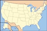
Aravaipa Canyon Wilderness
Encyclopedia
Aravaipa Canyon Wilderness is a 19,410 acre (78.5 km²) wilderness area
located in the U.S. State
of Arizona
. It forms the northwest border of the Galiuro Mountain
range. The wilderness is administered by the BLM
and is located northeast of Mammoth, Arizona
in Graham
and Pinal
counties, about 120 miles southeast of Phoenix
. The wilderness includes the 11-mile long Aravaipa Canyon, the surrounding tablelands and nine side canyons.
The Nature Conservancy's Aravaipa Canyon Preserve protects 7,000 acres (28 km²) of private land and is contiguous with the BLM wilderness area. Pedestrian access to the preserve is allowed only with prior authorization from Preserve staff.
. At Winkelman, take State Highway 77 south for 11 miles to Aravaipa Road. Follow Aravaipa Road 12 miles east to the trailhead. Access to the east end of the wilderness is west of Klondyke. A high-clearance vehicle is needed to reach the east trailhead.
At both ends, travel in the canyon requires wading in Aravaipa Creek.
National Wilderness Preservation System
The National Wilderness Preservation System of the United States protects federally managed land areas designated for preservation in their natural condition. It was established by the Wilderness Act upon the signature of President Lyndon B. Johnson on September 3, 1964...
located in the U.S. State
U.S. state
A U.S. state is any one of the 50 federated states of the United States of America that share sovereignty with the federal government. Because of this shared sovereignty, an American is a citizen both of the federal entity and of his or her state of domicile. Four states use the official title of...
of Arizona
Arizona
Arizona ; is a state located in the southwestern region of the United States. It is also part of the western United States and the mountain west. The capital and largest city is Phoenix...
. It forms the northwest border of the Galiuro Mountain
Galiuro Mountains
The Galiuro Mountains are a large sky island mountain range of southeast Arizona, USA. It is a northerly mountain range in the Madrean Sky Islands region of southeast Arizona, northern Sonora, Northern Mexico, and extreme southwest, bootheel New Mexico....
range. The wilderness is administered by the BLM
Bureau of Land Management
The Bureau of Land Management is an agency within the United States Department of the Interior which administers America's public lands, totaling approximately , or one-eighth of the landmass of the country. The BLM also manages of subsurface mineral estate underlying federal, state and private...
and is located northeast of Mammoth, Arizona
Mammoth, Arizona
Mammoth is a town in Pinal County, Arizona, United States. The population was 1,762 at the 2000 census; according to 2006 Census Bureau estimates, the population of the town is 2,167.Mammoth was founded c. 1872 as Mammoth Camp, serving the nearby Mammoth Mine...
in Graham
Graham County, Arizona
-2010:Whereas according to the 2010 U.S. Census Bureau:*72.1% White*1.8% Black*14.4% Native American*0.5% Asian*0.1% Native Hawaiian or Pacific Islander*2.8% Two or more races*8.3% Other races*30.4% Hispanic or Latino -2000:...
and Pinal
Pinal County, Arizona
-2010:Whereas according to the 2010 U.S. Census Bureau:*72.4% White*4.6% Black*5.6% Native American*1.7% Asian*0.4% Native Hawaiian or Pacific Islander*3.8% Two or more races*11.5% Other races*28.5% Hispanic or Latino -2000:...
counties, about 120 miles southeast of Phoenix
Phoenix, Arizona
Phoenix is the capital, and largest city, of the U.S. state of Arizona, as well as the sixth most populated city in the United States. Phoenix is home to 1,445,632 people according to the official 2010 U.S. Census Bureau data...
. The wilderness includes the 11-mile long Aravaipa Canyon, the surrounding tablelands and nine side canyons.
The Nature Conservancy's Aravaipa Canyon Preserve protects 7,000 acres (28 km²) of private land and is contiguous with the BLM wilderness area. Pedestrian access to the preserve is allowed only with prior authorization from Preserve staff.
Access
From Phoenix, take US Highway 60 to Superior. At Superior, take State Highway 177 to WinkelmanWinkelman, Arizona
Winkelman is a town in Gila and Pinal counties in the U.S. state of Arizona. According to 2006 Census Bureau estimates, the population of the town was 444, almost all of whom lived in Gila County.-Geography:...
. At Winkelman, take State Highway 77 south for 11 miles to Aravaipa Road. Follow Aravaipa Road 12 miles east to the trailhead. Access to the east end of the wilderness is west of Klondyke. A high-clearance vehicle is needed to reach the east trailhead.
At both ends, travel in the canyon requires wading in Aravaipa Creek.
Permits and fees
A permit is required to enter Aravaipa Canyon Wilderness. Use is limited to 50 people per day. Permits can be obtained via the Web.See also
- Redfield Canyon & Galiuro WildernessGaliuro WildernessGaliuro Wilderness is a wilderness area encompassing the mid to upper slopes of the Galiuro Mountains. It is located within the Safford Ranger District of the Coronado National Forest in the U.S. state of Arizona. It is bordered on the south by the Redfield Canyon...
es, southern Galiuro MountainsGaliuro MountainsThe Galiuro Mountains are a large sky island mountain range of southeast Arizona, USA. It is a northerly mountain range in the Madrean Sky Islands region of southeast Arizona, northern Sonora, Northern Mexico, and extreme southwest, bootheel New Mexico.... - List of Arizona Wilderness Areas
- List of U.S. Wilderness Areas
- Native Fishes of Aravaipa Canyon
Sources and external links
- BLM Aravaipa Canyon Wilderness page
- Nature Conservancy Aravaipa Canyon Preserve
- Wilderness.net Aravaipa Canyon Wilderness page
- GORP Aravaipa Canyon Wilderness page

