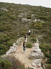
Arkadiko Bridge
Encyclopedia
The Arkadiko Bridge or Kazarma Bridge is a Mycenae
an bridge
near the modern road from Tiryns
to Epidauros on the Peloponnese
, Greece
. Dating to the Greek Bronze Age, it is one of the oldest arch bridge
s still in existence and use.
The corbel arch
bridge belonged in Mycenaean times to a highway between the two cities, which formed part of a wider military road network. It has a culvert span of ca. 1 m and is made in the typical Mycenaean manner of Cyclopean stones. The structure is 22 m long, 5.60 m wide at the base and 4 m high. The width of the roadway atop is about 2.50 m. The sophisticated lay-out of the bridge and the road indicate that they were specifically constructed for the use by chariot
s. Built in the late Late Helladic III
(ca. 1300-1190 BC), the bridge is still used by the local populace.
 The Arkadiko Bridge is only one of four known Mycenaean corbel arch bridges nearby Arkadiko, all belonging to the same Bronze Age highway between the two cities, and all of similar design and age.
One of them is the Petrogephyri bridge, which crosses the same stream 1 km to the west of the Arkadiko bridge. Otherwise similar in size and appearance, the structure has a larger span and a little higher vault. It, too, is still used as a local track.
A fifth, well-preserved Mycenaean bridge is located in the wider region at Lykotroupi, where it was part of another Mycenaean main road. Its measurements are close to the Arkadiko Bridge: 5.20 m wide at the bottom, 2.40 m at the top and a corbelled arch span of a little more than a metre. The road still features kerbs, obviously meant for guiding reasonably fast moving chariots.
Mycenae
Mycenae is an archaeological site in Greece, located about 90 km south-west of Athens, in the north-eastern Peloponnese. Argos is 11 km to the south; Corinth, 48 km to the north...
an bridge
Bridge
A bridge is a structure built to span physical obstacles such as a body of water, valley, or road, for the purpose of providing passage over the obstacle...
near the modern road from Tiryns
Tiryns
Tiryns is a Mycenaean archaeological site in the prefecture of Argolis in the Peloponnese, some kilometres north of Nauplion.-General information:...
to Epidauros on the Peloponnese
Peloponnese
The Peloponnese, Peloponnesos or Peloponnesus , is a large peninsula , located in a region of southern Greece, forming the part of the country south of the Gulf of Corinth...
, Greece
Greece
Greece , officially the Hellenic Republic , and historically Hellas or the Republic of Greece in English, is a country in southeastern Europe....
. Dating to the Greek Bronze Age, it is one of the oldest arch bridge
Arch bridge
An arch bridge is a bridge with abutments at each end shaped as a curved arch. Arch bridges work by transferring the weight of the bridge and its loads partially into a horizontal thrust restrained by the abutments at either side...
s still in existence and use.
The corbel arch
Corbel arch
A corbel arch is an arch-like construction method that uses the architectural technique of corbeling to span a space or void in a structure, such as an entranceway in a wall or as the span of a bridge...
bridge belonged in Mycenaean times to a highway between the two cities, which formed part of a wider military road network. It has a culvert span of ca. 1 m and is made in the typical Mycenaean manner of Cyclopean stones. The structure is 22 m long, 5.60 m wide at the base and 4 m high. The width of the roadway atop is about 2.50 m. The sophisticated lay-out of the bridge and the road indicate that they were specifically constructed for the use by chariot
Chariot
The chariot is a type of horse carriage used in both peace and war as the chief vehicle of many ancient peoples. Ox carts, proto-chariots, were built by the Proto-Indo-Europeans and also built in Mesopotamia as early as 3000 BC. The original horse chariot was a fast, light, open, two wheeled...
s. Built in the late Late Helladic III
Helladic period
Helladic is a modern archaeological term meant to identify a sequence of periods characterizing the culture of mainland ancient Greece during the Bronze Age. The term is commonly used in archaeology and art history...
(ca. 1300-1190 BC), the bridge is still used by the local populace.
Further Mycenaean bridges in the Argolis

One of them is the Petrogephyri bridge, which crosses the same stream 1 km to the west of the Arkadiko bridge. Otherwise similar in size and appearance, the structure has a larger span and a little higher vault. It, too, is still used as a local track.
A fifth, well-preserved Mycenaean bridge is located in the wider region at Lykotroupi, where it was part of another Mycenaean main road. Its measurements are close to the Arkadiko Bridge: 5.20 m wide at the bottom, 2.40 m at the top and a corbelled arch span of a little more than a metre. The road still features kerbs, obviously meant for guiding reasonably fast moving chariots.
Sources
- R. Hope Simpson, D. K. Hagel: "Mycenaean Fortifications, Highways, Dams and Canals", Paul Aströms Förlag, Sävedalen, in: Studies in Mediterranean Archaeology, Vol. CXXXIII ISBN 91-7081-212-8
- R. Hope Simpson, "The Mycenaean Highways", Classical Views, XLII, n.s. 17 (1998), 239–260
Further reading
- Anton Jansen: "Bronze Age Highways at Mycenae", Classical Views, XLI, n.s. 16 (1997), 1–16
External links
- Mycenaean bridge at Kazarma, Hellenic Ministry of Culture

