Arless
Encyclopedia
Arles or Arless is a village in County Laois
, Ireland
. It lies 2 km (1.24 mi) northwest of Ballickmoyler
and 10 km (6.21 mi) northwest of Carlow
, on the N80 national secondary road
.
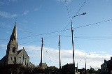
Located close to Carlow, the village has rapidly expanded in size since the 1960s, when it comprised just a few houses around the church. This was built in the 1680s (according to an inscription on a stone in the wall) and originally had a thatched roof.
County Laois
County Laois is a county in Ireland. It is part of the Midlands Region and is also located in the province of Leinster. It was formerly known as Queen's County until the establishment of the Irish Free State in 1922. The county's name was formerly spelt as Laoighis and Leix. Laois County Council...
, Ireland
Republic of Ireland
Ireland , described as the Republic of Ireland , is a sovereign state in Europe occupying approximately five-sixths of the island of the same name. Its capital is Dublin. Ireland, which had a population of 4.58 million in 2011, is a constitutional republic governed as a parliamentary democracy,...
. It lies 2 km (1.24 mi) northwest of Ballickmoyler
Ballickmoyler
Ballickmoyler or Ballicmoyler is a small town in County Laois, Ireland. It lies southeast of Portlaoise, at the junction of the N80 national secondary road and the R429 regional road.-See also:* List of towns and villages in Ireland-External links:...
and 10 km (6.21 mi) northwest of Carlow
Carlow
Carlow is the county town of County Carlow in Ireland. It is situated in the south-east of Ireland, 84 km from Dublin. County Carlow is the second smallest county in Ireland by area, however Carlow Town is the 14th largest urban area in Ireland by population according to the 2006 census. The...
, on the N80 national secondary road
National secondary road
A national secondary road is a category of road in Ireland. These roads form an important part of the national route network, but are secondary to the main arterial routes which are classified as national primary roads. National secondary roads are designated with route numbers higher than those...
.
Located close to Carlow, the village has rapidly expanded in size since the 1960s, when it comprised just a few houses around the church. This was built in the 1680s (according to an inscription on a stone in the wall) and originally had a thatched roof.
See also
- List of towns and villages in Ireland

