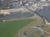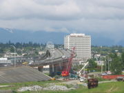
Arthur Laing Bridge
Encyclopedia

Grant McConachie Way
Grant McConachie Way is a three-to-six lane expressway in Richmond and Vancouver, British Columbia, Canada. Named for aviator Grant McConachie, it is the primary access road into Vancouver International Airport on Sea Island. It is also one of the three roads entering Vancouver from the south,...
over the North Arm of the Fraser River
Fraser River
The Fraser River is the longest river within British Columbia, Canada, rising at Fraser Pass near Mount Robson in the Rocky Mountains and flowing for , into the Strait of Georgia at the city of Vancouver. It is the tenth longest river in Canada...
between Vancouver
Vancouver
Vancouver is a coastal seaport city on the mainland of British Columbia, Canada. It is the hub of Greater Vancouver, which, with over 2.3 million residents, is the third most populous metropolitan area in the country,...
and Richmond, British Columbia
Richmond, British Columbia
Richmond is a coastal city, incorporated in the Canadian province of British Columbia. Part of Metro Vancouver, its neighbouring communities are Vancouver and Burnaby to the north, New Westminster to the east, and Delta to the south, while the Strait of Georgia forms its western border...
's Sea Island
Sea Island, British Columbia
Sea Island is located in the city of Richmond, British Columbia, directly across the river from Vancouver and fifteen kilometres from Vancouver's downtown core. The island is in the estuary of the Fraser River, giving it a unique ecological environment...
where the Vancouver International Airport
Vancouver International Airport
Vancouver International Airport is located on Sea Island in Richmond, British Columbia, Canada, about from Downtown Vancouver. In 2010 it was the second busiest airport in Canada by aircraft movements and passengers , behind Toronto Pearson International Airport, with non-stop flights daily to...
is located. Two parallel independent unpainted steel box girders make up the main spans. The bridge is operated by the Vancouver International Airport.
History
The current bridge is on the same alignment as its predecessor, the MarpoleMarpole
Marpole is a mostly residential neighbourhood of 22,400 located on the southern edge of the city of Vancouver, British Columbia, immediately northeast of Vancouver International Airport. It is approximately bordered by Angus Drive to the west, 57th Avenue to the north, Main Street to the east and...
Bridge. The first Marpole bridge (1889–1901) was a low-level road bridge consisting of a series of timber through-truss spans, with a steel through-truss for navigation.
The second Marpole bridge (1901–1957), with its half-through steel plate girder swing span, was frequently opened at inconvenient times. Records show, for example, that the bridge opened 7,015 times in 1954. It was dismantled in 1957 after the completion that same year of the Oak Street Bridge
Oak Street Bridge
The Oak Street Bridge is a four-lane bridge crossing the Fraser River connecting Vancouver to Richmond in British Columbia. The main spans are heavy steel deck plate girders continuous over three spans of 60.9, 91.4 and 60.9 metres. The bridge is a part of Highway 99.- History :The Oak Street...
, which was built to the east and connected Vancouver
Vancouver
Vancouver is a coastal seaport city on the mainland of British Columbia, Canada. It is the hub of Greater Vancouver, which, with over 2.3 million residents, is the third most populous metropolitan area in the country,...
directly to the main island of Richmond
Richmond, British Columbia
Richmond is a coastal city, incorporated in the Canadian province of British Columbia. Part of Metro Vancouver, its neighbouring communities are Vancouver and Burnaby to the north, New Westminster to the east, and Delta to the south, while the Strait of Georgia forms its western border...
, Lulu Island
Lulu Island
Lulu Island is the name of the largest island in the estuary of the Fraser River. The island makes up most of the City of Richmond, a major suburb of Vancouver, British Columbia...
. Access to Sea Island and the airport was then made via the Moray Bridge
Moray Bridge
Moray Bridge, originally christened 'The Middle-arm Swing Bridge' in October 1957, is a low-level one-way swing bridge in Richmond, British Columbia, Canada...
. The Oak Street Bridge soon become congested and a new bridge needed to be built.
On September 6, 1974, Pierre Trudeau
Pierre Trudeau
Joseph Philippe Pierre Yves Elliott Trudeau, , usually known as Pierre Trudeau or Pierre Elliott Trudeau, was the 15th Prime Minister of Canada from April 20, 1968 to June 4, 1979, and again from March 3, 1980 to June 30, 1984.Trudeau began his political career campaigning for socialist ideals,...
announced that the new bridge over the North Arm of the Fraser River would be named after Arthur Laing
Arthur Laing
Arthur Laing, PC was a Canadian politician. He was a Liberal Member of the Canadian House of Commons from Vancouver, British Columbia....
who was a Member of the Canadian House of Commons from Vancouver. Arthur Laing died before the bridge was officially opened on May 15, 1976 (traffic had been using it since August 1975). This new bridge had the same alignment as the Marpole bridge, but was higher and longer.
Recently the Vancouver International Airport has discussed the possibility of adding a toll to this structure to reduce traffic volume. http://www.cbc.ca/canada/british-columbia/story/2006/09/08/bc-airport.html This has been strongly opposed by many Richmond residents, while opposition has been championed on the local level by local city councillors Bill McNulty and Derek Dang http://www.cbc.ca/canada/british-columbia/story/2006/09/08/bc-airport.html. Since that time, other city councillors have spoken up and voiced their opposition to this plan, such as Harold Steves and Rob Howard http://richmond-news.com/issues06/102206/news/102206nn5.html.

