Arucas, Las Palmas
Encyclopedia
Arucas is a Canary Islands
municipality in the province of Las Palmas
. It is situated in the north of Gran Canaria
. Arucas is a suburb of Las Palmas
city.
Arucas's area is 33.01 km² with a population of about 33,701 (ISTAC, 2003) and its density is 1,009.31/km² making the second most populated municipality in the island.
Arucas is situated in the mountains and the valleys, the farmlands cover parts of Arucas, the mountains cover the southern part and the valleys in the northern part. Farmlands are within the coastline, the Atlantic Ocean lies to the north. Arucas is located W of Las Palmas de Gran Canaria and serves an interchange with the GC2
, N of the GC30, E of Gáldar
and NW of Telde
. The main industry are agriculture, businesses and tourism.

 The Church of San Juan Bautista the leading architectural and social monument in the municipality. It was built entirely in Arucas stone by local master masons, and it dates from 1909. Apart from the wealth of the carved stone columns and column heads, there are also some beautiful stained glass windows, the works of Canary Island painter Cristobal Hernandez de Quintana, and an extraordinary carving of the Reclining Christ, by Manuel Ramos. To the north is the Montaña de Arucas which is thought to be the area where courageous Doramas the Guanche leader was killed in 1481 by Pedro de Vera in the Battle of Arucas. Arucus is known for the production of rum.
was produced here long before sugar plantations were cultivated in Cuba
. One of the main features of modern-day Arucas is its rum factory. Arucas boomed with the demand for cochinilla (a beatle feeding off cactus pear, crushed to produce red dye) in the second half of the 19th century.
Canary Islands
The Canary Islands , also known as the Canaries , is a Spanish archipelago located just off the northwest coast of mainland Africa, 100 km west of the border between Morocco and the Western Sahara. The Canaries are a Spanish autonomous community and an outermost region of the European Union...
municipality in the province of Las Palmas
Las Palmas (province)
The Province of Las Palmas is a province of Spain, consisting of the eastern part of the autonomous community of the Canary Islands.-Composition:...
. It is situated in the north of Gran Canaria
Gran Canaria
Gran Canaria is the second most populous island of the Canary Islands, with a population of 838,397 which constitutes approximately 40% of the population of the archipelago...
. Arucas is a suburb of Las Palmas
Las Palmas de Gran Canaria
Las Palmas de Gran Canaria commonly known as Las Palmas is the political capital, jointly with Santa Cruz, the most populous city in the Autonomous Community of the Canary Islands and the ninth largest city in Spain, with a population of 383,308 in 2010. Nearly half of the people of the island...
city.
Arucas's area is 33.01 km² with a population of about 33,701 (ISTAC, 2003) and its density is 1,009.31/km² making the second most populated municipality in the island.
Arucas is situated in the mountains and the valleys, the farmlands cover parts of Arucas, the mountains cover the southern part and the valleys in the northern part. Farmlands are within the coastline, the Atlantic Ocean lies to the north. Arucas is located W of Las Palmas de Gran Canaria and serves an interchange with the GC2
GC2 (Gran Canaria)
The GC-2 North Highway in Gran Canaria . Connects Las Palmas de Gran Canaria with the north little port and village of Agaete...
, N of the GC30, E of Gáldar
Gáldar, Las Palmas
Gáldar's area is 61.59 km² with a population of about 22,763 and its density is 369.59/km².Gáldar is situated in the mountains and are surrounded by valleys. Farmlands are within the coastline while the mountains lies to the southeast, the Atlantic Ocean lies to the west and to the north. A...
and NW of Telde
Telde, Las Palmas
Telde is a municipality in the eastern on the island of Gran Canaria, Canary Islands, Spain. The suburb of Las Palmas city. It is the second most populated municipality on the island, with a population of 100,015...
. The main industry are agriculture, businesses and tourism.
Geography
- Location:
- Latitude: 29.11667 (29°7") N
- Longitude: 15.51667 (15°31') W
- Altitude:
- Lowest: Atlantic Ocean
- Centre: 240 m
- Highest: southern part
- Name of inhabitants: Aruquenses
- Postal code: -
Sites of interest


History and Information
Arucas was rebuilt in 1480 after being completely destroyed in 1478. Since the 15th century, the main crop of the Arucas area was sugar cane. RumRum
Rum is a distilled alcoholic beverage made from sugarcane by-products such as molasses, or directly from sugarcane juice, by a process of fermentation and distillation. The distillate, a clear liquid, is then usually aged in oak barrels...
was produced here long before sugar plantations were cultivated in Cuba
Cuba
The Republic of Cuba is an island nation in the Caribbean. The nation of Cuba consists of the main island of Cuba, the Isla de la Juventud, and several archipelagos. Havana is the largest city in Cuba and the country's capital. Santiago de Cuba is the second largest city...
. One of the main features of modern-day Arucas is its rum factory. Arucas boomed with the demand for cochinilla (a beatle feeding off cactus pear, crushed to produce red dye) in the second half of the 19th century.
Other
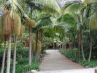
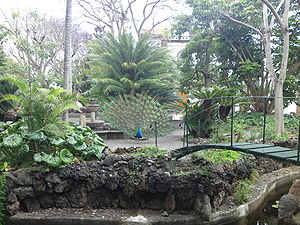
Arucas has schools, lyceums, gymnasia, churches: the famous Arucas cathedral, a post office and squares (plazas). There is also a Botanical Garden, the Jardín de la Marquesa de Arucas.- Church of San Juan Bautista (also vulgarly known as Catedral de Arucas due to its big size) built entirely in Arucas stone by local master masons, and it dates from 1909 (Initial Configuration from the XVII century). Apart from the wealth of the carved stone columns and column heads, there are also some beautiful stained glass windows, the works of Canary Island painter Cristobal Hernandez de Quintana, and an extraordinary carving of the Reclining Christ, by Manuel Ramos.
- Jardín de la Marquesa de Arucas - Botanical Garden in Arucas.
External links
- English version of Arucas tourism site
- Map and aerial photos
- Street map: Street map from Mapquest, MapPoint, Google or Yahoo! Maps
- Satellite images: Google or Microsoft Virtual Earth - image now available

