Batken Province
Encyclopedia
Batken Province is a province
(oblast
) of Kyrgyzstan
. Its capital is Batken
. It is bounded on the east by Osh Province
, on the south, west and north by Tajikistan
and on the northeast by Uzbekistan
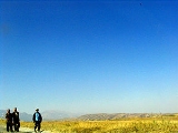
. The northern part of the province is part of the flat, agricultural Ferghana Valley. The land rises southward to the mountains on the southern border: the Alay Mountains
in the east, and the Turkestan Range in the west.
The population of the province was reported as 382,400 by the census of 1999. Of them, 26.2 per cent lived in the province's four cities, and 73.8 per cent in the rural areas. The majority (74.3 per cent) of the province's population are Kyrgyz; there are also Uzbeks (14.4 per cent) and Tajiks (6.9 per cent), as well as a few Russians (2.2 per cent), Tatars (1 per cent), and Turks
(0.3 per cent).
Batken province was created on 12 October 1999, from the westernmost section of Osh Province
. This was partly in response to the activities of the Islamic Movement for Uzbekistan (IMU), with bases in Tajikistan. In 1999 they kidnapped a group of Japanese geologists and in 2000 some American climbers. In the two years, 49 Kyrgyz soldiers were killed. There have been no incidents since, except for an attack on a Tajik border post in May 2006, which was probably connected to drug running.
 Batken province is divided administratively into 3 districts::
There are four town
s in Batken oblast: Batken
, Isfana
, Kyzyl-Kiya
and Sulyukta
. There are five urban-type settlement
s, including Chauvay
, Khaidarkan
, Sovetskiy
, Kadamjay
and Vostochny
.
 In the Soviet period a number of enclaves and exclaves were established in the Batken area.
Chong-Kara is a small exclave of Uzbekistan
, immediately north of So'x, and lies on the Sokh River
. It measures approximately 2 kilometres long by 1 kilometre wide.
Jangy-ayyl is a very small exclave of Uzbekistan, about 60 kilometres east of Batken
near the Uzbek border. It measures barely 2 to 3 kilometres across.
Kayragach
is a very small exclave of Tajikistan
, located near the border in the north west corner of the province, about 130 kilometres west of Batken.
Shohimardon
is an exclave of Uzbekistan, about 80 kilometres east of Batken
and 19 kilometres south of the Uzbek border. It has an area of 90 square kilometres, and a population in 1993 of 5,100. Uzbeks comprise 91 per cent of the population.
So'x is an exclave of Uzbekistan, about 24 kilometres east of Batken. The largest of the exclaves, it has an area of 325 square kilometres, stretches from 3 to 13 kilometres from east to west, and about 35 kilometres north to south, and is crossed by the main highway from Batken to Osh
. Tajiks comprise 99 per cent of the population, which in 1993 numbered 42,800.
Vorukh
is an exclave of Tajikistan, with an area of 130 square kilometrers, located 45 kilometres south of Isfara
and 24 kilometres south west of Batken, on the right bank of the Karafshin River. The population, distributed among 17 villages, is estimated to be between 23,000 and 29,000, 95 per cent of which are Tajiks and 5 per cent Kyrgyz.
 Until recently, travel by foreigners was not recommended because of security problems. To travel between Osh
and Batken
the road crosses the So'x enclave, which requires a double-entry Kyrgyz visa and an Uzbek transit visa: it is possible to take an unmetalled road around the enclave. The southern mountains offer excellent, but very difficult climbing with many sheer rock faces. Summits are Pyramid Peak [5509 metres (18,074.1 ft)] and Pik Skalistiy [5621 metres (18,441.6 ft)].
Province
A province is a territorial unit, almost always an administrative division, within a country or state.-Etymology:The English word "province" is attested since about 1330 and derives from the 13th-century Old French "province," which itself comes from the Latin word "provincia," which referred to...
(oblast
Oblast
Oblast is a type of administrative division in Slavic countries, including some countries of the former Soviet Union. The word "oblast" is a loanword in English, but it is nevertheless often translated as "area", "zone", "province", or "region"...
) of Kyrgyzstan
Kyrgyzstan
Kyrgyzstan , officially the Kyrgyz Republic is one of the world's six independent Turkic states . Located in Central Asia, landlocked and mountainous, Kyrgyzstan is bordered by Kazakhstan to the north, Uzbekistan to the west, Tajikistan to the southwest and China to the east...
. Its capital is Batken
Batken
Batken is a small town of about 12,000 population, in southwestern Kyrgyzstan, on the southern fringe of the Fergana Valley. Its geographical location is...
. It is bounded on the east by Osh Province
Osh Province
Osh Province is a province of Kyrgyzstan. Its capital is Osh. It is bounded by Jalal-Abad Province, Naryn Province, Xinjiang, China, Tajikistan, Batken Province and Uzbekistan.-Geography:...
, on the south, west and north by Tajikistan
Tajikistan
Tajikistan , officially the Republic of Tajikistan , is a mountainous landlocked country in Central Asia. Afghanistan borders it to the south, Uzbekistan to the west, Kyrgyzstan to the north, and China to the east....
and on the northeast by Uzbekistan
Uzbekistan
Uzbekistan , officially the Republic of Uzbekistan is a doubly landlocked country in Central Asia and one of the six independent Turkic states. It shares borders with Kazakhstan to the west and to the north, Kyrgyzstan and Tajikistan to the east, and Afghanistan and Turkmenistan to the south....
. The northern part of the province is part of the flat, agricultural Ferghana Valley. The land rises southward to the mountains on the southern border: the Alay Mountains
Alay Mountains
The Alay or Alai Mountains is a mountain range that extends from the Tien Shan mountain range in Kyrgyzstan west into Tajikistan. It is part of the Pamir-Alay mountain system. The range runs approximately east to west. Its highest summit is Pik Tandykul , 5544 m. The southern slopes of the range...
in the east, and the Turkestan Range in the west.
The population of the province was reported as 382,400 by the census of 1999. Of them, 26.2 per cent lived in the province's four cities, and 73.8 per cent in the rural areas. The majority (74.3 per cent) of the province's population are Kyrgyz; there are also Uzbeks (14.4 per cent) and Tajiks (6.9 per cent), as well as a few Russians (2.2 per cent), Tatars (1 per cent), and Turks
Turkish people
Turkish people, also known as the "Turks" , are an ethnic group primarily living in Turkey and in the former lands of the Ottoman Empire where Turkish minorities had been established in Bulgaria, Cyprus, Bosnia and Herzegovina, Georgia, Greece, Kosovo, Macedonia, and Romania...
(0.3 per cent).
Batken province was created on 12 October 1999, from the westernmost section of Osh Province
Osh Province
Osh Province is a province of Kyrgyzstan. Its capital is Osh. It is bounded by Jalal-Abad Province, Naryn Province, Xinjiang, China, Tajikistan, Batken Province and Uzbekistan.-Geography:...
. This was partly in response to the activities of the Islamic Movement for Uzbekistan (IMU), with bases in Tajikistan. In 1999 they kidnapped a group of Japanese geologists and in 2000 some American climbers. In the two years, 49 Kyrgyz soldiers were killed. There have been no incidents since, except for an attack on a Tajik border post in May 2006, which was probably connected to drug running.
Basic Socio-Economic Indicators
- Population: 428,800 (assessment for 1 January 2009) including 25.2% - urban, and 74.8% - rural population
- Employed population: 157,300 (2008)
- Registered unemployed population: 5,499 (2008)
- Export: 14.7 million US dollars (2008)
- Import: 53.6 million US dollars (2008)
Subdivisions of Batken Province

| District | Capital | Location |
|---|---|---|
| Kadamjay District Kadamjay District Kadamjay District is a district in Batken Province, in south-western Kyrgyzstan.:The district capital lies at Pulgon. Its population in 2005 was approximately 30,000... |
Pülgön Pulgon Pulgon is a village in the Batken Province of Kyrgyzstan. It is the administrative center of the Kadamjay District of this province. In the Soviet era, the village was officially known as Frunzenskoye, and the district was known as the Frunzensky District of Osh Province.The village is located... |
East |
| Batken District Batken District Batken is a raion of Batken Province in south-western Kyrgyzstan. The capital lies at Batken.:-Towns and villages:Batken district is divided into nine administrative divisions :- Darin A/O... |
Batken Batken Batken is a small town of about 12,000 population, in southwestern Kyrgyzstan, on the southern fringe of the Fergana Valley. Its geographical location is... |
Center |
| Leilek District Leilek District Leilek is a raion of Batken Province in south-western Kyrgyzstan. It borders with Batken District in the east, and Tajikistan in the south, west, and north. The capital lies at Isfana... |
Isfana Isfana Isfana is a small town of about 28,085 at the extreme western end of Batken Oblast in southern Kyrgyzstan, at the southern fringe of the Fergana valley. Backed up against the enormous mountains in the south and surrounded on three sides by Tajikistan, the town and the nearby villages are largely... |
West |
There are four town
Town
A town is a human settlement larger than a village but smaller than a city. The size a settlement must be in order to be called a "town" varies considerably in different parts of the world, so that, for example, many American "small towns" seem to British people to be no more than villages, while...
s in Batken oblast: Batken
Batken
Batken is a small town of about 12,000 population, in southwestern Kyrgyzstan, on the southern fringe of the Fergana Valley. Its geographical location is...
, Isfana
Isfana
Isfana is a small town of about 28,085 at the extreme western end of Batken Oblast in southern Kyrgyzstan, at the southern fringe of the Fergana valley. Backed up against the enormous mountains in the south and surrounded on three sides by Tajikistan, the town and the nearby villages are largely...
, Kyzyl-Kiya
Kyzyl-Kiya
Kyzyl-Kiya is a city in the Batken Oblast, in southwestern Kyrgyzstan. It is situated on the southern edge of the Fergana Valley, 32 km southeast of Fergana, and 65 km southwest of Osh. The town is one of the oldest centers of the coal mining industry in Kyrgyzstan.Coordinates: ....
and Sulyukta
Sulyukta
- Sources :** – World-Gazetteer.com...
. There are five urban-type settlement
Urban-type settlement
Urban-type settlement ; , selyshche mis'koho typu ) is an official designation for a type of locality used in some of the countries of the former Soviet Union...
s, including Chauvay
Chauvay
Chauvay is a village in the Batken Province of Kyrgyzstan.Nearby towns and villages include Kara-Kshtak and Kara-Dzhegach .- External links :*...
, Khaidarkan
Khaidarkan
Khaidarkan is a town in the Batken Province of Kyrgyzstan.Population 9,100 .- Sources :* – World-Gazetteer.com...
, Sovetskiy
Sovetskiy, Kyrgyzstan
Sovetskiy is a small town in the Batken Province of Kyrgyzstan.Nearby towns and villages include Tillya-Bay-Kurgan , Shuran , Kyrgyz-Kyshtak and Oruk-Zar .- External links :* *...
, Kadamjay
Kadamjay
Kadamjay is the town in Kadamjay District of Batken Province of Kyrgyzstan. Kadamjay is located between the cities of Khaidarkan and Kyzyl-Kiya ....
and Vostochny
Vostochny, Kyrgyzstan
Vostochnyy is a town in the Batken Province of Kyrgyzstan.Nearby towns and villages include Seluka , Maat-Murat and Isfana .- External links :* * *...
.
Enclaves and exclaves

Chong-Kara is a small exclave of Uzbekistan
Uzbekistan
Uzbekistan , officially the Republic of Uzbekistan is a doubly landlocked country in Central Asia and one of the six independent Turkic states. It shares borders with Kazakhstan to the west and to the north, Kyrgyzstan and Tajikistan to the east, and Afghanistan and Turkmenistan to the south....
, immediately north of So'x, and lies on the Sokh River
Sokh River
The Sokh River is a river in Kyrgyzstan and Uzbekistan. It takes its rise on the north slopes of Alay Mountains and ends in Ferghana Valley. In the past, Sokh River was a left tributary of the Syr Darya. But, nowadays it is entirely used for irrigation....
. It measures approximately 2 kilometres long by 1 kilometre wide.
Jangy-ayyl is a very small exclave of Uzbekistan, about 60 kilometres east of Batken
Batken
Batken is a small town of about 12,000 population, in southwestern Kyrgyzstan, on the southern fringe of the Fergana Valley. Its geographical location is...
near the Uzbek border. It measures barely 2 to 3 kilometres across.
Kayragach
Kayragach
Kayragach is a village in the Sughd Province of Tajikistan.This village is an exclave of Tajikistan inside Kyrgyzstan.See Batken Province. Nearby towns and villages include Tagan , Beshkent and Andarkhan .- External links :* *...
is a very small exclave of Tajikistan
Tajikistan
Tajikistan , officially the Republic of Tajikistan , is a mountainous landlocked country in Central Asia. Afghanistan borders it to the south, Uzbekistan to the west, Kyrgyzstan to the north, and China to the east....
, located near the border in the north west corner of the province, about 130 kilometres west of Batken.
Shohimardon
Shohimardon
Shohimardon is a small town in Fergana Province in eastern Uzbekistan. It is an exclave of Uzbekistan, completely surrounded by Kyrgyzstan, in a valley in the Pamiro-Alai mountains. According to legend, the Caliph Ali was buried in Shohimardon...
is an exclave of Uzbekistan, about 80 kilometres east of Batken
Batken
Batken is a small town of about 12,000 population, in southwestern Kyrgyzstan, on the southern fringe of the Fergana Valley. Its geographical location is...
and 19 kilometres south of the Uzbek border. It has an area of 90 square kilometres, and a population in 1993 of 5,100. Uzbeks comprise 91 per cent of the population.
So'x is an exclave of Uzbekistan, about 24 kilometres east of Batken. The largest of the exclaves, it has an area of 325 square kilometres, stretches from 3 to 13 kilometres from east to west, and about 35 kilometres north to south, and is crossed by the main highway from Batken to Osh
Osh
Osh is the second largest city in Kyrgyzstan, located in the Fergana Valley in the south of the country and often referred to as the "capital of the south". The city is at least 3,000 years old, and has served as the administrative center of Osh Province since 1939...
. Tajiks comprise 99 per cent of the population, which in 1993 numbered 42,800.
Vorukh
Vorukh
Vorukh is a jamoat in northern Tajikistan. It is located in Isfara District in Sughd province. The jamoat has a total population of 23,121.Vorukh forms part of an exclave of Tajikistan within Kyrgyzstan. There are several such enclaves, and they all come from Stalin's drawing of borders in the...
is an exclave of Tajikistan, with an area of 130 square kilometrers, located 45 kilometres south of Isfara
Isfara
Isfara is a city in Sughd Province in northern Tajikistan, situated on the border with Kyrgyzstan. It has a population of 40,600 . The city is capital of Isfara district.-History:...
and 24 kilometres south west of Batken, on the right bank of the Karafshin River. The population, distributed among 17 villages, is estimated to be between 23,000 and 29,000, 95 per cent of which are Tajiks and 5 per cent Kyrgyz.
Travel

Osh
Osh is the second largest city in Kyrgyzstan, located in the Fergana Valley in the south of the country and often referred to as the "capital of the south". The city is at least 3,000 years old, and has served as the administrative center of Osh Province since 1939...
and Batken
Batken
Batken is a small town of about 12,000 population, in southwestern Kyrgyzstan, on the southern fringe of the Fergana Valley. Its geographical location is...
the road crosses the So'x enclave, which requires a double-entry Kyrgyz visa and an Uzbek transit visa: it is possible to take an unmetalled road around the enclave. The southern mountains offer excellent, but very difficult climbing with many sheer rock faces. Summits are Pyramid Peak [5509 metres (18,074.1 ft)] and Pik Skalistiy [5621 metres (18,441.6 ft)].
Sources
- Laurence Mitchell, Kyrgyzstan, Bradt Travel Guides, 2008.

