
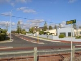
Beach Road, Perth
Encyclopedia
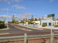
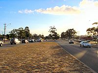
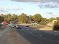
Road
A road is a thoroughfare, route, or way on land between two places, which typically has been paved or otherwise improved to allow travel by some conveyance, including a horse, cart, or motor vehicle. Roads consist of one, or sometimes two, roadways each with one or more lanes and also any...
in the northern suburbs of Perth
Perth, Western Australia
Perth is the capital and largest city of the Australian state of Western Australia and the fourth most populous city in Australia. The Perth metropolitan area has an estimated population of almost 1,700,000....
, Western Australia
Western Australia
Western Australia is a state of Australia, occupying the entire western third of the Australian continent. It is bounded by the Indian Ocean to the north and west, the Great Australian Bight and Indian Ocean to the south, the Northern Territory to the north-east and South Australia to the south-east...
, connecting Perth's inner northern beachside suburbs and inland state housing areas with shopping and public transport facilities at Warwick
Warwick, Western Australia
Warwick is a suburb of Perth, Western Australia, located within the City of Joondalup. Its postcode is 6024. The eastern third of the suburb is a native bushland area known as the Warwick Open Space....
and the Malaga
Malaga, Western Australia
Malaga is a suburb of Perth, Western Australia, approximately 11 kilometres north of it. It is located in the City of Swan. The suburb is thought to be named after either the Spanish city of Málaga, or the Aboriginal word malaga which means ironstone. The name was approved in 1969.Malaga is an...
industrial area. It was mostly built between 1967 and 1974, and is a dual carriageway for most of its length, except for a small western part between Marmion Avenue
Marmion Avenue
Marmion Avenue is a major arterial road in Perth, Western Australia, designated State Route 71.It runs through the northern coastal suburbs of Perth from the end of West Coast Highway in Trigg and Karrinyup, to the outer northern suburb of Yanchep...
and the coast, which is a minor residential distributor road and is discontinuous at Marmion Avenue.
Beach Road is unusual in two respects: despite its size and traffic levels, and the fact it crosses Mitchell Freeway
Mitchell Freeway
Mitchell Freeway is a long freeway in Perth, Western Australia, linking Perth's central business district with its outer northern suburbs. It is allocated Route 2 for its entire length and is named after former state Premier and Governor Sir James Mitchell....
, it does not have entry or exit to the freeway - one of only two major east-west roads not to do so (along with Scarborough Beach Road) - and secondly, it was not assigned a route number when Main Roads Department introduced the State Route system in 1986.
History
It was surveyed as Road No.246 by A. Crowther in 1900. It included modern-day Sandstone Place in Marmion and Treen Street in Balga, running purely east-west, and formed the boundary between the Wanneroo and Perth Road Districts (now the Cities of JoondalupCity of Joondalup
The City of Joondalup is a council and Local Government Area with City status in Perth, Western Australia. It covers the metropolitan Perth city of Joondalup in its entirety, as well as the town centres of Hillarys and Warwick....
and Wanneroo, and the City of Stirling). The road serviced a small number of rural grants around Lake Carine as well as the small coastal town of Marmion
Marmion, Western Australia
Marmion is a northern coastal suburb of Perth, the capital city of Western Australia. Its Local Government Area is the City of Joondalup.-History:...
, which was gazetted in 1940.
By 1968, two different parts of the road were impacted by development. The Hamersley Development Scheme
Hamersley Development Scheme
The Hamersley Development Scheme was conceived in 1967 and built over the ensuing years as part of a major effort by the Government of Western Australia to force down the price of land elsewhere in the Perth metropolitan area by opening up and developing land for housing as quickly as possible...
had been approved on both sides of the road between Marmion Avenue and Wanneroo Road
Wanneroo Road
Wanneroo Road is an important arterial road in Perth, Australia. It is about 75 kilometres long. It links Perth with the City of Wanneroo, and the Towns of Yanchep and Lancelin...
, while the State Housing Commission had commenced the Mirrabooka Satellite City development, which consisted mainly of housing construction in the Balga
Balga, Western Australia
Balga is a suburb of Perth, the capital city of Western Australia, and is located north of Perth's central business district . Its Local Government Area is the City of Stirling....
and Girrawheen
Girrawheen, Western Australia
Girrawheen is a northern suburb of Perth, the capital city of Western Australia. Its Local Government Area is the City of Wanneroo.-History:...
areas. The Shires of Perth and Wanneroo agreed to build a new road on the present alignment, and close 95 chains (1.8 km) of the old road between what is now Glendale Avenue and Wanneroo Road.
In 1974, the Warwick Grove
Centro Warwick
Centro Warwick is a major shopping centre in Warwick, a suburb of Perth in western Australia. The centre was originally known as Warwick Grove Shopping Centre prior to its purchase by Centro in 2001.-History and Development:*1972 - Opened...
Shopping Centre was built at the intersection of Erindale Road. A bus transfer station alongside the proposed Mitchell Freeway
Mitchell Freeway
Mitchell Freeway is a long freeway in Perth, Western Australia, linking Perth's central business district with its outer northern suburbs. It is allocated Route 2 for its entire length and is named after former state Premier and Governor Sir James Mitchell....
was constructed in the early 1980s, which was demolished in 1992 to construct Warwick railway station
Warwick railway station, Perth
Warwick railway station is a Transperth train and bus interchange located north-northwest of Perth railway station in Western Australia, on the Joondalup Line.-History:...
. The construction of the Reid Highway
Reid Highway
Reid Highway is a major arterial highway in Perth, Western Australia. It is allocated Route 3, and runs between Marmion Avenue, North Beach, and West Swan Road, West Swan, a distance of...
in stages from 1988 to 2001 about 1–2 km further south for Beach Road's entire length provided an alternative for east-west traffic.
Major intersections
-
 Marmion AvenueMarmion AvenueMarmion Avenue is a major arterial road in Perth, Western Australia, designated State Route 71.It runs through the northern coastal suburbs of Perth from the end of West Coast Highway in Trigg and Karrinyup, to the outer northern suburb of Yanchep...
- Watermans BayWatermans Bay, Western AustraliaWatermans Bay is a northern coastal suburb of Perth, the capital city of Western Australia. Its Local Government Area is the City of Stirling.-History:...
, MarmionMarmion, Western AustraliaMarmion is a northern coastal suburb of Perth, the capital city of Western Australia. Its Local Government Area is the City of Joondalup.-History:...
, DuncraigDuncraig, Western AustraliaDuncraig is a large northern suburb of Perth, the capital city of Western Australia, Australia, and is located north of Perth's central business district between Marmion Avenue and Mitchell Freeway...
and CarineCarine, Western AustraliaCarine is a suburb of Perth, the capital city of Western Australia, and is located north of Perth's central business district between Marmion Avenue and Mitchell Freeway. Its Local Government Area is the City of Stirling.-History:...
. The section from the coast meets Marmion Avenue 80 m south of the main intersection. - Okely Road and Davallia Road - DuncraigDuncraig, Western AustraliaDuncraig is a large northern suburb of Perth, the capital city of Western Australia, Australia, and is located north of Perth's central business district between Marmion Avenue and Mitchell Freeway...
and CarineCarine, Western AustraliaCarine is a suburb of Perth, the capital city of Western Australia, and is located north of Perth's central business district between Marmion Avenue and Mitchell Freeway. Its Local Government Area is the City of Stirling.-History:... - Duffy Road - CarineCarine, Western AustraliaCarine is a suburb of Perth, the capital city of Western Australia, and is located north of Perth's central business district between Marmion Avenue and Mitchell Freeway. Its Local Government Area is the City of Stirling.-History:...
- (crosses
 Mitchell FreewayMitchell FreewayMitchell Freeway is a long freeway in Perth, Western Australia, linking Perth's central business district with its outer northern suburbs. It is allocated Route 2 for its entire length and is named after former state Premier and Governor Sir James Mitchell....
- no entry or exit) - Entrance road to Warwick railway stationWarwick railway station, PerthWarwick railway station is a Transperth train and bus interchange located north-northwest of Perth railway station in Western Australia, on the Joondalup Line.-History:...
- WarwickWarwick, Western AustraliaWarwick is a suburb of Perth, Western Australia, located within the City of Joondalup. Its postcode is 6024. The eastern third of the suburb is a native bushland area known as the Warwick Open Space.... -
 Erindale Road - WarwickWarwick, Western AustraliaWarwick is a suburb of Perth, Western Australia, located within the City of Joondalup. Its postcode is 6024. The eastern third of the suburb is a native bushland area known as the Warwick Open Space....
and HamersleyHamersley, Western AustraliaHamersley is a residential suburb 14 kilometres north-northwest of the central business district of Perth, the capital of Western Australia, and six kilometres from the Indian Ocean. The suburb adjoins two major arterial roads—Mitchell Freeway to the west and Reid Highway to the... -
 Wanneroo RoadWanneroo RoadWanneroo Road is an important arterial road in Perth, Australia. It is about 75 kilometres long. It links Perth with the City of Wanneroo, and the Towns of Yanchep and Lancelin...
- WarwickWarwick, Western AustraliaWarwick is a suburb of Perth, Western Australia, located within the City of Joondalup. Its postcode is 6024. The eastern third of the suburb is a native bushland area known as the Warwick Open Space....
, HamersleyHamersley, Western AustraliaHamersley is a residential suburb 14 kilometres north-northwest of the central business district of Perth, the capital of Western Australia, and six kilometres from the Indian Ocean. The suburb adjoins two major arterial roads—Mitchell Freeway to the west and Reid Highway to the...
, GirrawheenGirrawheen, Western AustraliaGirrawheen is a northern suburb of Perth, the capital city of Western Australia. Its Local Government Area is the City of Wanneroo.-History:...
and BalgaBalga, Western AustraliaBalga is a suburb of Perth, the capital city of Western Australia, and is located north of Perth's central business district . Its Local Government Area is the City of Stirling.... - Princess Road and Girrahween Avenue - GirrawheenGirrawheen, Western AustraliaGirrawheen is a northern suburb of Perth, the capital city of Western Australia. Its Local Government Area is the City of Wanneroo.-History:...
and BalgaBalga, Western AustraliaBalga is a suburb of Perth, the capital city of Western Australia, and is located north of Perth's central business district . Its Local Government Area is the City of Stirling.... - Mirrabooka Avenue - GirrawheenGirrawheen, Western AustraliaGirrawheen is a northern suburb of Perth, the capital city of Western Australia. Its Local Government Area is the City of Wanneroo.-History:...
, BalgaBalga, Western AustraliaBalga is a suburb of Perth, the capital city of Western Australia, and is located north of Perth's central business district . Its Local Government Area is the City of Stirling....
, KoondoolaKoondoola, Western AustraliaKoondoola is a suburb of Perth, Western Australia, located within the City of Wanneroo. Its postcode is 6064.Koondoola is a relatively new suburb, with most of its infrastructure being built in the 1970s. For example, two of the area's focal points, Koondoola Primary School and Koondoola Plaza,...
and MirrabookaMirrabooka, Western AustraliaMirrabooka is a suburb of Perth, Western Australia. Its Local Government Area is the City of Stirling.Mirrabooka is the Aboriginal name for the constellation most commonly known as the Southern Cross.... -
 Alexander Drive - KoondoolaKoondoola, Western AustraliaKoondoola is a suburb of Perth, Western Australia, located within the City of Wanneroo. Its postcode is 6064.Koondoola is a relatively new suburb, with most of its infrastructure being built in the 1970s. For example, two of the area's focal points, Koondoola Primary School and Koondoola Plaza,...
, MirrabookaMirrabooka, Western AustraliaMirrabooka is a suburb of Perth, Western Australia. Its Local Government Area is the City of Stirling.Mirrabooka is the Aboriginal name for the constellation most commonly known as the Southern Cross....
, BallajuraBallajura, Western AustraliaBallajura is a suburb of Perth, Western Australia, in the City of Swan local government area. Ballajura is located 14 km north of the Perth CBD...
and MalagaMalaga, Western AustraliaMalaga is a suburb of Perth, Western Australia, approximately 11 kilometres north of it. It is located in the City of Swan. The suburb is thought to be named after either the Spanish city of Málaga, or the Aboriginal word malaga which means ironstone. The name was approved in 1969.Malaga is an... - Malaga Drive (to
 Reid HighwayReid HighwayReid Highway is a major arterial highway in Perth, Western Australia. It is allocated Route 3, and runs between Marmion Avenue, North Beach, and West Swan Road, West Swan, a distance of...
) - MalagaMalaga, Western AustraliaMalaga is a suburb of Perth, Western Australia, approximately 11 kilometres north of it. It is located in the City of Swan. The suburb is thought to be named after either the Spanish city of Málaga, or the Aboriginal word malaga which means ironstone. The name was approved in 1969.Malaga is an...