
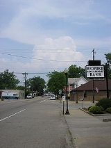
Bedford, Kentucky
Encyclopedia
Bedford is a city in Trimble County
, Kentucky
, United States
. The population was 677 at the 2000 census. It is the county seat
of Trimble County
.
It is located at the junction of U.S. Routes 42
and 421
. It is named for Bedford, Virginia
, former home of the first settler, Richard Ball, who built a house near what he called Bedford Spring in 1805. The town was founded in 1816 but not incorporated until 1850.
According to the United States Census Bureau
, the city has a total area of 0.4 square miles (1 km²), all of it land.
of 2000, there were 677 people, 282 households, and 183 families residing in the city. The population density
was 1,690.3 people per square mile (653.5/km²). There were 297 housing units at an average density of 741.5 per square mile (286.7/km²). The racial makeup of the city was 97.93% White, 0.15% African American, 1.77% from other races
, and 0.15% from two or more races. Hispanic or Latino of any race were 2.36% of the population.
There were 282 households out of which 35.8% had children under the age of 18 living with them, 40.4% were married couples
living together, 20.6% had a female householder with no husband present, and 35.1% were non-families. 28.7% of all households were made up of individuals and 13.8% had someone living alone who was 65 years of age or older. The average household size was 2.40 and the average family size was 2.96.
In the city the population was spread out with 28.5% under the age of 18, 10.2% from 18 to 24, 30.9% from 25 to 44, 17.3% from 45 to 64, and 13.1% who were 65 years of age or older. The median age was 32 years. For every 100 females there were 89.6 males. For every 100 females age 18 and over, there were 74.1 males.
The median income for a household in the city was $31,528, and the median income for a family was $36,250. Males had a median income of $30,341 versus $22,188 for females. The per capita income
for the city was $14,818. About 12.9% of families and 15.5% of the population were below the poverty line, including 19.3% of those under age 18 and 7.1% of those age 65 or over.
Trimble County, Kentucky
Trimble County is a county located in the U.S. state of Kentucky. As of 2000, the population was 8,125. Its county seat is Bedford. The county is named for Robert Trimble. Trimble is a prohibition or dry county. It is part of the Louisville/Jefferson County, KY–IN Metropolitan Statistical...
, Kentucky
Kentucky
The Commonwealth of Kentucky is a state located in the East Central United States of America. As classified by the United States Census Bureau, Kentucky is a Southern state, more specifically in the East South Central region. Kentucky is one of four U.S. states constituted as a commonwealth...
, United States
United States
The United States of America is a federal constitutional republic comprising fifty states and a federal district...
. The population was 677 at the 2000 census. It is the county seat
County seat
A county seat is an administrative center, or seat of government, for a county or civil parish. The term is primarily used in the United States....
of Trimble County
Trimble County, Kentucky
Trimble County is a county located in the U.S. state of Kentucky. As of 2000, the population was 8,125. Its county seat is Bedford. The county is named for Robert Trimble. Trimble is a prohibition or dry county. It is part of the Louisville/Jefferson County, KY–IN Metropolitan Statistical...
.
It is located at the junction of U.S. Routes 42
U.S. Route 42
U.S. Route 42 is an east–west United States highway that runs northeast-southwest for 355 miles from Cleveland, Ohio to Louisville, Kentucky. The route has several names including Pearl Road from Cleveland to Medina in Northeast Ohio, the Cincinnati and Lebanon Pike in southwestern Ohio and...
and 421
U.S. Route 421
U.S. Route 421 is a spur route of U.S. 21. It runs for from Michigan City, Indiana, at U.S. 20, to Fort Fisher in North Carolina. The highway goes through the cities of Indianapolis, Indiana, Lexington, Kentucky, Boone, North Carolina, Winston-Salem, North Carolina, Greensboro, North Carolina and...
. It is named for Bedford, Virginia
Bedford, Virginia
Bedford is an independent city located within the confines of Bedford County in the U.S. state of Virginia. It serves as the county seat of Bedford County. As of 2010, the city had a total population of 6,222. The Bureau of Economic Analysis combines the city of Bedford with surrounding Bedford...
, former home of the first settler, Richard Ball, who built a house near what he called Bedford Spring in 1805. The town was founded in 1816 but not incorporated until 1850.
Geography
Bedford is located at 38.592047°N 85.317160°W.According to the United States Census Bureau
United States Census Bureau
The United States Census Bureau is the government agency that is responsible for the United States Census. It also gathers other national demographic and economic data...
, the city has a total area of 0.4 square miles (1 km²), all of it land.
Demographics
As of the censusCensus
A census is the procedure of systematically acquiring and recording information about the members of a given population. It is a regularly occurring and official count of a particular population. The term is used mostly in connection with national population and housing censuses; other common...
of 2000, there were 677 people, 282 households, and 183 families residing in the city. The population density
Population density
Population density is a measurement of population per unit area or unit volume. It is frequently applied to living organisms, and particularly to humans...
was 1,690.3 people per square mile (653.5/km²). There were 297 housing units at an average density of 741.5 per square mile (286.7/km²). The racial makeup of the city was 97.93% White, 0.15% African American, 1.77% from other races
Race (United States Census)
Race and ethnicity in the United States Census, as defined by the Federal Office of Management and Budget and the United States Census Bureau, are self-identification data items in which residents choose the race or races with which they most closely identify, and indicate whether or not they are...
, and 0.15% from two or more races. Hispanic or Latino of any race were 2.36% of the population.
There were 282 households out of which 35.8% had children under the age of 18 living with them, 40.4% were married couples
Marriage
Marriage is a social union or legal contract between people that creates kinship. It is an institution in which interpersonal relationships, usually intimate and sexual, are acknowledged in a variety of ways, depending on the culture or subculture in which it is found...
living together, 20.6% had a female householder with no husband present, and 35.1% were non-families. 28.7% of all households were made up of individuals and 13.8% had someone living alone who was 65 years of age or older. The average household size was 2.40 and the average family size was 2.96.
In the city the population was spread out with 28.5% under the age of 18, 10.2% from 18 to 24, 30.9% from 25 to 44, 17.3% from 45 to 64, and 13.1% who were 65 years of age or older. The median age was 32 years. For every 100 females there were 89.6 males. For every 100 females age 18 and over, there were 74.1 males.
The median income for a household in the city was $31,528, and the median income for a family was $36,250. Males had a median income of $30,341 versus $22,188 for females. The per capita income
Per capita income
Per capita income or income per person is a measure of mean income within an economic aggregate, such as a country or city. It is calculated by taking a measure of all sources of income in the aggregate and dividing it by the total population...
for the city was $14,818. About 12.9% of families and 15.5% of the population were below the poverty line, including 19.3% of those under age 18 and 7.1% of those age 65 or over.