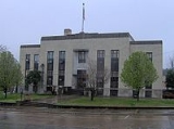
Benton, Tennessee
Encyclopedia
Benton is a town in Polk County, Tennessee
, United States
. The population was 1,138 at the 2000 census. It is the county seat
of Polk County.
Benton is included in the Cleveland, Tennessee
Metropolitan Statistical Area
.
, roughly 34 miles (54.7 km) upstream from the latter's mouth along the Chickamauga Lake
impoundment of the Tennessee River
. The Unicoi Mountains
rise prominently to the east of Benton.
Benton is centered around the junction of U.S. Route 411
, which connects the town to Etowah, Tennessee
to the north and Tennga, Georgia
to the south, and Tennessee State Route 314, which connects Benton to Parksville and the Ocoee dam area to the southeast. Benton is located approximately 20 miles (32.2 km) east of Interstate 75
.
According to the United States Census Bureau
, the town has a total area of 2.3 square miles (6 km²), all of it land.
of 2000, there were 1,138 people, 468 households, and 301 families residing in the town. The population density
was 502.1 people per square mile (193.6/km2). There were 513 housing units at an average density of 226.3 per square mile (87.3/km2). The racial makeup of the town was 98.86% White, 0.09% African American, 0.18% Native American, 0.09% Pacific Islander, 0.09% from other races
, and 0.70% from two or more races. Hispanic or Latino of any race were 0.53% of the population.
There were 468 households out of which 26.5% had children under the age of 18 living with them, 47.6% were married couples
living together, 12.8% had a female householder with no husband present, and 35.5% were non-families. 31.8% of all households were made up of individuals and 14.5% had someone living alone who was 65 years of age or older. The average household size was 2.34 and the average family size was 2.95.
In the town the population was spread out with 22.7% under the age of 18, 11.1% from 18 to 24, 29.4% from 25 to 44, 22.6% from 45 to 64, and 14.2% who were 65 years of age or older. The median age was 37 years. For every 100 females there were 91.6 males. For every 100 females age 18 and over, there were 92.6 males.
The median income for a household in the town was $22,667, and the median income for a family was $31,146. Males had a median income of $24,667 versus $23,295 for females. The per capita income
for the town was $12,580. About 15.1% of families and 20.4% of the population were below the poverty line, including 34.5% of those under age 18 and 20.9% of those age 65 or over.
 Benton was founded in 1840 as a county seat for Polk County, which had been established the previous year. The town, originally a trading post known as McKamy's stock stand, was named in honor of Thomas Hart Benton
.
Tennessee
Tennessee is a U.S. state located in the Southeastern United States. It has a population of 6,346,105, making it the nation's 17th-largest state by population, and covers , making it the 36th-largest by total land area...
, United States
United States
The United States of America is a federal constitutional republic comprising fifty states and a federal district...
. The population was 1,138 at the 2000 census. It is the county seat
County seat
A county seat is an administrative center, or seat of government, for a county or civil parish. The term is primarily used in the United States....
of Polk County.
Benton is included in the Cleveland, Tennessee
Cleveland, Tennessee
Cleveland is a city in Bradley County, Tennessee, United States. The population was 41,285 at the 2010 census. It is the county seat of Bradley County...
Metropolitan Statistical Area
Cleveland, Tennessee metropolitan area
The Cleveland, Tennessee Metropolitan Statistical Area, as defined by the United States Census Bureau, is an area consisting of two counties in southeast Tennessee – Bradley and Polk – anchored by the city of Cleveland...
.
Geography
Benton is located at 35°10′23"N 84°39′0"W (35.173185, -84.650000). The town is situated just southeast of the confluence of the Ocoee River and the Hiwassee RiverHiwassee River
The Hiwassee River has its headwaters on the north slope of Rocky Mountain in Towns County in northern Georgia and flows northward into North Carolina before turning westward into Tennessee, flowing into the Tennessee River a few miles west of State Route 58 in Meigs County, Tennessee...
, roughly 34 miles (54.7 km) upstream from the latter's mouth along the Chickamauga Lake
Chickamauga Lake
Chickamauga Lake is a United States reservoir along the Tennessee River created when the Chickamauga Dam, as part of the Tennessee Valley Authority, was completed in 1940. The lake stretches from Watts Bar Dam at mile 529.9 to Chickamauga Dam at mile 471.0 making the lake 58.9 miles long...
impoundment of the Tennessee River
Tennessee River
The Tennessee River is the largest tributary of the Ohio River. It is approximately 652 miles long and is located in the southeastern United States in the Tennessee Valley. The river was once popularly known as the Cherokee River, among other names...
. The Unicoi Mountains
Unicoi Range
The Unicoi Mountains are a mountain range rising along the border between Tennessee and North Carolina in the southeastern United States. They are part of the Blue Ridge Mountain Province of the Southern Appalachian Mountains. The Unicois are located immediately south of the Great Smoky Mountains...
rise prominently to the east of Benton.
Benton is centered around the junction of U.S. Route 411
U.S. Route 411
U.S. Highway 411 is an alternate parallel-highway associated with U.S. Highway 11. U.S. 411 extends for about 313 miles from U.S. Route 78 in Leeds, Jefferson County, Alabama, to U.S. Highway 25 in Newport, Cocke County, Tennessee. U.S. 411 passes through the northeastern State of Alabama, the...
, which connects the town to Etowah, Tennessee
Etowah, Tennessee
Etowah is a city in McMinn County, Tennessee, United States. The population was 3,663 at the 2000 census.-History:Etowah was founded in 1906, primarily as a location for a depot on the Louisville & Nashville Railroad line as part of a more direct route between Atlanta, Georgia and Cincinnati, Ohio...
to the north and Tennga, Georgia
Tennga, Georgia
Tennga is a small unincorporated community in Murray County, Georgia, United States, along U.S. Route 411 near the Tennessee border. The community's name is unique, being a portmanteau of the "Tenn." and "Ga." abbreviations used prior to USPS-standard state codes.Tennga is located at , at an...
to the south, and Tennessee State Route 314, which connects Benton to Parksville and the Ocoee dam area to the southeast. Benton is located approximately 20 miles (32.2 km) east of Interstate 75
Interstate 75
Interstate 75 is a major north–south Interstate Highway in the Great Lakes and Southeastern regions of the United States. It travels from State Road 826 and State Road 924 in Hialeah, Florida to Sault Ste. Marie, Michigan, at the Ontario, Canada, border...
.
According to the United States Census Bureau
United States Census Bureau
The United States Census Bureau is the government agency that is responsible for the United States Census. It also gathers other national demographic and economic data...
, the town has a total area of 2.3 square miles (6 km²), all of it land.
Demographics
As of the censusCensus
A census is the procedure of systematically acquiring and recording information about the members of a given population. It is a regularly occurring and official count of a particular population. The term is used mostly in connection with national population and housing censuses; other common...
of 2000, there were 1,138 people, 468 households, and 301 families residing in the town. The population density
Population density
Population density is a measurement of population per unit area or unit volume. It is frequently applied to living organisms, and particularly to humans...
was 502.1 people per square mile (193.6/km2). There were 513 housing units at an average density of 226.3 per square mile (87.3/km2). The racial makeup of the town was 98.86% White, 0.09% African American, 0.18% Native American, 0.09% Pacific Islander, 0.09% from other races
Race (United States Census)
Race and ethnicity in the United States Census, as defined by the Federal Office of Management and Budget and the United States Census Bureau, are self-identification data items in which residents choose the race or races with which they most closely identify, and indicate whether or not they are...
, and 0.70% from two or more races. Hispanic or Latino of any race were 0.53% of the population.
There were 468 households out of which 26.5% had children under the age of 18 living with them, 47.6% were married couples
Marriage
Marriage is a social union or legal contract between people that creates kinship. It is an institution in which interpersonal relationships, usually intimate and sexual, are acknowledged in a variety of ways, depending on the culture or subculture in which it is found...
living together, 12.8% had a female householder with no husband present, and 35.5% were non-families. 31.8% of all households were made up of individuals and 14.5% had someone living alone who was 65 years of age or older. The average household size was 2.34 and the average family size was 2.95.
In the town the population was spread out with 22.7% under the age of 18, 11.1% from 18 to 24, 29.4% from 25 to 44, 22.6% from 45 to 64, and 14.2% who were 65 years of age or older. The median age was 37 years. For every 100 females there were 91.6 males. For every 100 females age 18 and over, there were 92.6 males.
The median income for a household in the town was $22,667, and the median income for a family was $31,146. Males had a median income of $24,667 versus $23,295 for females. The per capita income
Per capita income
Per capita income or income per person is a measure of mean income within an economic aggregate, such as a country or city. It is calculated by taking a measure of all sources of income in the aggregate and dividing it by the total population...
for the town was $12,580. About 15.1% of families and 20.4% of the population were below the poverty line, including 34.5% of those under age 18 and 20.9% of those age 65 or over.
History

Thomas Hart Benton (senator)
Thomas Hart Benton , nicknamed "Old Bullion", was a U.S. Senator from Missouri and a staunch advocate of westward expansion of the United States. He served in the Senate from 1821 to 1851, becoming the first member of that body to serve five terms...
.

