Billinge Hill
Encyclopedia
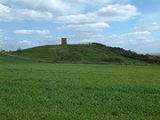
Billinge Hill, also known as Billinge Lump, is the highest point in the Metropolitan Borough of St Helens
in North West England
. It is also the highest point of Merseyside
It lies in Billinge, within the historic county boundaries
of Lancashire
.
A beacon
tower is at the summit. Built as a summerhouse to Winstanley Hall
in the eighteenth century, it was used for the Year 2000 celebrations. Most fireworks displays for miles around can be seen from the summit and people often gather there in small numbers to watch displays over the towns of Wigan and St Helens and the local village of Rainford. Over the years it has been covered in graffiti
which was recently cleaned off and the metal panels restricting access to the insides of the beacon have been painted black.
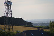
 Nearby to the north-west are several large transmitter
masts which take advantage of the height and relative isolation of the land. The views are fairly extensive, notably to the south-west where, when clear, the mountains of Snowdonia
, in Wales, can be seen and to the north-east Winter Hill
can be seen. Looking east one sees Manchester
and the Derbyshire
Peak District
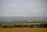
. On a clear day, it is possible to see Blackpool Tower
over thirty miles away, the town of St. Helens and the Widnes - Runcorn bridge. Depending on the conditions and direction it is facing, the telescope at Jodrell Bank can be seen to the south-east too.
 Billinge Hill was also used by the Royal Observer Corps
, and there was a bunker at the site, 60 yards (54.9 m) West of and below Beacon. The Beacon itself was used for aircraft observation during and after the war. The bunker would have been used to monitor the location of nuclear blast
s and the resulting fallout over Lancashire in the event of nuclear war
. The post opened in January 1960 and closed in October 1968.
Metropolitan Borough of St Helens
The Metropolitan Borough of St Helens is a metropolitan borough of Merseyside, in North West England. It is named after its largest town St Helens, and covers an area which includes the settlements of Newton-le-Willows, Earlestown, Haydock, Rainhill, Eccleston, Clock Face, Billinge and...
in North West England
North West England
North West England, informally known as The North West, is one of the nine official regions of England.North West England had a 2006 estimated population of 6,853,201 the third most populated region after London and the South East...
. It is also the highest point of Merseyside
Merseyside
Merseyside is a metropolitan county in North West England, with a population of 1,365,900. It encompasses the metropolitan area centred on both banks of the lower reaches of the Mersey Estuary, and comprises five metropolitan boroughs: Knowsley, St Helens, Sefton, Wirral, and the city of Liverpool...
It lies in Billinge, within the historic county boundaries
Historic counties of England
The historic counties of England are subdivisions of England established for administration by the Normans and in most cases based on earlier Anglo-Saxon kingdoms and shires...
of Lancashire
Lancashire
Lancashire is a non-metropolitan county of historic origin in the North West of England. It takes its name from the city of Lancaster, and is sometimes known as the County of Lancaster. Although Lancaster is still considered to be the county town, Lancashire County Council is based in Preston...
.
A beacon
Beacon
A beacon is an intentionally conspicuous device designed to attract attention to a specific location.Beacons can also be combined with semaphoric or other indicators to provide important information, such as the status of an airport, by the colour and rotational pattern of its airport beacon, or of...
tower is at the summit. Built as a summerhouse to Winstanley Hall
Winstanley Hall
Winstanley Hall is a late 16th century house in Winstanley, in the Metropolitan Borough of Wigan . It is listed as a Scheduled Ancient Monument and a Grade II* listed building...
in the eighteenth century, it was used for the Year 2000 celebrations. Most fireworks displays for miles around can be seen from the summit and people often gather there in small numbers to watch displays over the towns of Wigan and St Helens and the local village of Rainford. Over the years it has been covered in graffiti
Graffiti
Graffiti is the name for images or lettering scratched, scrawled, painted or marked in any manner on property....
which was recently cleaned off and the metal panels restricting access to the insides of the beacon have been painted black.

Transmitter
In electronics and telecommunications a transmitter or radio transmitter is an electronic device which, with the aid of an antenna, produces radio waves. The transmitter itself generates a radio frequency alternating current, which is applied to the antenna. When excited by this alternating...
masts which take advantage of the height and relative isolation of the land. The views are fairly extensive, notably to the south-west where, when clear, the mountains of Snowdonia
Snowdonia
Snowdonia is a region in north Wales and a national park of in area. It was the first to be designated of the three National Parks in Wales, in 1951.-Name and extent:...
, in Wales, can be seen and to the north-east Winter Hill
Winter Hill (Lancashire)
Winter Hill is a hill on the border of the boroughs of Chorley, Blackburn with Darwen and Bolton, in North West England. It is located on Rivington Moor, Chorley and is high...
can be seen. Looking east one sees Manchester
Manchester
Manchester is a city and metropolitan borough in Greater Manchester, England. According to the Office for National Statistics, the 2010 mid-year population estimate for Manchester was 498,800. Manchester lies within one of the UK's largest metropolitan areas, the metropolitan county of Greater...
and the Derbyshire
Derbyshire
Derbyshire is a county in the East Midlands of England. A substantial portion of the Peak District National Park lies within Derbyshire. The northern part of Derbyshire overlaps with the Pennines, a famous chain of hills and mountains. The county contains within its boundary of approx...
Peak District
Peak District
The Peak District is an upland area in central and northern England, lying mainly in northern Derbyshire, but also covering parts of Cheshire, Greater Manchester, Staffordshire, and South and West Yorkshire....
. On a clear day, it is possible to see Blackpool Tower
Blackpool Tower
Blackpool Tower Eye is a tourist attraction in Blackpool, Lancashire in England which was opened to the public on 14 May 1894. . Inspired by the Eiffel Tower in Paris, it rises to 518 feet & 9 inches . The tower is a member of the World Federation of Great Towers...
over thirty miles away, the town of St. Helens and the Widnes - Runcorn bridge. Depending on the conditions and direction it is facing, the telescope at Jodrell Bank can be seen to the south-east too.

Royal Observer Corps
The Royal Observer Corps was a civil defence organisation operating in the United Kingdom between 29 October 1925 and 31 December 1995, when the Corps' civilian volunteers were stood down....
, and there was a bunker at the site, 60 yards (54.9 m) West of and below Beacon. The Beacon itself was used for aircraft observation during and after the war. The bunker would have been used to monitor the location of nuclear blast
Nuclear blast
Nuclear blast may refer to:* Nuclear explosion* Nuclear Blast, a record label...
s and the resulting fallout over Lancashire in the event of nuclear war
Nuclear warfare
Nuclear warfare, or atomic warfare, is a military conflict or political strategy in which nuclear weaponry is detonated on an opponent. Compared to conventional warfare, nuclear warfare can be vastly more destructive in range and extent of damage...
. The post opened in January 1960 and closed in October 1968.
External links
- Visit St Helens - Billinge Hill - Tourist information regarding Billinge Hill

