Blisworth Tunnel
Encyclopedia
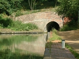
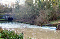
Blisworth Tunnel is a canal tunnel on the Grand Union Canal
in Northamptonshire
, England
between the villages of Stoke Bruerne
at the southern end and Blisworth
at the northern end.
at Braunston, Northamptonshire and the southern end about 20 miles (32.2 km).
At 3,076 yards (2,813m) long it is the third-longest navigable canal tunnel on the UK canal network
after Standedge Tunnel
and Dudley Tunnel
(and the ninth-longest canal tunnel in the world). At its deepest point it is ca.143 feet (ca.43m) below ground level.
, claiming the lives of 14 men. It was then decided to begin again with a new tunnel.
By the time the rest of the Grand Junction Canal had opened between London
and Braunston, Northamptonshire in 1800, apart from the crossing of the River Great Ouse
, the section of canal from Blisworth to the lower end of Stoke Bruerne
locks was the only section unfinished. This was despite the tunnel having been under construction for seven years: the gap was filled by a temporary horse-drawn tramway over the top of the hill, with goods being transported from boat to wagon and back again. The tramway, built in 1801, was Northamptonshire
's first railway
. In March 1805, the tunnel was finally opened and the rails were used to connect the main line of the canal to the River Nene
until the branch canal to Northampton
was constructed.
There was some major rebuilding of the tunnel in the 1980s, with sections lined with pre-cast concrete rings. It was also used to test out the materials that were later used on the Channel Tunnel
. One of the unused rings is on display just outside the south portal.

Grand Union Canal
The Grand Union Canal in England is part of the British canal system. Its main line connects London and Birmingham, stretching for 137 miles with 166 locks...
in Northamptonshire
Northamptonshire
Northamptonshire is a landlocked county in the English East Midlands, with a population of 629,676 as at the 2001 census. It has boundaries with the ceremonial counties of Warwickshire to the west, Leicestershire and Rutland to the north, Cambridgeshire to the east, Bedfordshire to the south-east,...
, England
England
England is a country that is part of the United Kingdom. It shares land borders with Scotland to the north and Wales to the west; the Irish Sea is to the north west, the Celtic Sea to the south west, with the North Sea to the east and the English Channel to the south separating it from continental...
between the villages of Stoke Bruerne
Stoke Bruerne
Stoke Bruerne is a small village and civil parish in South Northamptonshire, England about north of Milton Keynes and south of Northampton.-History:...
at the southern end and Blisworth
Blisworth
Blisworth is a village and civil parish in the South Northamptonshire district of Northamptonshire, England. The West Coast Main Line, from London Euston to Manchester and Scotland, runs alongside the village partly hidden and partly on an embankment...
at the northern end.
Measurements
The northern end is about 18 miles (29 km) from the northern end of the Grand Junction CanalGrand Junction Canal
The Grand Junction Canal is a canal in England from Braunston in Northamptonshire to the River Thames at Brentford, with a number of branches. The mainline was built between 1793 and 1805, to improve the route from the Midlands to London, by-passing the upper reaches of the River Thames near Oxford...
at Braunston, Northamptonshire and the southern end about 20 miles (32.2 km).
At 3,076 yards (2,813m) long it is the third-longest navigable canal tunnel on the UK canal network
Canals of the United Kingdom
The canals of the United Kingdom are a major part of the network of inland waterways in the United Kingdom. They have a colourful history, from use for irrigation and transport, through becoming the focus of the Industrial Revolution, to today's role for recreational boating...
after Standedge Tunnel
Standedge Tunnels
The Standedge Tunnels are four parallel tunnels that run beneath the Pennines at the traditional Standedge crossing point between Marsden and Diggle, on the edges of the conurbations of West Yorkshire and Greater Manchester respectively, in northern England.There are three railway tunnels and a...
and Dudley Tunnel
Dudley Tunnel
Dudley Tunnel is a canal tunnel on the Dudley Canal Line No 1, England. At about long, it is now the second longest canal tunnel on the UK canal network today....
(and the ninth-longest canal tunnel in the world). At its deepest point it is ca.143 feet (ca.43m) below ground level.
Construction
Work began in 1793, but errors by contractor left a wiggle in the tunnel, and after three years work it collapsed due to quicksandQuicksand
Quicksand is a colloid hydrogel consisting of fine granular matter , clay, and water.Water circulation underground can focus in an area with the optimal mixture of fine sands and other materials such as clay. The water moves up and then down slowly in a convection-like manner throughout a column...
, claiming the lives of 14 men. It was then decided to begin again with a new tunnel.
By the time the rest of the Grand Junction Canal had opened between London
London
London is the capital city of :England and the :United Kingdom, the largest metropolitan area in the United Kingdom, and the largest urban zone in the European Union by most measures. Located on the River Thames, London has been a major settlement for two millennia, its history going back to its...
and Braunston, Northamptonshire in 1800, apart from the crossing of the River Great Ouse
River Great Ouse
The Great Ouse is a river in the east of England. At long, it is the fourth-longest river in the United Kingdom. The river has been important for navigation, and for draining the low-lying region through which it flows. Its course has been modified several times, with the first recorded being in...
, the section of canal from Blisworth to the lower end of Stoke Bruerne
Stoke Bruerne
Stoke Bruerne is a small village and civil parish in South Northamptonshire, England about north of Milton Keynes and south of Northampton.-History:...
locks was the only section unfinished. This was despite the tunnel having been under construction for seven years: the gap was filled by a temporary horse-drawn tramway over the top of the hill, with goods being transported from boat to wagon and back again. The tramway, built in 1801, was Northamptonshire
Northamptonshire
Northamptonshire is a landlocked county in the English East Midlands, with a population of 629,676 as at the 2001 census. It has boundaries with the ceremonial counties of Warwickshire to the west, Leicestershire and Rutland to the north, Cambridgeshire to the east, Bedfordshire to the south-east,...
's first railway
Rail transport
Rail transport is a means of conveyance of passengers and goods by way of wheeled vehicles running on rail tracks. In contrast to road transport, where vehicles merely run on a prepared surface, rail vehicles are also directionally guided by the tracks they run on...
. In March 1805, the tunnel was finally opened and the rails were used to connect the main line of the canal to the River Nene
River Nene
The River Nene is a river in the east of England that rises from three sources in the county of Northamptonshire. The tidal river forms the border between Cambridgeshire and Norfolk for about . It is the tenth longest river in the United Kingdom, and is navigable for from Northampton to The...
until the branch canal to Northampton
Northampton
Northampton is a large market town and local government district in the East Midlands region of England. Situated about north-west of London and around south-east of Birmingham, Northampton lies on the River Nene and is the county town of Northamptonshire. The demonym of Northampton is...
was constructed.
There was some major rebuilding of the tunnel in the 1980s, with sections lined with pre-cast concrete rings. It was also used to test out the materials that were later used on the Channel Tunnel
Channel Tunnel
The Channel Tunnel is a undersea rail tunnel linking Folkestone, Kent in the United Kingdom with Coquelles, Pas-de-Calais near Calais in northern France beneath the English Channel at the Strait of Dover. At its lowest point, it is deep...
. One of the unused rings is on display just outside the south portal.
Features

| Point | Coordinates (With links to map and aerial photo sources) |
|---|---|
| Northern portal | 52.1696°N 0.9354°W |
| Mid point | 52.1560°N 0.9285°W |
| Southern portal | 52.1458°N 0.9217°W |
External links
- Blisworth Images - A compilation of archival and modern photographs recorded since c. 1880 and a collection of articles on both the heritage and the history of the village.
- Blisworth Tunnel Narrowboats - Day Boat Hire, Narrow Boat servicing and base for Ownerships Afloat.
- William Piper Narrowboats - Experienced Canal Boat Builders based near Blisworth.

