Bourg-Saint-Maurice
Encyclopedia
Bourg-Saint-Maurice, popularly known as Bourg, is a commune
in the Savoie
department in the Rhône-Alpes
region
in south-eastern France
.
It is the last large town along the Tarentaise valley in the heart of the French Alps
.
side of the pass of the Alpes Graiae, lying on the road marked in the Antonine Itinerary
between Mediolanum (modern Milan
) and Vienna (modern Vienne
). D'Anville (Notice, etc.) places it, according to the Table, between Axima (modern Aime
) and Alpis Graia. The distance from Bergintrum to Axima is marked viiii M. P. The Alpis Graia is usually identified with a settlement at the watershed on the pass of the Little Saint Bernard, which divides the waters that flow to the Isère
on the French side from those that flow to the Dora Baltea
on the Italian side. This is the place D'Anville calls l'Hôpital, on the authority of a manuscript map of the country. D'Anville first proposed the identification of Bergintrum with Bourg-Saint-Maurice; although he acknowledged that xii, the distance in the Table between Bergintrum and Alpis Graia, does not fit the distance between Bourg-Saint-Maurice and l'Hôpital, which is less. Modern scholarship confirms the identification.

 Bourg-Saint-Maurice is part of the Paradiski
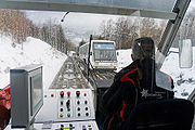
ski area (425 km of slopes, 141 lifts, 239 slopes - 12 Green, 132 Blue, 66 Red, 29 Black). Although there is no skiing at this altitude, it is conveniently linked to Arc 1600 by the Arc en Ciel funicular railway and is therefore home to many budget rental properties. Unlike the other villages that make up Les Arcs
, Bourg-Saint-Maurice is open all year.
Bourg is also a popular summer destination, as it offers lots of opportunity for lovers of the outdoors and watersports. There is a whitewater slalom course on the Isere river used for international canoe and kayak competitions. The course on the Isere has been host to the ICF world championships and is used by many European teams as a training course in the summer. The course is often changed by the floods that occur during the winter months.
The surrounding mountains are good for walking and mountain biking. They also are a good place for paragliding and hang gliding. Some of Les Arcs ski lifts operate during July and August to get walkers to the higher peaks and you can take mountain bikes up on these. Mountain bikes ( VTT (Vélo Tout Terrain) in French) can be hired in both Bourg and Les Arcs
. Some of the high altitude restaurants open in these months, the ones at Pre st Esprit and L'Arpete have small outdoor pools.
The nearest summer glacier skiing is in Tignes
(approximately 27 km from Bourg) on the Grande Motte, however due to glacial recession it is now closed at certain times of the year.
Communes of France
The commune is the lowest level of administrative division in the French Republic. French communes are roughly equivalent to incorporated municipalities or villages in the United States or Gemeinden in Germany...
in the Savoie
Savoie
Savoie is a French department located in the Rhône-Alpes region in the French Alps.Together with the Haute-Savoie, Savoie is one of the two departments of the historic region of Savoy that was annexed by France on June 14, 1860, following the signature of the Treaty of Turin on March 24, 1860...
department in the Rhône-Alpes
Rhône-Alpes
Rhône-Alpes is one of the 27 regions of France, located on the eastern border of the country, towards the south. The region was named after the Rhône River and the Alps mountain range. Its capital, Lyon, is the second-largest metropolitan area in France after Paris...
region
Régions of France
France is divided into 27 administrative regions , 22 of which are in Metropolitan France, and five of which are overseas. Corsica is a territorial collectivity , but is considered a region in mainstream usage, and is even shown as such on the INSEE website...
in south-eastern France
France
The French Republic , The French Republic , The French Republic , (commonly known as France , is a unitary semi-presidential republic in Western Europe with several overseas territories and islands located on other continents and in the Indian, Pacific, and Atlantic oceans. Metropolitan France...
.
It is the last large town along the Tarentaise valley in the heart of the French Alps
Alps
The Alps is one of the great mountain range systems of Europe, stretching from Austria and Slovenia in the east through Italy, Switzerland, Liechtenstein and Germany to France in the west....
.
History
Bergintrum was a place on the GallicGaul
Gaul was a region of Western Europe during the Iron Age and Roman era, encompassing present day France, Luxembourg and Belgium, most of Switzerland, the western part of Northern Italy, as well as the parts of the Netherlands and Germany on the left bank of the Rhine. The Gauls were the speakers of...
side of the pass of the Alpes Graiae, lying on the road marked in the Antonine Itinerary
Antonine Itinerary
The Antonine Itinerary is a register of the stations and distances along the various roads of the Roman empire, containing directions how to get from one Roman settlement to another...
between Mediolanum (modern Milan
Milan
Milan is the second-largest city in Italy and the capital city of the region of Lombardy and of the province of Milan. The city proper has a population of about 1.3 million, while its urban area, roughly coinciding with its administrative province and the bordering Province of Monza and Brianza ,...
) and Vienna (modern Vienne
Vienne, Isère
Vienne is a commune in south-eastern France, located south of Lyon, on the Rhône River. It is the second largest city after Grenoble in the Isère department, of which it is a subprefecture. The city's population was of 29,400 as of the 2001 census....
). D'Anville (Notice, etc.) places it, according to the Table, between Axima (modern Aime
Aime
Aime is a commune in the Savoie department in the Rhône-Alpes region in south-eastern France.-Geography:The commune lies in the Tarentaise Valley, partly overlapping the ski resorts of La Plagne and Les Arcs.-Transportation:...
) and Alpis Graia. The distance from Bergintrum to Axima is marked viiii M. P. The Alpis Graia is usually identified with a settlement at the watershed on the pass of the Little Saint Bernard, which divides the waters that flow to the Isère
Isère
Isère is a department in the Rhône-Alpes region in the east of France named after the river Isère.- History :Isère is one of the original 83 departments created during the French Revolution on March 4, 1790. It was created from part of the former province of Dauphiné...
on the French side from those that flow to the Dora Baltea
Dora Baltea
Dora Baltea or Doire Baltée , is a river in northern Italy. It is a left-hand tributary of the Po River, and is about 160 km long...
on the Italian side. This is the place D'Anville calls l'Hôpital, on the authority of a manuscript map of the country. D'Anville first proposed the identification of Bergintrum with Bourg-Saint-Maurice; although he acknowledged that xii, the distance in the Table between Bergintrum and Alpis Graia, does not fit the distance between Bourg-Saint-Maurice and l'Hôpital, which is less. Modern scholarship confirms the identification.
Outdoor activities


Paradiski
Paradiski is a ski-area in the Tarentaise Valley offering uninterrupted skiing in between the areas of Les Arcs, Peisey-Vallandry and La Plagne. The area is linked, since December 2003, by the Vanoise Express...
ski area (425 km of slopes, 141 lifts, 239 slopes - 12 Green, 132 Blue, 66 Red, 29 Black). Although there is no skiing at this altitude, it is conveniently linked to Arc 1600 by the Arc en Ciel funicular railway and is therefore home to many budget rental properties. Unlike the other villages that make up Les Arcs
Les Arcs
Les Arcs is a ski resort located in Savoie, France, in the Tarentaise Valley town of Bourg-Saint-Maurice. Initially created by Robert Blanc and Roger Godino...
, Bourg-Saint-Maurice is open all year.
Bourg is also a popular summer destination, as it offers lots of opportunity for lovers of the outdoors and watersports. There is a whitewater slalom course on the Isere river used for international canoe and kayak competitions. The course on the Isere has been host to the ICF world championships and is used by many European teams as a training course in the summer. The course is often changed by the floods that occur during the winter months.
The surrounding mountains are good for walking and mountain biking. They also are a good place for paragliding and hang gliding. Some of Les Arcs ski lifts operate during July and August to get walkers to the higher peaks and you can take mountain bikes up on these. Mountain bikes ( VTT (Vélo Tout Terrain) in French) can be hired in both Bourg and Les Arcs
Les Arcs
Les Arcs is a ski resort located in Savoie, France, in the Tarentaise Valley town of Bourg-Saint-Maurice. Initially created by Robert Blanc and Roger Godino...
. Some of the high altitude restaurants open in these months, the ones at Pre st Esprit and L'Arpete have small outdoor pools.
The nearest summer glacier skiing is in Tignes
Tignes
Tignes is a commune in the Tarentaise Valley, Savoie department in the Rhône-Alpes region in south-eastern France.It is also a ski resort near Val d'Isère, that are linked together as the "Espace Killy" region...
(approximately 27 km from Bourg) on the Grande Motte, however due to glacial recession it is now closed at certain times of the year.
People
- The French ski mountaineer Bertrand BlancBertrand BlancBertrand Blanc is a French ski mountaineer.Blanc is born in Bourg-Saint-Maurice. He started ski mountaineering in 1992 and competed first at the Pierra Menta race in 1994...
was born in Bourg-Saint-Maurice on October 29, 1973.

