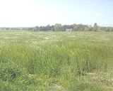
Broomhedge
Encyclopedia
Broomhedge is a small village
in County Antrim
, Northern Ireland
, near Lisburn
, approximately 12 miles (19 km) southwest of Belfast
. It lies within the Lisburn City Council
area, and the Maghaberry
electoral ward.
, the output area
which contained Broomhedge (see http://www.nicensus2001.gov.uk/nica/analyser/scrolmap.jsp?BBOX=319367.6264158576%2C361168.6960962783%2C320967.368527508%2C363163.0412621359&WIDTH=383&HEIGHT=309&LAYERS=&useBaseLayers=true&REQUEST=GetMap&FORMAT=JPG&MAPSERVICE=NICALive&QUERY_LAYERS=&AVAILABLE_LAYERS=%2CLocal+Government+District%2CHealth+and+Social+Services+Board%2CParliamentary+Constituency%2CElectoral+Ward%2COutput+Area%2CNorthern+Ireland%2CEducation+and+Library+Board%2CNUTS3&X=&Y=&SELECTBBOX=&northArrowLocation=&northArrowSize=25&northArrowType=1&northArrowColour=0x000000%2C0x555555&JSMAPTOOL=dZoomIn&WINDOW.WIDTH=800&WINDOW.HEIGHT=600&BGCOLOR=0xFFFFFF&queryPointAccuracy=5&toolbarText=false&mapLegend=true&GROUP_TITLE=false&RADIOLAYER=&REFLAYER=&ZOOMLEVEL=6&SHOW_INSET=false&ALL_BBOX=&QUERYCOLUMN=&QUERYTEST=&QUERYVALUE=&placename=&postcode=&topicId=&tableId=&tableName=&levelId=1&areaId=95SS&clearAreas=false#use-maphere]) had a population of 403. Of these:
For more information, see the NI Statistical Research Agency (NISRA) page for this output area.
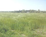
of Broomhedge do not exactly correspond with those of the Church of Ireland
parish
of the same name. Indeed, Broomhedge per se straddles the boundary between the postal districts
of Lisburn
and Moira
(Craigavon
), and encompasses several townland
s. The exact boundaries depend on whether Upper Broomhedge and Lurganure are considered separately, and the issue is further complicated by the close proximity of Mazetown and the River Lagan
which separates counties Antrim
and Down
. Broomhedge is situated within the Upper Massereene
barony.
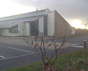
area, Moira
or further afield.
Grammar

at Sprucefield
and reaching the Lurganure Road (later becoming the Halfpenny Gate
Road) via Blaris. The nearest train stops are at Moira
and Lisburn
; Broomhedge Halt railway station opened on 29 April 1935, but eventually closed on 3 July 1973.
, Connor diocese
), and Broomhedge Methodist
. There is also a Plymouth Brethren
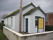
gospel hall
.
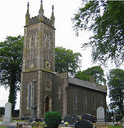
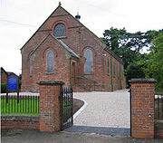
, the church of St Matthew was erected as a chapel of ease
to cover the Broomhedge area. The foundation stone was laid in 1839, the church was in use by 1841 and was officially consecrated
in September 1848. It was served by curates
from Lisburn Cathedral until 1867 when Maurice Knox McKay was appointed as a perpetual curate. The parish
itself was set up in 1880 with the Rev. John Leslie as the first rector
, who served until his death in 1927. The current incumbent
, Rev Peter Galbraith, has ministered in Broomhedge since 1991. In 2001 a new church hall was built, replacing the Bradbury Memorial Hall (built in 1951).
List of rectors
:
, the Rev Ed McDade, previously minister of Cullybackey
Methodist Church, was installed at Broomhedge, Magheragall and Trinity on Sunday 13 July 2008. He succeeded the Rev Clive Webster, who preached his final sermon on Sunday 29 June 2008. The building is shared with Magheragall Methodist for evening services every second Sunday of the month.
Village
A village is a clustered human settlement or community, larger than a hamlet with the population ranging from a few hundred to a few thousand , Though often located in rural areas, the term urban village is also applied to certain urban neighbourhoods, such as the West Village in Manhattan, New...
in County Antrim
County Antrim
County Antrim is one of six counties that form Northern Ireland, situated in the north-east of the island of Ireland. Adjoined to the north-east shore of Lough Neagh, the county covers an area of 2,844 km², with a population of approximately 616,000...
, Northern Ireland
Northern Ireland
Northern Ireland is one of the four countries of the United Kingdom. Situated in the north-east of the island of Ireland, it shares a border with the Republic of Ireland to the south and west...
, near Lisburn
Lisburn
DemographicsLisburn Urban Area is within Belfast Metropolitan Urban Area and is classified as a Large Town by the . On census day there were 71,465 people living in Lisburn...
, approximately 12 miles (19 km) southwest of Belfast
Belfast
Belfast is the capital of and largest city in Northern Ireland. By population, it is the 14th biggest city in the United Kingdom and second biggest on the island of Ireland . It is the seat of the devolved government and legislative Northern Ireland Assembly...
. It lies within the Lisburn City Council
Lisburn City Council
Lisburn City Council is a district council covering an area partly in County Antrim and partly in County Down in Northern Ireland. The council is the second largest in the Belfast Metropolitan Area. Council headquarters are in the city of Lisburn, upon which was conferred city status in May 2002 as...
area, and the Maghaberry
Maghaberry
Maghaberry or Magaberry is a village and townland in County Antrim, Northern Ireland. It is 9 kilometres west of Lisburn and 4 kilometres north of Moira. In the 2001 Census it had a population of 1,696 people...
electoral ward.
Demographics
In the 2001 CensusUnited Kingdom Census 2001
A nationwide census, known as Census 2001, was conducted in the United Kingdom on Sunday, 29 April 2001. This was the 20th UK Census and recorded a resident population of 58,789,194....
, the output area
ONS coding system
In the United Kingdom, the Office for National Statistics maintains a series of codes to represent a wide range of geographical areas of the UK, for use in tabulating census and other statistical data...
which contained Broomhedge (see http://www.nicensus2001.gov.uk/nica/analyser/scrolmap.jsp?BBOX=319367.6264158576%2C361168.6960962783%2C320967.368527508%2C363163.0412621359&WIDTH=383&HEIGHT=309&LAYERS=&useBaseLayers=true&REQUEST=GetMap&FORMAT=JPG&MAPSERVICE=NICALive&QUERY_LAYERS=&AVAILABLE_LAYERS=%2CLocal+Government+District%2CHealth+and+Social+Services+Board%2CParliamentary+Constituency%2CElectoral+Ward%2COutput+Area%2CNorthern+Ireland%2CEducation+and+Library+Board%2CNUTS3&X=&Y=&SELECTBBOX=&northArrowLocation=&northArrowSize=25&northArrowType=1&northArrowColour=0x000000%2C0x555555&JSMAPTOOL=dZoomIn&WINDOW.WIDTH=800&WINDOW.HEIGHT=600&BGCOLOR=0xFFFFFF&queryPointAccuracy=5&toolbarText=false&mapLegend=true&GROUP_TITLE=false&RADIOLAYER=&REFLAYER=&ZOOMLEVEL=6&SHOW_INSET=false&ALL_BBOX=&QUERYCOLUMN=&QUERYTEST=&QUERYVALUE=&placename=&postcode=&topicId=&tableId=&tableName=&levelId=1&areaId=95SS&clearAreas=false#use-maphere]) had a population of 403. Of these:
- 52.9% were male, 47.1% were female
- 25.6% were under 18 and 20.6% were aged 60 and over
- All were ethnically 'whiteWhite peopleWhite people is a term which usually refers to human beings characterized, at least in part, by the light pigmentation of their skin...
' - 97% were born in Northern IrelandNorthern IrelandNorthern Ireland is one of the four countries of the United Kingdom. Situated in the north-east of the island of Ireland, it shares a border with the Republic of Ireland to the south and west...
- 4.5% were from a CatholicCatholicThe word catholic comes from the Greek phrase , meaning "on the whole," "according to the whole" or "in general", and is a combination of the Greek words meaning "about" and meaning "whole"...
background and 92.6% from a ProtestantProtestantismProtestantism is one of the three major groupings within Christianity. It is a movement that began in Germany in the early 16th century as a reaction against medieval Roman Catholic doctrines and practices, especially in regards to salvation, justification, and ecclesiology.The doctrines of the...
background - 92% of households were detached
- 10.9% of persons aged 16–74 were employed in agricultureAgricultureAgriculture is the cultivation of animals, plants, fungi and other life forms for food, fiber, and other products used to sustain life. Agriculture was the key implement in the rise of sedentary human civilization, whereby farming of domesticated species created food surpluses that nurtured the...
For more information, see the NI Statistical Research Agency (NISRA) page for this output area.

Geography
The boundaries of the hamletHamlet (place)
A hamlet is usually a rural settlement which is too small to be considered a village, though sometimes the word is used for a different sort of community. Historically, when a hamlet became large enough to justify building a church, it was then classified as a village...
of Broomhedge do not exactly correspond with those of the Church of Ireland
Church of Ireland
The Church of Ireland is an autonomous province of the Anglican Communion. The church operates in all parts of Ireland and is the second largest religious body on the island after the Roman Catholic Church...
parish
Parish
A parish is a territorial unit historically under the pastoral care and clerical jurisdiction of one parish priest, who might be assisted in his pastoral duties by a curate or curates - also priests but not the parish priest - from a more or less central parish church with its associated organization...
of the same name. Indeed, Broomhedge per se straddles the boundary between the postal districts
Postal code
A postal code is a series of letters and/or digits appended to a postal address for the purpose of sorting mail. Once postal codes were introduced, other applications became possible.In February 2005, 117 of the 190 member countries of the Universal Postal Union had postal code systems...
of Lisburn
Lisburn
DemographicsLisburn Urban Area is within Belfast Metropolitan Urban Area and is classified as a Large Town by the . On census day there were 71,465 people living in Lisburn...
and Moira
Moira, County Down
Moira is a village in County Down, Northern Ireland. It is in the northwest of the county, near the borders with counties Antrim and Armagh. The M1 motorway and Dublin–Belfast railway line are nearby. The settlement has existed since time immemorial...
(Craigavon
Craigavon
Craigavon is a settlement in north County Armagh, Northern Ireland. It was a planned settlement that was begun in 1965 and named after Northern Ireland's first Prime Minister — James Craig, 1st Viscount Craigavon. It was intended to be a linear city incorporating Lurgan and Portadown, but this plan...
), and encompasses several townland
Townland
A townland or bally is a small geographical division of land used in Ireland. The townland system is of Gaelic origin—most townlands are believed to pre-date the Norman invasion and most have names derived from the Irish language...
s. The exact boundaries depend on whether Upper Broomhedge and Lurganure are considered separately, and the issue is further complicated by the close proximity of Mazetown and the River Lagan
River Lagan
The River Lagan is a major river in Northern Ireland which runs 40 miles from the Slieve Croob mountain in County Down to Belfast where it enters Belfast Lough, an inlet of the Irish Sea. The River Lagan forms much of the border between County Antrim and County Down. It rises as a tiny fast...
which separates counties Antrim
County Antrim
County Antrim is one of six counties that form Northern Ireland, situated in the north-east of the island of Ireland. Adjoined to the north-east shore of Lough Neagh, the county covers an area of 2,844 km², with a population of approximately 616,000...
and Down
County Down
-Cities:*Belfast *Newry -Large towns:*Dundonald*Newtownards*Bangor-Medium towns:...
. Broomhedge is situated within the Upper Massereene
Viscount Massereene
Viscount Massereene is a title in the Peerage of Ireland. It was created in 1660, along with the subsidiary title of Baron Loughneugh. From 1665 to 1816 the Skeffington Baronetcy of Fisherwick was attached to the viscountcy and from 1756 to 1816 the Viscounts also held the title of Earl of Massereene...
barony.
Townland names
| English name | Original Irish Irish language Irish , also known as Irish Gaelic, is a Goidelic language of the Indo-European language family, originating in Ireland and historically spoken by the Irish people. Irish is now spoken as a first language by a minority of Irish people, as well as being a second language of a larger proportion of... spelling | Meaning | Parish Parish A parish is a territorial unit historically under the pastoral care and clerical jurisdiction of one parish priest, who might be assisted in his pastoral duties by a curate or curates - also priests but not the parish priest - from a more or less central parish church with its associated organization... |
|---|---|---|---|
| Broughmore | Bruach Mór | big edge/margin | Blaris |
| Lurganure | Lurga an Iubhair | long hill of the yew | Blaris |
| Gortnacor | Gort na Cora | field of the weir | Blaris/Magheramesk |
| Creenagh | Críonach | withered wood | Magheramesk |
| Carnlougherin | Carn Laochthréin | Loughrin's cairn Cairn Cairn is a term used mainly in the English-speaking world for a man-made pile of stones. It comes from the or . Cairns are found all over the world in uplands, on moorland, on mountaintops, near waterways and on sea cliffs, and also in barren desert and tundra areas... |
Magheramesk |
| Trummery | Tromráith or Druimrátha | fort of the elder trees/ridge | Magheramesk |
| Inisloughlin | Inis Lochlainn | Loughlin's island | Magheramesk |

Education
The only school situated within Broomhedge itself is the new Brookfield Special School, the construction of which was recently completed on the site of the former Broomhedge P.S.. Therefore most children travel to school elsewhere in the LisburnLisburn
DemographicsLisburn Urban Area is within Belfast Metropolitan Urban Area and is classified as a Large Town by the . On census day there were 71,465 people living in Lisburn...
area, Moira
Moira, County Down
Moira is a village in County Down, Northern Ireland. It is in the northwest of the county, near the borders with counties Antrim and Armagh. The M1 motorway and Dublin–Belfast railway line are nearby. The settlement has existed since time immemorial...
or further afield.
Primary Education
- Meadow Bridge Primary School (formerly St James' PS, Maze PS and St John's PS). The Maze Primary School was situated on the Kesh Road. It recently amalgamated to become part of Meadow Bridge PS.
- Moira Primary School
- Maghaberry Primary School
- St Aloysius' Primary School
Post-Primary Education
Secondary- Lurgan Junior High SchoolLurgan Junior High SchoolLurgan Junior High School is a school situated in the town of Lurgan, County Armagh, Northern Ireland. It caters to around 700 pupils aged 11 to 14....
, which follows the 'Dickson PlanDickson PlanThe Dickson Plan is a school transfer system implemented in North County Armagh in Northern Ireland. It is a two tier system in which the majority of pupils in the Craigavon Borough Council Area and parts of Armagh City and District Council Area attend Junior High Schools for 3 years before...
' system implemented in the CraigavonCraigavonCraigavon is a settlement in north County Armagh, Northern Ireland. It was a planned settlement that was begun in 1965 and named after Northern Ireland's first Prime Minister — James Craig, 1st Viscount Craigavon. It was intended to be a linear city incorporating Lurgan and Portadown, but this plan...
area. After attending the Junior High, some pupils go on to study at Lurgan CollegeLurgan CollegeLurgan College is a selective age 14-19 grammar school situated in the town of Lurgan, County Armagh, Northern Ireland.- History :As befitted a growing industrial town, Lurgan had a strong educational establishment from the mid 19th Century. The opening of the Model School in 1863 had been the...
, while others study at the Lurgan campus of the Southern Regional College (formerly Lurgan 'Tech'). - Laurelhill Community College
- Lisnagarvey High School
- Forthill Integrated College
Grammar
- The two main grammar schools for the area are WallaceWallace High School (Northern Ireland)The Wallace High School is a co-educational voluntary grammar school situated in Lisburn, Northern Ireland.It was founded in 1880 by a bequest from the estate of Sir Richard Wallace, local landowner and Unionist MP, as the Lisburn Intermediate and University School on a site fronting the Antrim Road...
and Friends'. Some children also travel further, for example to BelfastBelfastBelfast is the capital of and largest city in Northern Ireland. By population, it is the 14th biggest city in the United Kingdom and second biggest on the island of Ireland . It is the seat of the devolved government and legislative Northern Ireland Assembly...
, LurganLurganLurgan is a town in County Armagh, Northern Ireland. The town is near the southern shore of Lough Neagh and in the north-eastern corner of the county. Part of the Craigavon Borough Council area, Lurgan is about 18 miles south-west of Belfast and is linked to the city by both the M1 motorway...
or BanbridgeBanbridgeBanbridge is a town in County Down, Northern Ireland. It lies on the River Bann and the A1 road. It was named after a bridge built over the Bann in 1712. The town grew as a coaching stop on the road from Belfast to Dublin and thrived from Irish linen manufacturing...
.

Transport
Broomhedge is accessible by turning off the M1M1 motorway (Northern Ireland)
The M1 is a motorway in Northern Ireland. It is the longest motorway in Northern Ireland and runs for from Belfast to Dungannon through County Down and County Armagh...
at Sprucefield
Sprucefield
Sprucefield is a major out-of-town retail park in the townland of Magherageery, County Down, Northern Ireland. It is on the southern edge of Lisburn; about one mile from the middle of Lisburn and ten miles from the middle of Belfast. Sprucefield is located beside the M1 motorway and the A1 road...
and reaching the Lurganure Road (later becoming the Halfpenny Gate
Halfpenny Gate
Halfpenny Gate is a small village in southern County Antrim, Northern Ireland. It is within the townland of Creenagh , between Moira, Maghaberry and Lurganure. In the 2001 Census it had a population of 60 people. It is in the Lisburn City Council area....
Road) via Blaris. The nearest train stops are at Moira
Moira, County Down
Moira is a village in County Down, Northern Ireland. It is in the northwest of the county, near the borders with counties Antrim and Armagh. The M1 motorway and Dublin–Belfast railway line are nearby. The settlement has existed since time immemorial...
and Lisburn
Lisburn
DemographicsLisburn Urban Area is within Belfast Metropolitan Urban Area and is classified as a Large Town by the . On census day there were 71,465 people living in Lisburn...
; Broomhedge Halt railway station opened on 29 April 1935, but eventually closed on 3 July 1973.
Churches
There are two main churches in the area: St Matthew's Parish Church (Church of IrelandChurch of Ireland
The Church of Ireland is an autonomous province of the Anglican Communion. The church operates in all parts of Ireland and is the second largest religious body on the island after the Roman Catholic Church...
, Connor diocese
Diocese of Connor (Church of Ireland)
The Diocese of Connor is in the Province of Armagh of the Church of Ireland.-Overview and history:Christianity has been present in Connor Diocese for over 1500 years. Tradition holds that St. Patrick herded sheep on Slemish, in the heart of the Diocese, when first brought to Ireland as a slave...
), and Broomhedge Methodist
Methodism
Methodism is a movement of Protestant Christianity represented by a number of denominations and organizations, claiming a total of approximately seventy million adherents worldwide. The movement traces its roots to John Wesley's evangelistic revival movement within Anglicanism. His younger brother...
. There is also a Plymouth Brethren
Plymouth Brethren
The Plymouth Brethren is a conservative, Evangelical Christian movement, whose history can be traced to Dublin, Ireland, in the late 1820s. Although the group is notable for not taking any official "church name" to itself, and not having an official clergy or liturgy, the title "The Brethren," is...
gospel hall
Gospel Halls
Gospel Hall is a term used by Christians to refer to their building for its purpose of delivering the Gospel. The word Gospel Hall is not limited to any one denomination in Christianity. In U.S. and Canada some Presbyterian Churches are known to label a facility on their property or campus,...
.


St Matthew's Broomhedge
Originally part of Blaris parishParish
A parish is a territorial unit historically under the pastoral care and clerical jurisdiction of one parish priest, who might be assisted in his pastoral duties by a curate or curates - also priests but not the parish priest - from a more or less central parish church with its associated organization...
, the church of St Matthew was erected as a chapel of ease
Chapel of ease
A chapel of ease is a church building other than the parish church, built within the bounds of a parish for the attendance of those who cannot reach the parish church conveniently....
to cover the Broomhedge area. The foundation stone was laid in 1839, the church was in use by 1841 and was officially consecrated
Consecration
Consecration is the solemn dedication to a special purpose or service, usually religious. The word "consecration" literally means "to associate with the sacred". Persons, places, or things can be consecrated, and the term is used in various ways by different groups...
in September 1848. It was served by curates
Deacon
Deacon is a ministry in the Christian Church that is generally associated with service of some kind, but which varies among theological and denominational traditions...
from Lisburn Cathedral until 1867 when Maurice Knox McKay was appointed as a perpetual curate. The parish
Parish
A parish is a territorial unit historically under the pastoral care and clerical jurisdiction of one parish priest, who might be assisted in his pastoral duties by a curate or curates - also priests but not the parish priest - from a more or less central parish church with its associated organization...
itself was set up in 1880 with the Rev. John Leslie as the first rector
Presbyter
Presbyter in the New Testament refers to a leader in local Christian congregations, then a synonym of episkopos...
, who served until his death in 1927. The current incumbent
Presbyter
Presbyter in the New Testament refers to a leader in local Christian congregations, then a synonym of episkopos...
, Rev Peter Galbraith, has ministered in Broomhedge since 1991. In 2001 a new church hall was built, replacing the Bradbury Memorial Hall (built in 1951).
List of rectors
Presbyter
Presbyter in the New Testament refers to a leader in local Christian congregations, then a synonym of episkopos...
:
- 1880-1927 - Rev J Leslie
- 1928-1952 - Rev W R N Ruddock
- 1953-1958 - Rev G Mitchell
- 1959-1965 - Rev F Rusk
- 1966-1983 - Rev J F M Moore
- 1983-1990 - Rev G Graham
- 1991-now - Rev P Galbraith
Broomhedge Methodist
The church was founded in 1751, though the current building was built in 1897. The present ministerPresbyter
Presbyter in the New Testament refers to a leader in local Christian congregations, then a synonym of episkopos...
, the Rev Ed McDade, previously minister of Cullybackey
Cullybackey
Cullybackey or Cullybacky is a village in County Antrim, Northern Ireland. It lies 4 miles north of Ballymena, on the banks of the River Maine, and is within the Borough of Ballymena. It had a population of 2,405 people in the 2001 Census....
Methodist Church, was installed at Broomhedge, Magheragall and Trinity on Sunday 13 July 2008. He succeeded the Rev Clive Webster, who preached his final sermon on Sunday 29 June 2008. The building is shared with Magheragall Methodist for evening services every second Sunday of the month.
Broomhedge Gospel Hall
The assembly was formed in about 1890 and met in two different locations before the current hall was built in 1935.Other denominations
No other Christian or Christian-related denominations have meeting places in Broomhedge itself, so members of other churches generally travel elsewhere. For more information, see Churches in the Lisburn City Council area.See also
- List of villages in Northern Ireland
- List of towns in Northern Ireland
- List of schools in Northern Ireland

