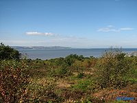
Caldy Hill
Encyclopedia

Wirral Peninsula
Wirral or the Wirral is a peninsula in North West England. It is bounded by three bodies of water: to the west by the River Dee, forming a boundary with Wales, to the east by the River Mersey and to the north by the Irish Sea. Both terms "Wirral" and "the Wirral" are used locally , although the...
. The land was bought by Hoylake
Hoylake
Hoylake is a seaside town within the Metropolitan Borough of Wirral, on Merseyside, England. It is located at the north western corner of the Wirral Peninsula, near to the town of West Kirby and where the River Dee estuary meets the Irish Sea...
District Council between 1897 and 1974. The village of Caldy
Caldy
Caldy is a village on the Wirral Peninsula, England, located to the south east of West Kirby. It is part of the West Kirby & Thurstaston Ward of the Metropolitan Borough of Wirral and is situated in the parliamentary constituency of Wirral West...
is nearby.
Including Stapledon
Olaf Stapledon
William Olaf Stapledon was a British philosopher and author of several influential works of science fiction.-Life:...
Woods, the whole area covers 250 acres (1 km²) of which 13 acres (52,609.2 m²) are owned by the National Trust
National Trust for Places of Historic Interest or Natural Beauty
The National Trust for Places of Historic Interest or Natural Beauty, usually known as the National Trust, is a conservation organisation in England, Wales and Northern Ireland...
. The hill rises to 260 ft (often said to be the highest point on Wirral) where there is a view-finder. From here there are fine views over the estuary of the River Dee
Dee Estuary
The Dee Estuary is a large estuary by means of which the River Dee flows into Liverpool Bay. The estuary starts near Shotton after a five miles 'canalised' section and the river soon swells to be several miles wide forming the boundary between the Wirral Peninsula in north-west England and...
to Hilbre Island
Hilbre Island
Hilbre Island is the largest of a group of three islands at the mouth of the estuary of the River Dee, which is a part of the estuary Site of Special Scientific Interest. The island is currently uninhabited....
and the Irish Sea
Irish Sea
The Irish Sea separates the islands of Ireland and Great Britain. It is connected to the Celtic Sea in the south by St George's Channel, and to the Atlantic Ocean in the north by the North Channel. Anglesey is the largest island within the Irish Sea, followed by the Isle of Man...
. More distant views range to Snowdonia in the west and Blackpool and the Pennines in the east, more rarely as far as the Lake District to the north, and extremely rarely to the Isle of Man in the north-west.
The Mariners Beacon stands nearby on the site of an old windmill, which was missed by mariners after it was destroyed by a gale in 1839. Consequently, the Trustees of the Liverpool Docks erected the Mariners Beacon in 1841.
Calday Grange Grammar School
Calday Grange Grammar School
Calday Grange Grammar School is a non-denominational selective state grammar school, founded in 1636, situated on Caldy Hill above the town of West Kirby on the Wirral . The school admits boys from the ages of 11 through to 18, and girls for the sixth form only...
is situated on Caldy Hill.

