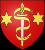
Calonne-Ricouart
Encyclopedia
Calonne-Ricouart is a commune
in the Pas-de-Calais department in the Nord-Pas-de-Calais region of France
.
and 33 miles (53.1 km) southwest of Lille
, at the junction of the D70 and the D341 roads, by the banks of the Clarence River
.
.
The church of St. Pierre was rebuilt between the years 1763 to 1781.
In 1786, a new chateau was built at the present location of the cemetery.
Around the same time, through the initiative of Bernard Calonne, the watermill
was built on the north bank of the river Clarence. It was sold during the Revolution
and ceased functioning as a working mill in 1945. Nowadays, only a small part of the original building still exists.
To the east of the town, were once the pit heads stood, is Park Calonnix, which covers 35 hectare
s of land including 15 hectares of forest and 5 hectares of ponds. Various sports and leisure activities are available (tennis, squash, horseriding, a climbing wall, pedal boats, freshwater and trout fishing, an inflatable playground and an animal park. Also located on the site, in the former coal mining explosives store, is a bat
sanctuary.
Communes of France
The commune is the lowest level of administrative division in the French Republic. French communes are roughly equivalent to incorporated municipalities or villages in the United States or Gemeinden in Germany...
in the Pas-de-Calais department in the Nord-Pas-de-Calais region of France
France
The French Republic , The French Republic , The French Republic , (commonly known as France , is a unitary semi-presidential republic in Western Europe with several overseas territories and islands located on other continents and in the Indian, Pacific, and Atlantic oceans. Metropolitan France...
.
Geography
Calonne-Ricouart is an ex-coalmining town some 6 miles (9.7 km) southwest of BéthuneBéthune
Béthune is a city in northern France, sub-prefecture of the Pas-de-Calais department.-Geography:Béthune is located in the former province of Artois. It is situated South-East of Calais, West of Lille, and North of Paris.-Landmarks:...
and 33 miles (53.1 km) southwest of Lille
Lille
Lille is a city in northern France . It is the principal city of the Lille Métropole, the fourth-largest metropolitan area in the country behind those of Paris, Lyon and Marseille. Lille is situated on the Deûle River, near France's border with Belgium...
, at the junction of the D70 and the D341 roads, by the banks of the Clarence River
Clarence River (France)
The Clarence is a river in northern France whose 32 km course crosses the département of Pas-de-Calais.Its source is near the village of Sains-lès-Pernes...
.
History
The village and the old castle were burned down in 1537 by the troops of Francis IFrancis I of France
Francis I was King of France from 1515 until his death. During his reign, huge cultural changes took place in France and he has been called France's original Renaissance monarch...
.
The church of St. Pierre was rebuilt between the years 1763 to 1781.
In 1786, a new chateau was built at the present location of the cemetery.
Around the same time, through the initiative of Bernard Calonne, the watermill
Watermill
A watermill is a structure that uses a water wheel or turbine to drive a mechanical process such as flour, lumber or textile production, or metal shaping .- History :...
was built on the north bank of the river Clarence. It was sold during the Revolution
French Revolution
The French Revolution , sometimes distinguished as the 'Great French Revolution' , was a period of radical social and political upheaval in France and Europe. The absolute monarchy that had ruled France for centuries collapsed in three years...
and ceased functioning as a working mill in 1945. Nowadays, only a small part of the original building still exists.
Features
The spoil heaps from the years of mining coal are now disappearing, as they contain material which can be used in road building.To the east of the town, were once the pit heads stood, is Park Calonnix, which covers 35 hectare
Hectare
The hectare is a metric unit of area defined as 10,000 square metres , and primarily used in the measurement of land. In 1795, when the metric system was introduced, the are was defined as being 100 square metres and the hectare was thus 100 ares or 1/100 km2...
s of land including 15 hectares of forest and 5 hectares of ponds. Various sports and leisure activities are available (tennis, squash, horseriding, a climbing wall, pedal boats, freshwater and trout fishing, an inflatable playground and an animal park. Also located on the site, in the former coal mining explosives store, is a bat
Bat
Bats are mammals of the order Chiroptera "hand" and pteron "wing") whose forelimbs form webbed wings, making them the only mammals naturally capable of true and sustained flight. By contrast, other mammals said to fly, such as flying squirrels, gliding possums, and colugos, glide rather than fly,...
sanctuary.
Population
Places of interest
- The church of St. Pierre, dating from the eighteenth century.
- The modern church of St.Paul.
- An old farm and a watermillWatermillA watermill is a structure that uses a water wheel or turbine to drive a mechanical process such as flour, lumber or textile production, or metal shaping .- History :...
.
Notable people
- Maryan Wisnieski, French international football player.

