Carleton College Cowling Arboretum
Encyclopedia
Carleton College Cowling Arboretum (also referred to as the Arb) consists of approximately 880 acres (360 hectares) of land adjacent to Carleton College
. It was created under the leadership of President Donald J. Cowling and Professor Harvey E. Stork in the 1920s. Professor Stork and Superintendent of Grounds D. Blake Stewart ("Stewsie") were responsible for much of the early development of the Arb, and their influences can still be seen and felt in many places. Stork and Stewsie were remarkable land managers, and it can be argued that they were among the nation's first restoration ecologists. In particular, their planting of upland forest trees and wildflowers in the Upper Arb (Stork Forest) decades ago is now coming to impressive maturity.
The original Arboretum has been augmented both by absorbing the Carleton Farm as it was closed down in the 1960s, and by purchases of adjoining farmland. Cultivated land, which originally made up much of the property within the Arboretum, has slowly been phased out since 1970, and will probably be eliminated within the next few years.
The Arb is divided by Highway 19 into the Upper Arb (south of the highway) and the Lower Arb (north of the highway; "lower" because it contains the low-lying floodplain of the Cannon River). The two portions of the Arb differ in character and in the pattern of visitor use. Since the Upper Arb is closer to both the campus and most Northfield residents, it receives more traffic and is being developed for heavier use. The Upper Arb has greater trail density, some trails designated for bike use, and generally smaller areas of natural communities. In contrast, the Lower Arb has populations of rare plants and animals and has primary conservation and education importance. Therefore the Lower Arb has fewer trails, no bike use, and large contiguous areas of natural habitat.
Carleton College
Carleton College is an independent non-sectarian, coeducational, liberal arts college in Northfield, Minnesota, USA. The college enrolls 1,958 undergraduate students, and employs 198 full-time faculty members. In 2012 U.S...
. It was created under the leadership of President Donald J. Cowling and Professor Harvey E. Stork in the 1920s. Professor Stork and Superintendent of Grounds D. Blake Stewart ("Stewsie") were responsible for much of the early development of the Arb, and their influences can still be seen and felt in many places. Stork and Stewsie were remarkable land managers, and it can be argued that they were among the nation's first restoration ecologists. In particular, their planting of upland forest trees and wildflowers in the Upper Arb (Stork Forest) decades ago is now coming to impressive maturity.
The original Arboretum has been augmented both by absorbing the Carleton Farm as it was closed down in the 1960s, and by purchases of adjoining farmland. Cultivated land, which originally made up much of the property within the Arboretum, has slowly been phased out since 1970, and will probably be eliminated within the next few years.
The Arb is divided by Highway 19 into the Upper Arb (south of the highway) and the Lower Arb (north of the highway; "lower" because it contains the low-lying floodplain of the Cannon River). The two portions of the Arb differ in character and in the pattern of visitor use. Since the Upper Arb is closer to both the campus and most Northfield residents, it receives more traffic and is being developed for heavier use. The Upper Arb has greater trail density, some trails designated for bike use, and generally smaller areas of natural communities. In contrast, the Lower Arb has populations of rare plants and animals and has primary conservation and education importance. Therefore the Lower Arb has fewer trails, no bike use, and large contiguous areas of natural habitat.
Purpose of the Arb
The three purposes of the Arb will all be served by maximizing its biological diversity, and this is a primary goal of current management practices. Diversity will be enhanced both by increasing the number and size of different community types and by increasing species diversity within particular communities.Education
- The Arb is used extensively as an outdoor classroom by a number of Carleton courses, especially in Biology and Geology. Students are able to carry out observations and experiments in a natural setting within walking distance of the campus, an invaluable asset for classes with a field component. It is also used by other educational institutions at levels from pre-school to graduate school, as well as for professional research programs.
Conservation
- The Arb has been a State Game Refuge for decades, and it serves a valuable role in providing habitat for species of diverse natural communities. As ecological restoration proceeds in the coming decades, the conservation value of the Arb will be substantially increased. Small populations of two rare turtles are found in the Arb: wood turtles (Clemmys insculpta, a threatened species in Minnesota) and Blanding’s turtles (Emydoidea blandingii, a species of special concern). Two threatened plant species were discovered in the Arb in the 1990s: ovate-leaved skullcap (Scutellaria ovata) and kitten-tails (Besseya bullii). Other rare species may remain undiscovered.
Recreation
- The most common recreational use of the Arb is by casual visitors who come to walk, run, ski, fish, or simply enjoy being outdoors. There are occasionally organized athletic events in the Arb, and both Carleton and St. Olaf teams use the Arb as a training facility for cross-country running and skiing.
Habitats
The Carleton Arb is located on a natural border between prairie and forest habitat. In the time before human settlement, when fires rolled across the prairie in the South part of the state, one Cannon River habitat acted as a fire buffer. The flame tolerant species of the prairie and oak savanna communities slowed the progress of natural fires, while the fire intolerant species of the maple-basswood deciduous forests were destroyed. As a result of this old demarcation, the species found throughout different sections of the Arb today serve as reminders of these old communities. In restoring the Arb to its former state, these trees and plants are used as clues in identifying what species grew and reproduced in a given area. To see the current location of the different habitats throughout the Arb look at the Arb map. The map also details the plans for future restoration of agricultural areas and buckthorn forest. Listed below are links to the management plans and natural history for each habitat found within the Arb.Upland Forest and Successional Upland Forest

- There are upland forests scattered throughout the Upper and Lower Arb. All of these forests have been disturbed to some degree, and many are only a few decades old. During the early 20th century, the area of forest in the Arb was much less than today (see map). The most mature upland forest is Best Woods (K17) and the oldest upland forest restoration is Stork Forest (G4). Until recent changes in land use, the upland forests were highly fragmented and shaped in such a way that they were plagued by edge effects. The highest priorities for upland forest management have been to increase total forest area and to decrease the amount of edge habitat, thereby producing habitat for interior forest plants and animals.
- A large block of upland forest is taking shape in the northeast portion of the Lower Arb, and eventually there will be about 180 acres (73 hectares) of contiguous forest in that area alone. There will be an additional area of at least 50 acres (20 hectares) of upland forest in the southeast corner of the Upper Arb. Some of these forests will grow by means of natural colonization of abandoned agricultural fields by trees. However, the forest-building process can be significantly accelerated by hand planting of tree seedlings, and this is being done in select areas. Only offspring of trees from the local area are planted in the Arb, to maintain genetic similarity to nearby forests. In the Upper Arb, forest planting has been concentrated in the Alumni Field (H3-4, I3-4). This field was removed from agriculture in 1986, and trees have been planted here over several years starting in 1990. Alumni volunteers have done substantial amounts of the tree planting here. Many thousands of trees have been planted in old fields in the Lower Arb as well.
- Trees planted into old fields suffer very high mortality without some further intervention. Competition with other plants, especially grasses, can be intense; this is prevented by placing black mats around the small trees to prevent growth of potential competitors. Browsing by deer (Odocoileus virginiana) and rodents (especially voles, Microtus spp.) can kill young trees, and some are now being protected by “sleeving” with plastic tubes until the trees are large enough to resist herbivores.
Floodplain Forest and Successional Floodplain Forest
- The Cannon River flows through the Lower Arb, and its floodplain supports a distinctive biological community. Some parts of the floodplain apparently were never cleared (such as the forest in D8; see inset map of 1931 land use), but large portions of the floodplain were cultivated for many decades. Agricultural areas were removed from cultivation in 1970, 1982, and 1990; there is currently no farming in the floodplain.
- Once these fields were abandoned, the process of ecological succession proceeded relatively rapidly. For instance, a farm field (H13-14) was abandoned as part of the celebration of the first Earth Day in 1970. Though many trees were planted in this field by volunteers at that time, mortality of saplings was very high. Luckily, there is ample nearby seed source for the appropriate floodplain trees such as cottonwoods (Populus deltoides), silver maple (Acer saccharinum), and willows (Salix spp.); these species have recruited successfully and a forest of young trees is rapidly approaching maturity. Relatively little intervention will be needed to produce a floodplain forest in the 1982 and 1990 Fields, and succession can be allowed to proceed naturally. Once back in forest cover, the Arb’s floodplains will help in the management of Cannon River flooding by acting as a buffer to rapid changes in water level and by holding the soil during flood periods.
Prairie

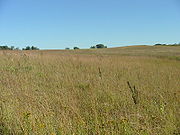
- Though large parts of the Arb were prairie at the time of European settlement, almost all of the prairie has been lost completely. This reflects the general condition of tallgrass prairie in Minnesota and in North America; by most estimates more than 99 percent of the tallgrass prairie in Minnesota was destroyed during European settlement. In the Arb, there are a few remnant prairie species along the Cannon River bluffs in the northeast corner of the Arb and along the railroad tracks near Waterford, but the best original prairie fragment is Postage Stamp Prairie in the Upper Arb (G4).And while not technically in the Arb, McKnight Prairie is the largest and most intact native prairie remnant owned by Carleton.
- Large areas of tallgrass prairie are being restored in the Arb. It is much more difficult to restore prairie than to restore forest, both because most of the prairie plants are locally extinct and because the process of succession to prairie is extremely slow. Intense planting and care are necessary to grow a prairie that even begins to approach the diversity of the original community. The first step is to introduce the appropriate plant species one by one, either as seed or seedlings. Introduced plants are from local sources whenever possible, to ensure that genotypes are adapted to regional conditions. Once the restored prairies have begun to mature, they can be a valuable source of seeds of local plant genotypes for other nearby prairie restoration projects.
- The first prairie restoration in the Arb was begun at Hillside Prairie (F10, G10-11) in 1978. New areas of prairie now are being planted annually in the Lower Arb, and the development of the prairie community is the subject of ongoing research by Carleton faculty and students. There ultimately will be about 140 acres (57 hectares) of restored prairie in this area of the Lower Arb.
- In the Upper Arb, prairie restoration to date has been focused around Postage Stamp Prairie. There were plantings in 1989, 1990 (the Okada Garden), and the fall of 1992 (as part of the Wright Savanna, see below). These plantings have expanded the prairie area at this site by at least 10 times.
- While not technically in the Arb, McKnight Prairie is the most intact native prairie remnant owned by the College.
Oak Savanna

- Though common at one time in southern Minnesota, the oak savanna community is essentially extinct in the state. The community was dependent on fires to maintain a park-like open forest, with scattered trees that did not have a closed canopy. Once fires were suppressed after European settlement, the savannas were very quickly grown over by fire-intolerant trees and shrubs. These in turn shaded out the full-sun plant species often found in savannas.
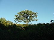
- Records from the presettlement General Land Survey of Rice and Dakota Counties show that the southeastern banks of the Cannon River in the Arb historically were oak savanna. This can be seen today by the presence of many old (over a century) bur oaks (Quercus macrocarpa) in the Arb forests, now overgrown by fire-intolerant species. European buckthorn (Rhamnus cathartica) is a particularly aggressive invader in these degraded oak habitats.
- Because the original oaks still remain, the Arb offers a unique opportunity to reconstruct this extremely rare ecological community. Starting in the 1980s, students began to clear trees and shrubs in the Oak Opening project in the Lower Arb. The Umbanhowar Oak Opening (H12) is named for Charles Umbanhowar, Jr. (Class of ‘85), who was instrumental in starting this project. The area of oak savanna has grown rapidly since this time, and eventually will include about 35 acres (14 hectares) in the Lower Arb.
- Oak savanna restoration proceeds in several steps. The first is to remove woody vegetation from around the oak trees, a time- and labor-intensive activity. These plants would quickly reinvade unless steps are taken to keep them out. The Arb savannas will be kept open by trying to approximate the original fire regime. After woody plant removal, prairie and other characteristic grasses are planted into the savannas; these are essential in allowing the fire to carry well through the savanna and prevent reinvasion by trees and shrubs. After the grasses are established, other appropriate species of wildflower are reintroduced to complete the plant community.
- Fire is essential to managing both prairie and oak savanna, so the main oak savanna restoration will be immediately adjacent to the large prairie restoration in the Lower Arb. This will allow a fire management program that approximates pre-settlement conditions: prairie fires sweeping into the woods at the prairie-forest border. The proximity of oak savanna to prairie is also important because these two communities share many species, and it can be expected that some species introduced into the prairies will migrate into the oak savanna and vice versa.
- Smaller oak savannas will be restored near prairies in the Upper Arb. The Wright Savanna was cleared and planted in 1992, adjacent to Postage Stamp Prairie. There are other potential savanna restoration sites scattered through the Upper Arb.
Water and Wetlands
-
- The Cannon River flows the length of the Lower Arb, and is home to a number of rare species including wood turtles (Clemmys insculpta) and several types of mussel. The Cannon River is a major watershed for southeast Minnesota, and has the water quality problems that are typical of rivers in agricultural regions. Improvements in water quality may occur in the near future, since it is the focus of conservation and cleanup efforts by such organizations as the Cannon River Watershed Partnership and The Nature Conservancy.

-
- Spring Creek runs through the Upper Arb from Wall Street Road to Lyman Lakes. The creek is prone to spring flooding and, when flooded, carries large sediment loads from agricultural areas upstream. A wetland restoration project is currently underway where Spring Creek flows past Wright Savanna. Funded by a generous grant from the family of Richard S. Cole, the Cole Wetland was planted in 1995.
-
- Kettle Hole Marsh in the Lower Arb is a particularly high quality marsh habitat. So far it has remained little disturbed and contains few non-native species. It is an important breeding site for frogs and toads, including at least five native species. Oxbow Pond and the area north of Hillside Prairie are also important wetland habitats. Invasion by purple loosestrife (Lythrum salicaria) is a serious threat to the Arb’s wetlands, but so far they are relatively free of this aggressive introduced species.
-
- The Retention Pond was created in 1999 to receive runoff from the new Recreation Center and adjacent parking lots in order to prevent rapid influx of water into the Cannon River. Runoff from the Recreation Center site is piped underground beneath Highway 19 and into the Retention Pond. From here it drains slowly into the river via underground pipe. The area around the Retention Pond has been planted with local wetland and floodplain species.
-
- Turtle Pond was created in 1998 by excavation in a flat area that had been previously cultivated.
-
- Oxbow Pond is a naturally occurring pond in the Lower Arb that was created by a change in course of the Cannon that left part of the river channel separated from the new course. It is below the escarpment on the west edge of Best Woods.
Conifer Plantation
- Starting in the 1940s, several species of pine (Pinus spp.) and other conifers were planted in the northeast section of the Lower Arb. None of the trees planted are native to the area (though they are native to Minnesota). In keeping with the overall goal of restoring native communities in the Arb, no new conifer plantations are planned. In 2001. some conifers were removed from plantings in the Lower Arb. Smaller stands of pines are being removed from areas near prairies and oak savannas, where they would be vulnerable to management burns. Other conifers will be allowed to remain since they provide habitat for some species, particularly in the winter, and increase the diversity of the Arb landscape. These trees are generally unable to reproduce successfully here (though some seedlings seem to be thirving in the 1992 Field), and they will disappear gradually as old trees die without replacement. It is expected that deciduous upland forest will take over most of the current conifer plantation areas.
Grass Monoculture
- Several areas in the Arb are planted monocultures of perennial grasses, particularly brome (Bromus inermis) and switchgrass (Panicum virgatum). The largest areas are the old fields in the Upper Arb along Spring Creek Road and a Lower Arb field near Highway 19. Because these grasses are highly competitive and form a thick sod, few plants can invade these areas and they will remain monocultures for many decades. These fields will be converted to appropriate native communities as the surrounding areas are restored to natural communities.

