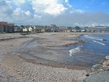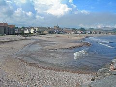
Carron Water, Aberdeenshire
Encyclopedia
Carron Water is a river in Aberdeenshire
, Scotland
.
 Carron Water rises in Fetteresso Forest
on the eastern edge of the Grampians
. It flows past Fetteresso Castle
and discharges into the North Sea
at Stonehaven Bay
. Carron Water separates the Old Town from Stonehaven's new town (just over two hundred years of age), laid out in grid-iron fashion. Somewhat to the north is Garron Point, whilst Bellman's Head
and Downie Point
lie to the south. Historic features in the vicinity include the Stonehaven Tolbooth
, Dunnottar Castle
, and slightly further north, the Chapel of St. Mary and St. Nathalan
and Muchalls Castle
.
Stonehaven's other river at the north end of town is the Cowie Water
.
Aberdeenshire
Aberdeenshire is one of the 32 unitary council areas in Scotland and a lieutenancy area.The present day Aberdeenshire council area does not include the City of Aberdeen, now a separate council area, from which its name derives. Together, the modern council area and the city formed historic...
, Scotland
Scotland
Scotland is a country that is part of the United Kingdom. Occupying the northern third of the island of Great Britain, it shares a border with England to the south and is bounded by the North Sea to the east, the Atlantic Ocean to the north and west, and the North Channel and Irish Sea to the...
.

Fetteresso Forest
The Fetteresso Forest is a woodland that is principally coniferous situated in the Mounth range of the Grampian Mountains in Aberdeenshire, Scotland. The forest has a number of prominent mountain peaks including the Hill of Blacklodge and Craiginour peak...
on the eastern edge of the Grampians
Grampian Mountains (Scotland)
The Grampian Mountains or Grampians are one of the three major mountain ranges in Scotland, occupying a considerable portion of the Scottish Highlands in northeast Scotland.-Extent:...
. It flows past Fetteresso Castle
Fetteresso Castle
Fetteresso Castle is a 14th century towerhouse, rebuilt in 1761 as a Scottish gothic style Palladian manor, with clear evidence of prehistoric use of the site. It is situated immediately west of the town of Stonehaven in Kincardineshire slightly to the west of the A90 dual carriageway...
and discharges into the North Sea
North Sea
In the southwest, beyond the Straits of Dover, the North Sea becomes the English Channel connecting to the Atlantic Ocean. In the east, it connects to the Baltic Sea via the Skagerrak and Kattegat, narrow straits that separate Denmark from Norway and Sweden respectively...
at Stonehaven Bay
Stonehaven Bay
Stonehaven Bay is a natural harbour in Aberdeenshire, Scotland. The town of Stonehaven is built along the shore of Stonehaven Bay. Nearby historical features include Fetteresso Castle, Stonehaven Tolbooth, Dunottar Castle and Muchalls Castle.-References:...
. Carron Water separates the Old Town from Stonehaven's new town (just over two hundred years of age), laid out in grid-iron fashion. Somewhat to the north is Garron Point, whilst Bellman's Head
Bellman's Head
Bellman's Head is a headland point comprising the northern boundary of Stonehaven Bay in Stonehaven, Scotland. The corresponding headland at the south of the bay is Downie Point. Notable historic features in the general vicinity include the Tolbooth, Fetteresso Castle and Muchalls Castle....
and Downie Point
Downie Point
Downie Point is a prominent headland located at the southern edge of Stonehaven Bay in Aberdeenshire, Scotland. From the Stonehaven Harbour, there is a panoramic view of this cliff landform, especially from the tip of Bellman's Head....
lie to the south. Historic features in the vicinity include the Stonehaven Tolbooth
Stonehaven Tolbooth
The Stonehaven Tolbooth is a late 16th century stone building originally used as a courthouse and a prison in the town of Stonehaven, Aberdeenshire, Scotland...
, Dunnottar Castle
Dunnottar Castle
Dunnottar Castle is a ruined medieval fortress located upon a rocky headland on the north-east coast of Scotland, about two miles south of Stonehaven. The surviving buildings are largely of the 15th–16th centuries, but the site is believed to have been an early fortress of the Dark Ages...
, and slightly further north, the Chapel of St. Mary and St. Nathalan
Chapel of St. Mary and St. Nathalan
The Chapel of St. Mary and St. Nathalan is a ruined chapel overlooking the North Sea immediately north of Stonehaven, in the Mearns of Scotland, along the northern shoreline of Stonehaven Bay. The founding of this Catholic place of worship is associated with St. Nathalan. who lived circa 650 AD...
and Muchalls Castle
Muchalls Castle
Muchalls Castle stands overlooking the North Sea in the countryside of Kincardine and Mearns, Aberdeenshire, Scotland. The lower course is a well preserved double groined 13th century towerhouse structure, built by the Frasers of Muchalls. Upon this structure, the 17th century castle was begun by...
.
Stonehaven's other river at the north end of town is the Cowie Water
Cowie Water
The Cowie Water is a river rising in the Grampian Mountains in Aberdeenshire, Scotland that discharges to the North Sea in the northern part of Stonehaven. south of the ruined Cowie Castle...
.

