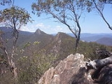
Cathedral Range State Park
Encyclopedia
.jpg)
Victoria (Australia)
Victoria is the second most populous state in Australia. Geographically the smallest mainland state, Victoria is bordered by New South Wales, South Australia, and Tasmania on Boundary Islet to the north, west and south respectively....
, Australia
Australia
Australia , officially the Commonwealth of Australia, is a country in the Southern Hemisphere comprising the mainland of the Australian continent, the island of Tasmania, and numerous smaller islands in the Indian and Pacific Oceans. It is the world's sixth-largest country by total area...
which encompasses the spectacular Cathedral Range
Cathedral Range (Victoria)
Cathedral Range is a mountain range in Victoria, Australia, located in Cathedral Range State Park. The range is formed from a 7km ridge of upturned sedimentary rock, consisting mainly of Sandstone, Mudstone and Conglomerates of the Devonian Period. This has given the range steep sides, and a narrow...
and adjacent Little River valley. It is located to the east of the Maroondah Highway
Maroondah Highway
Maroondah Highway , is a major east-west thoroughfare in the eastern suburbs of Melbourne and a highway servicing the lower alpine region Victoria, Australia.-History:...
, between Buxton
Buxton, Victoria
Buxton is a small town north-east of Melbourne in the Australian state of Victoria. At the 2006 Census, Buxton had a population of 396.The district around Buxton was significantly impacted by the Black Saturday Bushfires...
and Taggerty
Taggerty, Victoria
Taggerty is a town in central Victoria, Australia. It is located at the intersection of Maroondah Highway and Thornton Road. The Acheron River also crosses the highway at Taggerty. It is thought to be named after the Aboriginal word for blue clay. At the 2006 Census, Taggerty and the surrounding...
, approximately 150 km north-east of Melbourne.
The Cathedral Range State Park is a popular bushwalking destination for Victorians, as it provides a wide variety of terrain and is easily accessed from Melbourne. Managed trails cover the extent of the range, from Little Cathedral Peak at the north end of the range, through Cathedral Peak, North and South Jawbone, to Sugarloaf Peak at the south end. The trails carry signs warning of "steep and difficult terrain", as several of the higher trails require scrambling across rock formations. From Neds Gully carpark, the walk to Sugarloaf Peak via the Farmyard is listed as 4 hours one way.
The park has three camping areas: Cooks Mill in the centre of the park, Neds Gully in the north, both of which are accessible by vehicle, and The Farmyard, which is on the range and only accessible by foot. An access road traverses the park from north to south and connects the two main camping areas, with the main entrance from the north.
In addition to bushwalking and camping, rock climbing and abseiling at Sugarloaf Peak and The Jawbones are popular activities.
The park was extensively burnt by the Black Saturday bushfires in February 2009.

