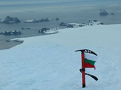
Charybdis Cove
Encyclopedia

Varna Peninsula
Varna Peninsula is a roughly rectangular predominantly ice-covered peninsula forming the northeast extremity of Livingston Island in the South Shetland Islands, Antarctica...
, Livingston Island in the South Shetland Islands
South Shetland Islands
The South Shetland Islands are a group of Antarctic islands, lying about north of the Antarctic Peninsula, with a total area of . By the Antarctic Treaty of 1959, the Islands' sovereignty is neither recognized nor disputed by the signatories and they are free for use by any signatory for...
, Antarctica and entered between Organpipe Point
Organpipe Point
Organpipe Point is a prominent east-west trending headland rising to about 60 or 70 m on the northwest coast of Varna Peninsula, Livingston Island in the South Shetland Islands, Antarctica and forming the north side of the entrance to Charybdis Cove and the southwest side of the entrance to Griffin...
to the north and Slab Point
Slab Point
Slab Point is a rocky point on the northwest coast of Varna Peninsula, Livingston Island in the South Shetland Islands, Antarctica forming the north side of the entrance to Eliseyna Cove and the south side of the entrance to Charybdis Cove....
to the south.
The feature is named after the Charybdis
Charybdis
Charybdis or Kharybdis was a sea monster, later rationalised as a whirlpool and considered a shipping hazard in the Strait of Messina.-The mythological background:...
, a mythical Greek
Greece
Greece , officially the Hellenic Republic , and historically Hellas or the Republic of Greece in English, is a country in southeastern Europe....
sea monster which wrecked ships and devoured sailors.
Location
The cove is centred at 62°28′38.2"S 60°09′13.5"W which is 16.25 km northeast of Siddons PointSiddons Point
Siddons Point is a point projecting into the middle of the head of Hero Bay on the north coast of Livingston Island in the South Shetland Islands, Antarctica...
and 2.92 km south-southwest of Williams Point
Williams Point
Williams Point is the point forming both the north extremity of Varna Peninsula and the northeast tip of Livingston Island in the South Shetland Islands, Antarctica...
(British mapping in 1968, and Bulgarian mapping in 2005 and 2009).
Maps
- L.L. Ivanov et al. Antarctica: Livingston Island and Greenwich Island, South Shetland Islands. Scale 1:100000 topographic map. Sofia: Antarctic Place-names Commission of Bulgaria, 2005.
- L.L. Ivanov. Antarctica: Livingston Island and Greenwich, Robert, Snow and Smith Islands. Scale 1:120000 topographic map. Troyan: Manfred Wörner Foundation, 2009. ISBN 978-954-92032-6-4

