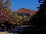
Chilhowee Mountain
Encyclopedia
Chilhowee Mountain is a low ridge at the outer edge of the Great Smoky Mountains
that stretches between the Little Tennessee River
(specifically Chilhowee Lake
) to the west and the Little Pigeon River
watershed to the east. While not part of the Great Smoky Mountains National Park
, the mountain's crest is traversed by the westernmost section of Foothills Parkway
.
While the mountain is 35 miles (56.3 km) long, it rarely reaches a width of more than 3 or 4 miles (6.4 km). Little River
cuts a large gap in the middle of the mountain (near Walland
), dividing it into eastern and western sections. The highest point on the western section is 2650 ft (808 m) at a knob known as Look Rock. The highest point on the eastern section, known as "The Three Sisters," rises to 2,843 feet (866m), and is a prominent landmark visible from nearby Maryville, Tennessee
.
Great Smoky Mountains
The Great Smoky Mountains are a mountain range rising along the Tennessee–North Carolina border in the southeastern United States. They are a subrange of the Appalachian Mountains, and form part of the Blue Ridge Physiographic Province. The range is sometimes called the Smoky Mountains or the...
that stretches between the Little Tennessee River
Little Tennessee River
The Little Tennessee River is a tributary of the Tennessee River, approximately 135 miles long, in the Appalachian Mountains in the southeastern United States.-Geography:...
(specifically Chilhowee Lake
Chilhowee Dam
Chilhowee Dam is a hydroelectric dam located in Blount and Monroe counties, Tennessee, between river mile 33 and 34 on the Little Tennessee River. Construction began in 1955 and was completed in 1957. The dam's reservoir covers approximately at normal full pool and has a drainage area of . The...
) to the west and the Little Pigeon River
Little Pigeon River (Tennessee)
The Little Pigeon River is a river located entirely within Sevier County, Tennessee.It rises from a series of streams which flow together on the dividing ridge between the states of Tennessee and North Carolina inside the boundary of the Great Smoky Mountains National Park. The river is subdivided...
watershed to the east. While not part of the Great Smoky Mountains National Park
Great Smoky Mountains National Park
Great Smoky Mountains National Park is a United States National Park and UNESCO World Heritage Site that straddles the ridgeline of the Great Smoky Mountains, part of the Blue Ridge Mountains, which are a division of the larger Appalachian Mountain chain. The border between Tennessee and North...
, the mountain's crest is traversed by the westernmost section of Foothills Parkway
Foothills Parkway
The Foothills Parkway is a national parkway which, if completed, will traverse the foothills of the northern Great Smoky Mountains in East Tennessee, located in the Southeastern United States. The 71-mile parkway will ideally connect U.S...
.
While the mountain is 35 miles (56.3 km) long, it rarely reaches a width of more than 3 or 4 miles (6.4 km). Little River
Little River (Tennessee)
Little River is a scenic river in Tennessee which drains a area containing some of the most spectacular scenery in the southeastern United States. The first of the river are all located within the borders of the Great Smoky Mountains National Park...
cuts a large gap in the middle of the mountain (near Walland
Walland, Tennessee
Walland is an unincorporated community in Blount County, Tennessee, in the Southeastern United States. Walland is the site of a post office and is the place name associated with zip code 37886, which covers an area beyond the Walland community...
), dividing it into eastern and western sections. The highest point on the western section is 2650 ft (808 m) at a knob known as Look Rock. The highest point on the eastern section, known as "The Three Sisters," rises to 2,843 feet (866m), and is a prominent landmark visible from nearby Maryville, Tennessee
Maryville, Tennessee
Maryville is the county seat of Blount County, Tennessee, in the Southeastern United States. The city is located south of Knoxville. Maryville's population was 27,258 at the 2010 census. It is included in the Knoxville Metropolitan Area. Maryville has received a number of accolades for its...
.
External links
- http://savechilhoweemountain.org/
- USGS Chilhowee Mountain

