Chno Dearg
Encyclopedia

Scotland
Scotland is a country that is part of the United Kingdom. Occupying the northern third of the island of Great Britain, it shares a border with England to the south and is bounded by the North Sea to the east, the Atlantic Ocean to the north and west, and the North Channel and Irish Sea to the...
mountain situated 25 km east of Fort William, Highland in the Lochaber
Lochaber
District of Lochaber 1975 to 1996Highland council area shown as one of the council areas of ScotlandLochaber is one of the 16 ward management areas of the Highland Council of Scotland and one of eight former local government districts of the two-tier Highland region...
area of the Highland
Highland (council area)
Highland is a council area in the Scottish Highlands and is the largest local government area in both Scotland and the United Kingdom as a whole. It shares borders with the council areas of Moray, Aberdeenshire, Perth and Kinross, and Argyll and Bute. Their councils, and those of Angus and...
council area.
Overview
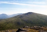
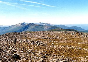
Chno Dearg is situated to the east of Loch TreigLoch Treig
Loch Treig is a 9 km freshwater loch situated in a steep-sided glen 20 km east of Fort William, in Lochaber, Highland, Scotland...
in the high ground between the loch and Strath Ossian. It reaches a height of 1046 metres (3432 feet), thus qualifying as a Munro
Munro
A Munro is a mountain in Scotland with a height over . They are named after Sir Hugh Munro, 4th Baronet , who produced the first list of such hills, known as Munros Tables, in 1891. A Munro top is a summit over 3,000 ft which is not regarded as a separate mountain...
and a Marilyn
Marilyn (hill)
A Marilyn is a mountain or hill in the United Kingdom, Republic of Ireland or Isle of Man with a relative height of at least 150 metres , regardless of absolute height or other merit...
. It is not regarded as a particularly striking hill, being described in the SMCs
Scottish Mountaineering Club
The Scottish Mountaineering Club is Scotland's second oldest mountaineering club. Founded in 1889, in Glasgow, the private club, with about 400 members, publishes guidebooks and runs a list of Munroists.-History:At the time of the club's founding there were a number of experienced Alpinists...
Munro guide as “a rounded and featureless hill”, its convex slopes giving a monotonous climb to the summit. The neighbouring Munro of Stob Coire Sgriodain with which Chno Dearg is usually climbed is considered a more exciting hill even though it is 70 metres lower in altitude.
Chno Dearg has a considerable topographic prominence
Topographic prominence
In topography, prominence, also known as autonomous height, relative height, shoulder drop , or prime factor , categorizes the height of the mountain's or hill's summit by the elevation between it and the lowest contour line encircling it and no higher summit...
of 649 metres, being surrounded by the deep glens of Glen Spean, Loch Treig and Strath Ossian, and its summit is a fine viewpoint especially for the Creag Meagaidh
Creag Meagaidh
Creag Meagaidh is a mountain on the northern side of Glen Spean in Scotland. It is a complex mountain, taking the form of a flat summit plateau from which five ridges radiate, and is most famed for the cliffs surrounding the corrie of Coire Ardair on the north-eastern face...
group of hills to the Northeast. Another feature of the mountain is its appeal to the ski mountaineer, with its sweeping northern slopes offering a continuous five km run with 750 metres of descent from the summit. The mountains name translates from the Gaelic
Scottish Gaelic language
Scottish Gaelic is a Celtic language native to Scotland. A member of the Goidelic branch of the Celtic languages, Scottish Gaelic, like Modern Irish and Manx, developed out of Middle Irish, and thus descends ultimately from Primitive Irish....
as “Red Nut”, however early maps give the name as Cnoc Dearg which translates as “Red Hill” and this is the correct name. The red refers to the profusion of heather on the hill.
Geography
Chno Dearg expansive northern flank falls gradually to Glen Spean and the shores of Loch LagganLoch Laggan
Loch Laggan is a freshwater loch situated east of Fort William, in Lochaber, Highland, Scotland. The A86 road from Spean Bridge to Kingussie follows along its north bank...
, the lower part being covered with an extensive forestry plantation. These northern slopes can be boggy at times with numerous small streams, and contain the subsidiary top of Meall Chaorach (815 metres) which is situated 1.5 km from the main summit. On the western side of the hill is Coire
Cirque
Cirque may refer to:* Cirque, a geological formation* Makhtesh, an erosional landform found in the Negev desert of Israel and Sinai of Egypt*Cirque , an album by Biosphere* Cirque Corporation, a company that makes touchpads...
an Lochain, a shallow hollow with gentle slopes which contains Lochan Coire an Lochain.
The mountain's main ridge goes Southwest from the summit to a col
Mountain pass
A mountain pass is a route through a mountain range or over a ridge. If following the lowest possible route, a pass is locally the highest point on that route...
with a height of 923 metres. Here it splits, with one spur swinging round the head of Coire an Lochain to go eventually north and link to the adjoining Munro of Stob Coire Sgriodain. The other spur continues southerly to link to Meall Garbh (976 metres) which is listed as a “top” in Munro's Tables and has steep crags on its eastern flank. The south side of Chno Dearg contains the steep-sided Coire nan Cnamh which falls precipitously to the glen of the Allt Feith Thuill, a tributary of the River Ossian. All drainage from the mountain reaches the River Spean to the north where it flows to the west coast of Scotland.
Ascents
Chno Dearg is usually climbed from the hamlet of Fersit ; as a rule the adjacent Munro of Stob Coire Sgriodain is also included in the ascent. The route from Fersit offers a natural round of Coire an Lochain, taking in both Munros, with a brief detour to take in the “top” of Meall Garbh. However the proximity of the West Highland LineWest Highland Line
The West Highland Line is considered the most scenic railway line in Britain, linking the ports of Mallaig and Oban on the west coast of Scotland to Glasgow. The line was voted the top rail journey in the world by readers of independent travel magazine Wanderlust in 2009, ahead of the iconic...
in the area offers walkers the alternative of starting from Corrour railway station
Corrour railway station
Corrour railway station is a railway station on the West Highland Line,Scotland. It is situated near Loch Ossian and Loch Treig, on the Corrour Estate. It is the highest mainline railway station in the United Kingdom.- Location :...
and climbing Beinn na Lap first and then continuing north over Chno Dearg and Stob Coire Sgriodain to finish at Tulloch railway station
Tulloch railway station
Tulloch railway station is a rural railway station in the Highland region of Scotland. This station is on the West Highland Line, north of .- History :...
to catch the evening train.

