Cirque of the Towers
Encyclopedia


Wind River Range
The Wind River Range , is a mountain range of the Rocky Mountains in western Wyoming in the United States. The range runs roughly NW-SE for approximately 100 miles . The Continental Divide follows the crest of the range and includes Gannett Peak, which at 13,804 feet , is the highest peak...
Wyoming
Wyoming
Wyoming is a state in the mountain region of the Western United States. The western two thirds of the state is covered mostly with the mountain ranges and rangelands in the foothills of the Eastern Rocky Mountains, while the eastern third of the state is high elevation prairie known as the High...
, U.S., part of which is in the Bridger Wilderness
Bridger Wilderness
The Bridger Wilderness is located in Bridger-Teton National Forest in Wyoming, United States. Originally established in 1931 as a primitive area, the 428,169 acre region was redesignated as a wilderness in 1964 and expanded to the current size in 1984...
in Bridger-Teton National Forest
Bridger-Teton National Forest
Bridger-Teton National Forest is located in western Wyoming, United States. The forest consists of , making it the second largest National Forest outside of Alaska. The forest stretches from Yellowstone National Park, along the eastern boundary of Grand Teton National Park and from there rides...
, while the remainder is in the Popo Agie Wilderness
Popo Agie Wilderness
Popo Agie Wilderness is located within Shoshone National Forest, Wyoming, United States. The wilderness consists of 101,870 acres on the east side of the continental divide in the Wind River Range. Originally set aside as a primitive area in 1932, in 1984 the Wyoming Wilderness Act was passed...
in Shoshone National Forest
Shoshone National Forest
Shoshone National Forest is the first federally protected National Forest in the United States and covers nearly 2.5 million acres in the state of Wyoming. Originally a part of the Yellowstone Timberland Reserve, the forest was created by an act of Congress and signed into law by U.S....
. Located in the southern section of the Wind River Range (or "Winds" for short), the cirque
Cirque
Cirque may refer to:* Cirque, a geological formation* Makhtesh, an erosional landform found in the Negev desert of Israel and Sinai of Egypt*Cirque , an album by Biosphere* Cirque Corporation, a company that makes touchpads...
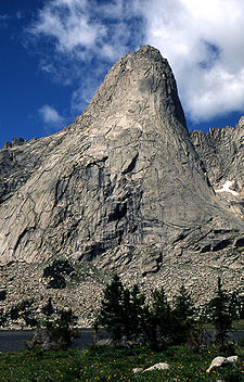
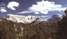
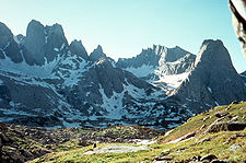
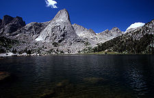
is a very popular destination for technical rock climbers. Climber Orrin Bonney gave the area its current name in 1941 after his survey of the cirque. Prior to this, few if any visitors had ventured into the cirque due to the remote location. The cirque is an almost circular hole or valley
Valley
In geology, a valley or dale is a depression with predominant extent in one direction. A very deep river valley may be called a canyon or gorge.The terms U-shaped and V-shaped are descriptive terms of geography to characterize the form of valleys...
carved by a glacier
Glacier
A glacier is a large persistent body of ice that forms where the accumulation of snow exceeds its ablation over many years, often centuries. At least 0.1 km² in area and 50 m thick, but often much larger, a glacier slowly deforms and flows due to stresses induced by its weight...
that retreated over 8,000 years ago. As is true with the rest of the Winds, the mountains are composed almost entirely of granite
Granite
Granite is a common and widely occurring type of intrusive, felsic, igneous rock. Granite usually has a medium- to coarse-grained texture. Occasionally some individual crystals are larger than the groundmass, in which case the texture is known as porphyritic. A granitic rock with a porphyritic...
. The Continental Divide
Continental Divide
The Continental Divide of the Americas, or merely the Continental Gulf of Division or Great Divide, is the name given to the principal, and largely mountainous, hydrological divide of the Americas that separates the watersheds that drain into the Pacific Ocean from those river systems that drain...
spans the crest of the main peaks.
The towers average 1,000 feet (305 m) lower in altitude than the highest mountains in the northern Winds, with Lizards Head Peak in the cirque (12,842 feet, 3,915 m) being the tallest. Other individual mountains in the cirque include Shark's Nose, Warbonnet, Warrior Peak, Wolf's Head
Wolf's Head (Wind River)
Wolf's Head is prominent granite peak in the Cirque of the Towers and part of the Wind River Range. The East Ridge route on the Wolf's Head is recognized in the historic climbing text Fifty Classic Climbs of North America and considered a classic around the world.- External links :* * *...
and Pingora Peak
Pingora Peak
Pingora Peak is prominent granite peak in the Cirque of the Towers. Pingora Peak is in the Popo Agie Wilderness and part of the Wind River Range within the greater Shoshone National Forest...
. There are hundreds of routes to choose from in difficulties
Yosemite Decimal System
The Yosemite Decimal System is a three-part system used for rating the difficulty of walks, hikes, and climbs. It is primarily used by mountaineers in the United States and Canada. The Class 5 portion of the Class scale is primarily a rock climbing classification system. Originally the system was...
ranging from 5.1 to 5.11a and since the mountains are composed primarily of granite rock, there is good anchoring. These climbs include two featured in Steck and Roper's Fifty Classic Climbs of North America
Fifty Classic Climbs of North America
Fifty Classic Climbs Of North America is a climbing guidebook and history written by Steve Roper and Allen Steck. It is considered a definitive piece of climbing literature, known to many climbers as simply "The Book", and has served as an inspiration for more recent climbing books, such as Mark...
the Northeast Face of Pingora
Northeast Face (Pingora)
The Northeast Face of Pingora is a technical rock climbing route on Pingora Peak part of the Cirque of the Towers in the Popo Agie Wilderness part of the Shoshone National Forest. The route is featured in Fifty Classic Climbs of North America....
(IV, 5.9) and the East Ridge of the Wolf's Head
East Ridge (Wolf's Head)
The Northeast Face of Pingora is a technical rock climbing route on the Wolf's Head part of the Cirque of the Towers. The route is featured in Fifty Classic Climbs of North America.- External links :***...
(III, 5.6).
For both the climber and backpacker, access to the cirque from the west from Pinedale, Wyoming
Pinedale, Wyoming
Pinedale is a town in and the county seat of Sublette County, Wyoming, United States. The population was 1,412 at the 2000 census. Pinedale is an important hunting outfitting town and a gateway to the Wind River Mountains. It is also a major gateway to the Jackson Hole area in Wyoming. Pinedale is...
requires a 55-mile (88 km) drive, partly paved and partly gravel, to the Big Sandy trailhead. There is a small National Forest
United States National Forest
National Forest is a classification of federal lands in the United States.National Forests are largely forest and woodland areas owned by the federal government and managed by the United States Forest Service, part of the United States Department of Agriculture. Land management of these areas...
campground at the trailhead. An 8.7-mile (14 km) hike beginning at 9,000 feet (2,743 m) above sea level which is relatively level the first 7 miles (11.3 km) becomes very steep the last mile (1.6 km) and ascends to Jackass Pass at 10,800 feet (3,290 m), crossing the continental divide. From there one must descend a steep half mile (800 m) to Lonesome Lake, which is one of four lakes in the cirque. Expect the trail to be busy in July and August as the cirque is the most popular hiking and climbing destination in the Wind River Range. Lonesome Lake was the first lake in the Wind River Range whose water was deemed unfit for consumption due to human waste and consequently, no camping is permitted within a quarter mile (400 m) of the lake. The granitic rocks allow poor filtration of ground water and the ability of many alpine
Alpine climate
Alpine climate is the average weather for a region above the tree line. This climate is also referred to as mountain climate or highland climate....
lakes to cleanse themselves is often poorer than one might find at lower altitudes.

