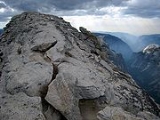
Clouds Rest
Encyclopedia
Clouds Rest is a mountain in Yosemite National Park
east northeast of Yosemite Village
, California
. Although there are many peaks in the park having far greater elevation, Clouds Rest's proximity to the valley gives it a very high degree of visual prominence.
or a 9.4 miles (15.1 km) trail hike from Happy Isles
by way of Little Yosemite Valley
. There are also several technical routes available.
Clouds Rest is an arête
, a thin, almost knife-like, ridge of rock formed when glaciers eroded away solid rock to form Tenaya Canyon
and Little Yosemite Valley. The northwest face, mostly solid granite, raises 5000 feet (1,524 m) above Tenaya Creek.
, notes that his party named the summit Clouds Rest because they returned to camp to avoid a snow storm after seeing "the clouds rapidly settling down to rest upon that mountain."
Yosemite National Park
Yosemite National Park is a United States National Park spanning eastern portions of Tuolumne, Mariposa and Madera counties in east central California, United States. The park covers an area of and reaches across the western slopes of the Sierra Nevada mountain chain...
east northeast of Yosemite Village
Yosemite Village, California
Yosemite Village is an unincorporated community in Mariposa County, California. It is located northeast of Mariposa, at an elevation of 3996 feet ....
, California
California
California is a state located on the West Coast of the United States. It is by far the most populous U.S. state, and the third-largest by land area...
. Although there are many peaks in the park having far greater elevation, Clouds Rest's proximity to the valley gives it a very high degree of visual prominence.
Geography
The summit can be reached by a 7 miles (11.3 km) trail hike from Tioga Pass RoadCalifornia State Route 120
State Route 120 , in northern California, runs between the Central Valley near Manteca, through Yosemite National Park, and ends at U.S. Route 6 in Mono County.-Route description:...
or a 9.4 miles (15.1 km) trail hike from Happy Isles
Happy Isles
Happy Isles is a group of small isles in the Merced River in Yosemite National Park, California, USA. They are located at the easternmost end of the Yosemite Valley floor...
by way of Little Yosemite Valley
Little Yosemite Valley
Little Yosemite Valley is, as the name implies, a smaller glacial valley upstream in the Merced River drainage from the Yosemite Valley in Yosemite National Park. The Merced River meanders through the long flat valley, draining out over Nevada Fall and Vernal Fall before emptying into the main...
. There are also several technical routes available.
Clouds Rest is an arête
Arete
Areté is the term meaning "virtue" or "excellence", from Greek ἈρετήArete may also be used:*as a given name of persons or things:**Queen Arete , a character in Homer's Odyssey.***197 Arete, an asteroid....
, a thin, almost knife-like, ridge of rock formed when glaciers eroded away solid rock to form Tenaya Canyon
Tenaya Canyon
Tenaya Canyon is a dramatic and dangerous canyon in Yosemite National Park, California, USA, that runs from the outlet of Tenaya Lake 10 miles down to Yosemite Valley, carrying water in Tenaya Creek through a series of spectacular cascades and pools and thence into a deep canyon below Cloud's Rest,...
and Little Yosemite Valley. The northwest face, mostly solid granite, raises 5000 feet (1,524 m) above Tenaya Creek.
History
Lafayette H. Bunnell, a medical doctor with the Mariposa BattalionMariposa Battalion
Mariposa Battalion was a California State Militia unit formed in 1851 to fight the Yosemites and Chowchillas in the Mariposa War.After a force under Mariposa County Sheriff James Burney was found unequal to the task of defeating the Indians, Burney made an appeal to Governor John McDougal for help...
, notes that his party named the summit Clouds Rest because they returned to camp to avoid a snow storm after seeing "the clouds rapidly settling down to rest upon that mountain."

