
Codornices Creek
Encyclopedia
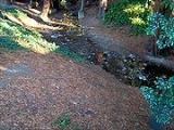
Codornices Creek 2 miles (3.2 km) long, is one of the principal creeks which runs out of the Berkeley Hills
in the East Bay
area of the San Francisco Bay Area
in California
. In its upper stretch, it passes entirely within the city limits of Berkeley
, and marks the city limit with the adjacent city of Albany
in its lower section. Before European settlement, Codornices probably had no direct, permanent connection to San Francisco Bay. Like many other small creeks, it filtered through a gravelly grassland to a large, northward-running salt marsh and slough that also carried waters from Marin Creek
and Schoolhouse Creek
. A channel was cut through in the 19th Century, and Codornices flows directly to San Francisco Bay
by way of a narrow remnant slough
adjacent to Golden Gate Fields
racetrack.
were once common in the area. The name was given by one of the Peraltas, owners of the vast Rancho San Antonio. Luis Maria Peralta, military governor at San Jose, divided the land grant amont his sons, giving the area that now is Berkeley and Albany to Domingo, who built his home on the banks of Codornices Creek.
The first of his dwellings was an adobe which was destroyed in the 1868 Hayward earthquake
on October 21, 1868. He replaced it with a wooden structure which was razed in the 1930s for an apartment building. Both were located on the high banks of Codornices Creek across from the site of what today is St. Mary's College High School
(Roman Catholic) near the Westbrae
district of Berkeley.
In the 19th century, a quarry was opened at one of the heads of Codornices Creek in the La Loma district
. It was replaced by a city park in the late 1960s. Another feeder comes down from Remillard Park. Others, on private land, have lovely small waterfalls.
Napoleon Bonaparte Byrne, a wealthy Missourian who crossed the plains before the Civil War, attempted to farm along the creek and built his large home (burned in the 1980s) on the south bank of the creek above today's Oxford Street. The Byrne family was accompanied by two freed slaves, believed to have been Berkeley's earliest African American residents. Byrne's property was later acquired by Henry Berryman, a developer who in 1877 built Berryman Reservoir south of today's Codornices Park, above Euclid. The reservoir became part of the East Bay Municipal Utility District system and was enlarged and covered, but has been drained because of fears it might rupture in an earthquake.
Codornices Creek was recognized early for its beauty. In 1914, the Berkeley City Council voted to acquire Live Oak Park (north of Rose Street between Shattuck and Oxford) as Berkeley's first "nature park." In 1915, Codornices Park was opened just above today's Euclid Avenue. In that streetcar era, both parks had busy club houses (now gone; Live Oak's was replaced by the current community center) and large picnic areas with stone fireplaces (still existing). Across Euclid from this park, the WPA
constructed the Berkeley Rose Garden
during the 1930s.
The creek once flowed into a swimming hole below today's Henry Street, but today enters a culvert above Henry. This culvert was installed to carry the creek under the extensive fill emplaced along Henry Street by the Southern Pacific
when it extended the Berkeley Branch steam line
for its new East Bay Electric Lines
. Much of the material used for the fill came from the excavation of the nearby Northbrae Tunnel
(constructed 1910 by the Southern Pacific). A steel bridge spanned a gap in the fill over Eunice Street. The overcrossing was removed when the Key System
ceased running its F-train here in 1958, and more fill was added to bring the uphill portion of Eunice up to the level of Henry Street. The lower portion of Eunice now deadends at a retaining wall below Henry.
Downstream, Berkeley's first zoning designated the marshy area near the creek and railroad tracks for "noxious industries." In the 1920s, the city built a garbage incinerator just south of the creek channel at Second Street, across from today's city Transfer Station. The incinerator failed, and the building became a slaughterhouse. (Today it is an official historic landmark, part of a storage company.) Other industries edging the creek included a gas plant and scrap-metal yard.
plus the freeway itself. The creek exits this last culvert into a narrow tidal slough -- the remnant of the former salt marsh - that makes a right turn to follow between Golden Gate Fields Racetrack and the I-880 freeway, following the creek's original northward course to San Francisco Bay. Just south of Buchanan Street in Albany, this channel widens into a small salt marsh. This marsh in turn empties into the Albany tide flats and San Francisco Bay via four pipes under Buchanan Street.
After a brief Post World War II boom, the industries that had polluted the lower creek began to wither. The University of California Berkeley bought the World War II housing that had been used for shipyard workers and then returning GIs, using it for student families. Contemplating expansion, the University had meanders straightened in the 1960s. But the creek was then largely left alone, its increasingly unpolluted waters shaded by volunteer bushes and trees. Upstream, water quality also improved due to improvements to the sewer system and, as the environmental movement got started, public education about keeping pollutant out of storm drains. Most of the channel was deeply incised and overgrown, making for cool water and undisturbed habitat. At some unknown time,perhaps in the 1980s, rainbow trout or steelhead (the same species -- those that go to sea are calld steelhead) found their way to the creek and began to reproduce.
Citizen work to restore the creek began in the 1970s with planting of natives at Codornices Park by Los Amigos de Codornices. In 1995, efforts of the nonprofit Urban Creeks Council and Richard Register's Ecocity Builders led to a block of the creek between 8th and 9th Streets being "daylighted" -- that is, removed from a culvert. In the late 1990s, the volunteer group Friends of Five Creeks
, planting natives at the BART crossing, "discovered" the steelhead/rainbow trout. This encouraged further restoration, notably below Albina Street adjacent to St. Mary's College High School, carried out by the Urban Creeks Council in 2007
Also by the late 1990s, the University of California Berkeley needed to replace the aging World War II student-family housing. Increased regulatory requirements and the need for flood control led to a collaboration with the City of Albany and, to a lesser extent, Berkeley, aimed at giving the creek a more meandering channel, with native plantings, along the south edge of [University Village, Albany, California|University Village]]. By 2010, restoration extended from the Union Pacific tracks upstream to the earlier restoration at 8th Street. There are hopes to eventually extend it to San Pablo Avenue, and to restore a shorter portion just upstream at Kains Street, creating a mini-park next to subsidized housing. Long term, if Golden Gate Fields Racetrack were to move, some of the large salt marsh could be restored in the areas that were filled to build the track itself.
Berkeley Hills
The Berkeley Hills are a range of the Pacific Coast Ranges that overlook the northeast side of the valley that surrounds San Francisco Bay. They were previously called the "Contra Costa Range/Hills" , but with the establishment of Berkeley and the University of California, the current usage was...
in the East Bay
East Bay (San Francisco Bay Area)
The East Bay is a commonly used, informal term for the lands on the eastern side of the San Francisco Bay, in the San Francisco Bay Area, in California, United States...
area of the San Francisco Bay Area
San Francisco Bay Area
The San Francisco Bay Area, commonly known as the Bay Area, is a populated region that surrounds the San Francisco and San Pablo estuaries in Northern California. The region encompasses metropolitan areas of San Francisco, Oakland, and San Jose, along with smaller urban and rural areas...
in California
California
California is a state located on the West Coast of the United States. It is by far the most populous U.S. state, and the third-largest by land area...
. In its upper stretch, it passes entirely within the city limits of Berkeley
Berkeley, California
Berkeley is a city on the east shore of the San Francisco Bay in Northern California, United States. Its neighbors to the south are the cities of Oakland and Emeryville. To the north is the city of Albany and the unincorporated community of Kensington...
, and marks the city limit with the adjacent city of Albany
Albany, California
Albany is a city in Alameda County, California, United States. The population was 18,539 at the 2010 census.-History:In 1908, a group of local women protested the dumping of Berkeley garbage in their community...
in its lower section. Before European settlement, Codornices probably had no direct, permanent connection to San Francisco Bay. Like many other small creeks, it filtered through a gravelly grassland to a large, northward-running salt marsh and slough that also carried waters from Marin Creek
Marin Creek
Marin Creek is a creek tributary of Codornices Creek in northwestern Alameda County, California. The lower stretch of Marin Creek is also known as Village Creek.-Overview:...
and Schoolhouse Creek
Schoolhouse Creek
Schoolhouse Creek is the name of a creek which flows through the city of Berkeley, California in the San Francisco Bay Area.-History:The creek acquired its name from a school which was sited adjacent to it, the Ocean View School...
. A channel was cut through in the 19th Century, and Codornices flows directly to San Francisco Bay
San Francisco Bay
San Francisco Bay is a shallow, productive estuary through which water draining from approximately forty percent of California, flowing in the Sacramento and San Joaquin rivers from the Sierra Nevada mountains, enters the Pacific Ocean...
by way of a narrow remnant slough
Slough (disambiguation)
Slough is a town in Berkshire, England.Slough may also refer to:-Hydrology:*Slough , a term in hydrology referring to:** a stream distributary or anabranch, or in some cases, a regular stream** a muddy marsh...
adjacent to Golden Gate Fields
Golden Gate Fields
Golden Gate Fields is an American horse racing track straddling both Albany, California and Berkeley, California along the shoreline of San Francisco Bay adjacent to the Eastshore Freeway in the San Francisco Bay Area...
racetrack.
Colonial period to 1900
The name derives from the Spanish word "codornices", meaning "quails". California valley quailCalifornia Quail
The California Quail, Callipepla californica, also known as the California Valley Quail or Valley Quail, is a small ground-dwelling bird in the New World quail family...
were once common in the area. The name was given by one of the Peraltas, owners of the vast Rancho San Antonio. Luis Maria Peralta, military governor at San Jose, divided the land grant amont his sons, giving the area that now is Berkeley and Albany to Domingo, who built his home on the banks of Codornices Creek.
The first of his dwellings was an adobe which was destroyed in the 1868 Hayward earthquake
1868 Hayward earthquake
The 1868 Hayward earthquake was the last large earthquake to occur on the Hayward Fault Zone in the San Francisco Bay Area, California, United States. It caused significant damage throughout the region, and was known as the "Great San Francisco Earthquake" prior to the 1906 San Francisco earthquake...
on October 21, 1868. He replaced it with a wooden structure which was razed in the 1930s for an apartment building. Both were located on the high banks of Codornices Creek across from the site of what today is St. Mary's College High School
St. Mary's College High School
Saint Mary's College High School came into being as part of St. Mary's College of California, founded in 1863 by the Catholic Church, and put under the auspices of the Institute of the Brothers of the Christian Schools in 1868...
(Roman Catholic) near the Westbrae
Westbrae, Berkeley, California
Westbrae is a neighborhood in the northern part of Berkeley, California in the East Bay section of the San Francisco Bay Area. Westbrae is "centered" on the intersection of Santa Fe Avenue and Gilman Street, although the main extent is east, south and west of this intersection, with the Albany...
district of Berkeley.
In the 19th century, a quarry was opened at one of the heads of Codornices Creek in the La Loma district
La Loma Park
La Loma Park is the historic name, no longer in common use, of a tract of land located in the Berkeley Hills section of the city of Berkeley, California in the San Francisco Bay Area. The Spanish word loma means "rise/low hill". It was the property of Captain Richard Parks Thomas, a veteran of the ...
. It was replaced by a city park in the late 1960s. Another feeder comes down from Remillard Park. Others, on private land, have lovely small waterfalls.
Napoleon Bonaparte Byrne, a wealthy Missourian who crossed the plains before the Civil War, attempted to farm along the creek and built his large home (burned in the 1980s) on the south bank of the creek above today's Oxford Street. The Byrne family was accompanied by two freed slaves, believed to have been Berkeley's earliest African American residents. Byrne's property was later acquired by Henry Berryman, a developer who in 1877 built Berryman Reservoir south of today's Codornices Park, above Euclid. The reservoir became part of the East Bay Municipal Utility District system and was enlarged and covered, but has been drained because of fears it might rupture in an earthquake.
Early 20th Century
From 1912 to 1928, a 275-foot-long wooden streetcar and road trestle spanned Codornices Creek along Euclid Avenue. In 1928, the trestle was filled in and a culvert laid through it for the creek.Codornices Creek was recognized early for its beauty. In 1914, the Berkeley City Council voted to acquire Live Oak Park (north of Rose Street between Shattuck and Oxford) as Berkeley's first "nature park." In 1915, Codornices Park was opened just above today's Euclid Avenue. In that streetcar era, both parks had busy club houses (now gone; Live Oak's was replaced by the current community center) and large picnic areas with stone fireplaces (still existing). Across Euclid from this park, the WPA
Works Progress Administration
The Works Progress Administration was the largest and most ambitious New Deal agency, employing millions of unskilled workers to carry out public works projects, including the construction of public buildings and roads, and operated large arts, drama, media, and literacy projects...
constructed the Berkeley Rose Garden
Berkeley Rose Garden
The Berkeley Rose Garden is a city-owned park in Berkeley, California. The Rose Garden is situated in a residential area of the Berkeley Hills between the Cragmont and La Loma Park neighborhoods, occupying most of the block between Eunice Street and Bayview Place along the west side of Euclid...
during the 1930s.
The creek once flowed into a swimming hole below today's Henry Street, but today enters a culvert above Henry. This culvert was installed to carry the creek under the extensive fill emplaced along Henry Street by the Southern Pacific
Southern Pacific Railroad
The Southern Pacific Transportation Company , earlier Southern Pacific Railroad and Southern Pacific Company, and usually simply called the Southern Pacific or Espee, was an American railroad....
when it extended the Berkeley Branch steam line
Berkeley Branch Railroad
The Berkeley Branch Railroad was a long branch line of the Central Pacific Railroad from a junction in what later became Emeryville called "Shellmound" to what soon became downtown Berkeley, adjacent to the new University of California campus. The line opened on August 16, 1876. The initial...
for its new East Bay Electric Lines
East Bay Electric Lines
The East Bay Electric Lines were a unit of the Southern Pacific Railroad which operated a system of electric interurban-type trains in the East Bay region of the San Francisco Bay Area...
. Much of the material used for the fill came from the excavation of the nearby Northbrae Tunnel
Northbrae Tunnel
The Northbrae Tunnel, also referred to as the Solano Avenue Tunnel, was built as a commuter electric railroad tunnel in the northern part of Berkeley, California and was later converted to street use.In 1910...
(constructed 1910 by the Southern Pacific). A steel bridge spanned a gap in the fill over Eunice Street. The overcrossing was removed when the Key System
Key System
The Key System was a privately owned company which provided mass transit in the cities of Oakland, Berkeley, Alameda, Emeryville, Piedmont, San Leandro, Richmond, Albany and El Cerrito in the eastern San Francisco Bay Area from 1903 until 1960, when the system was sold to a newly formed public...
ceased running its F-train here in 1958, and more fill was added to bring the uphill portion of Eunice up to the level of Henry Street. The lower portion of Eunice now deadends at a retaining wall below Henry.
Downstream, Berkeley's first zoning designated the marshy area near the creek and railroad tracks for "noxious industries." In the 1920s, the city built a garbage incinerator just south of the creek channel at Second Street, across from today's city Transfer Station. The incinerator failed, and the building became a slaughterhouse. (Today it is an official historic landmark, part of a storage company.) Other industries edging the creek included a gas plant and scrap-metal yard.
Late 20th -- Early 21st Century
Codornices Creek may have escaped burial in pipes because much of it formed the Berkeley-Albany border, making projects complicated. It is Berkeley's most intact creeks, in and out of culverts, mostly at streets. Some of the longer covered portions are below Nielson Street, San Pablo Avenue, and the frontage road east of Interstate 80Interstate 80
Interstate 80 is the second-longest Interstate Highway in the United States, following Interstate 90. It is a transcontinental artery running from downtown San Francisco, California to Teaneck, New Jersey in the New York City Metropolitan Area...
plus the freeway itself. The creek exits this last culvert into a narrow tidal slough -- the remnant of the former salt marsh - that makes a right turn to follow between Golden Gate Fields Racetrack and the I-880 freeway, following the creek's original northward course to San Francisco Bay. Just south of Buchanan Street in Albany, this channel widens into a small salt marsh. This marsh in turn empties into the Albany tide flats and San Francisco Bay via four pipes under Buchanan Street.
After a brief Post World War II boom, the industries that had polluted the lower creek began to wither. The University of California Berkeley bought the World War II housing that had been used for shipyard workers and then returning GIs, using it for student families. Contemplating expansion, the University had meanders straightened in the 1960s. But the creek was then largely left alone, its increasingly unpolluted waters shaded by volunteer bushes and trees. Upstream, water quality also improved due to improvements to the sewer system and, as the environmental movement got started, public education about keeping pollutant out of storm drains. Most of the channel was deeply incised and overgrown, making for cool water and undisturbed habitat. At some unknown time,perhaps in the 1980s, rainbow trout or steelhead (the same species -- those that go to sea are calld steelhead) found their way to the creek and began to reproduce.
Citizen work to restore the creek began in the 1970s with planting of natives at Codornices Park by Los Amigos de Codornices. In 1995, efforts of the nonprofit Urban Creeks Council and Richard Register's Ecocity Builders led to a block of the creek between 8th and 9th Streets being "daylighted" -- that is, removed from a culvert. In the late 1990s, the volunteer group Friends of Five Creeks
Friends of Five Creeks
Friends of Five Creeks is a regional community volunteer organization founded in 1996 by Sonja Wadman originally dedicated to the stewardship of creeks in northern Alameda County and western Contra Costa, California, United States...
, planting natives at the BART crossing, "discovered" the steelhead/rainbow trout. This encouraged further restoration, notably below Albina Street adjacent to St. Mary's College High School, carried out by the Urban Creeks Council in 2007
Also by the late 1990s, the University of California Berkeley needed to replace the aging World War II student-family housing. Increased regulatory requirements and the need for flood control led to a collaboration with the City of Albany and, to a lesser extent, Berkeley, aimed at giving the creek a more meandering channel, with native plantings, along the south edge of [University Village, Albany, California|University Village]]. By 2010, restoration extended from the Union Pacific tracks upstream to the earlier restoration at 8th Street. There are hopes to eventually extend it to San Pablo Avenue, and to restore a shorter portion just upstream at Kains Street, creating a mini-park next to subsidized housing. Long term, if Golden Gate Fields Racetrack were to move, some of the large salt marsh could be restored in the areas that were filled to build the track itself.
See also
- Cerrito CreekCerrito CreekCerrito Creek is one of the principal watercourses running out of the Berkeley Hills into San Francisco Bay in northern California. It is significant for its use as a boundary demarcation historically, as well as presently. In the early 19th century, it separated the vast Rancho San Antonio to...
- Schoolhouse CreekSchoolhouse CreekSchoolhouse Creek is the name of a creek which flows through the city of Berkeley, California in the San Francisco Bay Area.-History:The creek acquired its name from a school which was sited adjacent to it, the Ocean View School...
- Strawberry CreekStrawberry CreekStrawberry Creek is the principal watercourse running through the city of Berkeley, California. Two forks rise in the Berkeley Hills of the California Coast Ranges, and form a confluence at the campus of the University of California, Berkeley...
- Temescal Creek
- List of watercourses in the San Francisco Bay Area