Colonial Beach, Virginia
Encyclopedia
Colonial Beach is a town in Westmoreland County
, Virginia
, United States
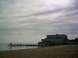
. The population was 3,228 at the 2000 census. Possessing the second largest beach front in the state, Colonial Beach was a popular resort town in the early to mid-20th century, before the Chesapeake Bay Bridge
made ocean beaches on the Eastern Shore of Maryland
more accessible to visitors from Washington, D.C.
The family of Alexander Graham Bell
maintained a summer home in Colonial Beach, the Bell House
, which still stands today. Sloan Wilson
, author of The Man in the Gray Flannel Suit
, retired and died in Colonial Beach. George Washington
, the first President of the United States, was born near here at what is now the George Washington Birthplace National Monument
. , the birthplace of President James Monroe
now has a small monument to him. A museum is planned for the future.
, as Monrovia.
Colonial Beach emerged as a bathing and fishing resort in the late 19th century known as the "Playground on the Potomac." Prior to automobile travel, most visitors arrived by boat from Washington, D.C.
The town was incorporated on 25 February 1892 and there was extensive construction of houses, summer cottages, and, hotels. Arguably the most famous of these structures is the Alexander Graham Bell house which still stands on Irving Avenue as the Bell House Bed and Breakfast.
The area was at the center of the Potomac River Oyster Wars
between Virginia watermen and the Maryland State Oyster Police that lasted from the late 19th century to the 1960.
The town began to gradually decline as the automobile made travel to more distant ocean beaches more feasible. However, because gambling was legal in Maryland
and the Maryland state line ends at the low-water mark of Virginia's Potomac River
shore, from 1949 to 1958, Colonial Beach offered slot machine
s in pier
casino
s extending into Maryland waters. This temporarily revitalized the town although it was sometimes called "the poor man's Las Vegas." However, the piers burned in the 1960s in a devastating fire and the town continued to decline.
 Colonial Beach has been devastated by several hurricanes including the 1933 Chesapeake Potomac hurricane
which destroyed an amusement park and three "beer piers," Hurricane Hazel
in 1954, and Hurricane Isabel
in 2003.
Colonial Beach is also the home of the 2009 Group A Division 1 High School Basketball State Champions.
. It is aligned on a northwest-southeast axis along the shoreline of the Potomac River which bounds the town to the northeast. The southern part of the town forms a peninsula
which ends just above Monroe Bay
and divides Monroe Creek from the Potomac. Just to the north of town is the community of Potomac Beach
and the mouth of Rosier Creek. Inland from Colonial Beach lie the settlements of Monroe Hall
, near the birthplace of President James Monroe, and Maple Grove
.
 According to the United States Census Bureau
, the town has a total area of 2.8 square miles (7.3 km²), of which, 2.6 square miles (6.7 km²) of it is land and 0.2 square mile (0.517997622 km²) of it (8.80%) is water. The town's 2.5 miles (4 km) of beaches are second in length only to those of Virginia Beach
in the Commonwealth of Virginia. Of the many small shops in the town, the NAPA auto parts has been cited as one of the best in the area.
, a spur of which bisects the town as State Route 205Y (Colonial Avenue). The town is accessible by boat and is the last deepwater port for pleasure boats going north on the Potomac River.
of 2000, there were 3,228 people, 1,437 households, and 863 families residing in the town. The population density
was 1246.7 /sqmi. There were 2,030 housing units at an average density of 784 /sqmi. The racial makeup of the town was 79.21% White, 16.95% African American, 0.09% Native American, 0.62% Asian, 1.64% from other races
, and 1.49% from two or more races. Hispanic or Latino of any race were 3.38% of the population.
There were 1,437 households out of which 24.1% had children under the age of 18 living with them, 40.9% were married couples
living together, 15.3% had a female householder with no husband present, and 39.9% were non-families. 34.9% of all households were made up of individuals and 18.2% had someone living alone who was 65 years of age or older. The average household size was 2.20 and the average family size was 2.77.
 In the town the population was spread out with 22.0% under the age of 18, 6.3% from 18 to 24, 23.2% from 25 to 44, 26.0% from 45 to 64, and 22.5% who were 65 years of age or older. The median age was 44 years. For every 100 females there were 82.7 males. For every 100 females age 18 and over, there were 77.6 males.
The median income for a household in the town was $31,711, and the median income for a family was $38,080. Males had a median income of $30,000 versus $19,535 for females. The per capita income
for the town was $19,991.20 About 23.0% of families and 25.4% of the population were below the poverty line, including 45.7% of those under age 18 and 16.6% of those age 65 or over.
Westmoreland County, Virginia
As of the census of 2000, there were 16,718 people, 6,846 households, and 4,689 families residing in the county. The population density was . There were 9,286 housing units at an average density of...
, Virginia
Virginia
The Commonwealth of Virginia , is a U.S. state on the Atlantic Coast of the Southern United States. Virginia is nicknamed the "Old Dominion" and sometimes the "Mother of Presidents" after the eight U.S. presidents born there...
, United States
United States
The United States of America is a federal constitutional republic comprising fifty states and a federal district...
. The population was 3,228 at the 2000 census. Possessing the second largest beach front in the state, Colonial Beach was a popular resort town in the early to mid-20th century, before the Chesapeake Bay Bridge
Chesapeake Bay Bridge
The Chesapeake Bay Bridge is a major dual-span bridge in the U.S. state of Maryland. Spanning the Chesapeake Bay, it connects the state's rural Eastern Shore region with the more urban Western Shore. The original span opened in 1952 and, at the time, with a length of , it was the world's longest...
made ocean beaches on the Eastern Shore of Maryland
Eastern Shore of Maryland
The Eastern Shore of Maryland is a territorial part of the U.S. state of Maryland that lies predominately on the east side of the Chesapeake Bay and consists of nine counties. The origin of term Eastern Shore was derived to distinguish a territorial part of the State of Maryland from the Western...
more accessible to visitors from Washington, D.C.
Washington, D.C.
Washington, D.C., formally the District of Columbia and commonly referred to as Washington, "the District", or simply D.C., is the capital of the United States. On July 16, 1790, the United States Congress approved the creation of a permanent national capital as permitted by the U.S. Constitution....
The family of Alexander Graham Bell
Alexander Graham Bell
Alexander Graham Bell was an eminent scientist, inventor, engineer and innovator who is credited with inventing the first practical telephone....
maintained a summer home in Colonial Beach, the Bell House
Bell House (Colonial Beach, Virginia)
Bell House in Colonial Beach, Virginia was a summer home of Alexander Graham Bell. It was built in 1883 and was listed on the National Register of Historic Places in 1987....
, which still stands today. Sloan Wilson
Sloan Wilson
Sloan Wilson was an American author.-Reporter:Born in Norwalk, Connecticut, Wilson graduated from Harvard University in 1942. He served in World War II, serving in the United States Coast Guard, commanding a naval trawler on the Greenland patrol and an army supply ship in the Pacific Ocean.After...
, author of The Man in the Gray Flannel Suit
The Man in the Gray Flannel Suit
The Man in the Gray Flannel Suit, by Sloan Wilson, is a 1955 novel about the American search for purpose in a world dominated by business. Tom and Betsy Rath share a struggle to find contentment in their hectic and material culture while several other characters fight essentially the same battle,...
, retired and died in Colonial Beach. George Washington
George Washington
George Washington was the dominant military and political leader of the new United States of America from 1775 to 1799. He led the American victory over Great Britain in the American Revolutionary War as commander-in-chief of the Continental Army from 1775 to 1783, and presided over the writing of...
, the first President of the United States, was born near here at what is now the George Washington Birthplace National Monument
George Washington Birthplace National Monument
The George Washington Birthplace National Monument is in Westmoreland County, Virginia, United States. Originally settled by John Washington, George Washington's great-grandfather, George Washington was born here on February 22, 1732...
. , the birthplace of President James Monroe
James Monroe
James Monroe was the fifth President of the United States . Monroe was the last president who was a Founding Father of the United States, and the last president from the Virginia dynasty and the Republican Generation...
now has a small monument to him. A museum is planned for the future.
History
The town was first settled in 1650 by Andrew Monroe, the great-great grandfather of President James MonroeJames Monroe
James Monroe was the fifth President of the United States . Monroe was the last president who was a Founding Father of the United States, and the last president from the Virginia dynasty and the Republican Generation...
, as Monrovia.
Colonial Beach emerged as a bathing and fishing resort in the late 19th century known as the "Playground on the Potomac." Prior to automobile travel, most visitors arrived by boat from Washington, D.C.
The town was incorporated on 25 February 1892 and there was extensive construction of houses, summer cottages, and, hotels. Arguably the most famous of these structures is the Alexander Graham Bell house which still stands on Irving Avenue as the Bell House Bed and Breakfast.
The area was at the center of the Potomac River Oyster Wars
Oyster Wars
The Oyster Wars were a series of sometimes violent disputes between oyster pirates and authorities and legal watermen from Maryland and Virginia in the waters of the Chesapeake Bay and the Potomac River from 1865 until about 1959.-Background:...
between Virginia watermen and the Maryland State Oyster Police that lasted from the late 19th century to the 1960.
The town began to gradually decline as the automobile made travel to more distant ocean beaches more feasible. However, because gambling was legal in Maryland
Maryland
Maryland is a U.S. state located in the Mid Atlantic region of the United States, bordering Virginia, West Virginia, and the District of Columbia to its south and west; Pennsylvania to its north; and Delaware to its east...
and the Maryland state line ends at the low-water mark of Virginia's Potomac River
Potomac River
The Potomac River flows into the Chesapeake Bay, located along the mid-Atlantic coast of the United States. The river is approximately long, with a drainage area of about 14,700 square miles...
shore, from 1949 to 1958, Colonial Beach offered slot machine
Slot machine
A slot machine , informally fruit machine , the slots , poker machine or "pokies" or simply slot is a casino gambling machine with three or more reels which spin when a button is pushed...
s in pier
Pier
A pier is a raised structure, including bridge and building supports and walkways, over water, typically supported by widely spread piles or pillars...
casino
Casino
In modern English, a casino is a facility which houses and accommodates certain types of gambling activities. Casinos are most commonly built near or combined with hotels, restaurants, retail shopping, cruise ships or other tourist attractions...
s extending into Maryland waters. This temporarily revitalized the town although it was sometimes called "the poor man's Las Vegas." However, the piers burned in the 1960s in a devastating fire and the town continued to decline.

1933 Chesapeake Potomac Hurricane
The 1933 Chesapeake-Potomac Hurricane was the eighth storm and third hurricane of the very active 1933 Atlantic hurricane season. The August storm formed in the central Atlantic, where it moved west-northwest...
which destroyed an amusement park and three "beer piers," Hurricane Hazel
Hurricane Hazel
Hurricane Hazel was the deadliest and costliest hurricane of the 1954 Atlantic hurricane season. The storm killed as many as 1,000 people in Haiti before striking the United States near the border between North and South Carolina, as a Category 4 hurricane...
in 1954, and Hurricane Isabel
Hurricane Isabel
Hurricane Isabel was the costliest and deadliest hurricane in the 2003 Atlantic hurricane season. The ninth named storm, fifth hurricane, and second major hurricane of the season, Isabel formed near the Cape Verde Islands from a tropical wave on September 6 in the tropical Atlantic Ocean...
in 2003.
Colonial Beach is also the home of the 2009 Group A Division 1 High School Basketball State Champions.
Geography
Colonial Beach is located at 38°15′14"N 76°58′8"W in the northwestern part of Westmoreland County in Virginia's Northern NeckNorthern Neck
The Northern Neck is the northernmost of three peninsulas on the western shore of the Chesapeake Bay in the Commonwealth of Virginia. This peninsula is bounded by the Potomac River on the north and the Rappahannock River on the south. It encompasses the following Virginia counties: Lancaster,...
. It is aligned on a northwest-southeast axis along the shoreline of the Potomac River which bounds the town to the northeast. The southern part of the town forms a peninsula
Peninsula
A peninsula is a piece of land that is bordered by water on three sides but connected to mainland. In many Germanic and Celtic languages and also in Baltic, Slavic and Hungarian, peninsulas are called "half-islands"....
which ends just above Monroe Bay
Monroe Bay
Monroe Bay is a protected body of water in Colonial Beach, Virginia that connects at its south end to the Potomac River which is more than six miles wide in Colonial Beach. The bay is approximately two miles long and one third mile wide and features numerous marinas and private piers providing a...
and divides Monroe Creek from the Potomac. Just to the north of town is the community of Potomac Beach
Potomac Beach, Virginia
Potomac Beach is an unincorporated community in Westmoreland County, in the U. S. state of Virginia.-References:*...
and the mouth of Rosier Creek. Inland from Colonial Beach lie the settlements of Monroe Hall
Monroe Hall, Virginia
Monroe Hall is an unincorporated community in Westmoreland County, in the U. S. state of Virginia. The site of James Monroe's birthplace is located in the community, and is marked with an obelisk, an historical marker, and a bronze plaque.-References:*...
, near the birthplace of President James Monroe, and Maple Grove
Maple Grove, Virginia
Maple Grove is an unincorporated community in Westmoreland County, in the U. S. state of Virginia.-References:*...
.

United States Census Bureau
The United States Census Bureau is the government agency that is responsible for the United States Census. It also gathers other national demographic and economic data...
, the town has a total area of 2.8 square miles (7.3 km²), of which, 2.6 square miles (6.7 km²) of it is land and 0.2 square mile (0.517997622 km²) of it (8.80%) is water. The town's 2.5 miles (4 km) of beaches are second in length only to those of Virginia Beach
Virginia Beach, Virginia
Virginia Beach is an independent city located in the Hampton Roads metropolitan area of Virginia, on the Atlantic Ocean at the mouth of the Chesapeake Bay...
in the Commonwealth of Virginia. Of the many small shops in the town, the NAPA auto parts has been cited as one of the best in the area.
Transportation
Colonial Beach is served by Virginia State Route 205Virginia State Route 205
State Route 205 is a primary state highway in the Northern Neck region of the U.S. state of Virginia. It runs from State Route 3 east of King George east via Edgehill, Potomac Beach, and Colonial Beach to State Route 3 at Oak Grove...
, a spur of which bisects the town as State Route 205Y (Colonial Avenue). The town is accessible by boat and is the last deepwater port for pleasure boats going north on the Potomac River.
Demographics
As of the censusCensus
A census is the procedure of systematically acquiring and recording information about the members of a given population. It is a regularly occurring and official count of a particular population. The term is used mostly in connection with national population and housing censuses; other common...
of 2000, there were 3,228 people, 1,437 households, and 863 families residing in the town. The population density
Population density
Population density is a measurement of population per unit area or unit volume. It is frequently applied to living organisms, and particularly to humans...
was 1246.7 /sqmi. There were 2,030 housing units at an average density of 784 /sqmi. The racial makeup of the town was 79.21% White, 16.95% African American, 0.09% Native American, 0.62% Asian, 1.64% from other races
Race (United States Census)
Race and ethnicity in the United States Census, as defined by the Federal Office of Management and Budget and the United States Census Bureau, are self-identification data items in which residents choose the race or races with which they most closely identify, and indicate whether or not they are...
, and 1.49% from two or more races. Hispanic or Latino of any race were 3.38% of the population.
There were 1,437 households out of which 24.1% had children under the age of 18 living with them, 40.9% were married couples
Marriage
Marriage is a social union or legal contract between people that creates kinship. It is an institution in which interpersonal relationships, usually intimate and sexual, are acknowledged in a variety of ways, depending on the culture or subculture in which it is found...
living together, 15.3% had a female householder with no husband present, and 39.9% were non-families. 34.9% of all households were made up of individuals and 18.2% had someone living alone who was 65 years of age or older. The average household size was 2.20 and the average family size was 2.77.

The median income for a household in the town was $31,711, and the median income for a family was $38,080. Males had a median income of $30,000 versus $19,535 for females. The per capita income
Per capita income
Per capita income or income per person is a measure of mean income within an economic aggregate, such as a country or city. It is calculated by taking a measure of all sources of income in the aggregate and dividing it by the total population...
for the town was $19,991.20 About 23.0% of families and 25.4% of the population were below the poverty line, including 45.7% of those under age 18 and 16.6% of those age 65 or over.

